SLR Measures the Tides
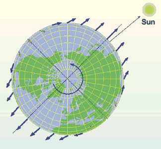 Space Geodesy measures mass redistribution in the atmosphere-hydrosphere-cryosphere-solid Earth system due to solar heating and the gravitational attraction of the sun and moon.
Earth/Moon Evolution
SLR and Lunar Laser Ranging (LLR) have shown that tidal dissipation, the momentum and energy exchange due to tidal processes, is the dominant explanation for the expanding lunar orbit (3.8m/century). The current rate of the lunar orbit expansion cannot be projected back into the past without convergence of the lunar orbit with Earth. This change in the rate of tidal dissipation must be due to tectonics having significantly altered the continent/ocean geography.
 Ocean Tides
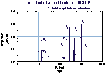
SLR makes a significant contribution to the knowledge of complex ocean tides, which is needed to isolate climatological processes ongoing in the ocean, and to understand tidal dissipation in the Earth/Moon system.
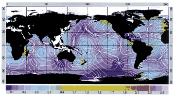 Satellite altimeters systematically map the height of the ocean surface. These measurements,which depend on accurate orbital knowledge, provide a valuable resource for determining the detailed tidal response of the ocean. Ocean tides represent a critical unknown in a host of geophysical studies. For altimeter missions, they are the largest source of error in the determination of the ocean’s dynamic topography. Understanding the nature of tidal dissipation and ocean bottom friction requires a more detailed knowledge of ocean tides. Better tide models are also required to support ocean tidal loading models needed to analyze precise gravimetry.
