Quick Links
Satellite Laser Ranging
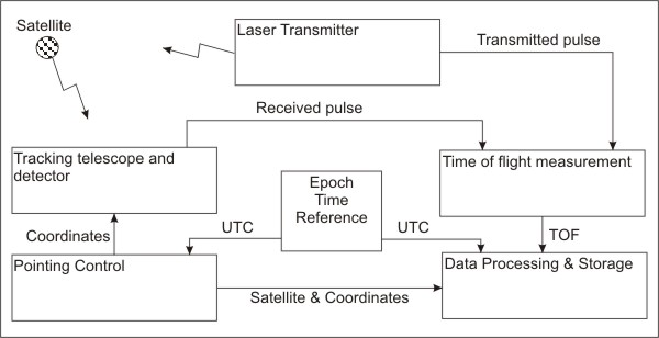
Satellite Laser Ranging (SLR) and Lunar Laser Ranging (LLR) use short-pulse lasers and state-of-the-art optical receivers and timing electronics to measure the two-way time of flight (and hence distance) from ground stations to retroreflector arrays on Earth orbiting satellites and the moon. The laser stations are also used to measure one-way distance from the ground stations to remote optical receivers on space and for very accurate time-transfer. Laser ranging activities are organized under the International Laser Ranging Service (ILRS) which provides global satellite and lunar laser ranging data and their derived products to support geodetic, geophysical, and fundamental research activities as well as IERS products important to the maintenance of an accurate International Terrestrial Reference Frame (ITRF). The service develops the necessary global standards/specifications and encourages international adherence to its conventions. The ILRS is one of the space geodetic services of the International Association of Geodesy (IAG) and an entity within its Global Geodetic Observing System (GGOS).


