

LPNTSAT-001
Jump to: Mission Objectives, Mission Instrumentation, Mission Parameters, Additional Information
Mission Photos:
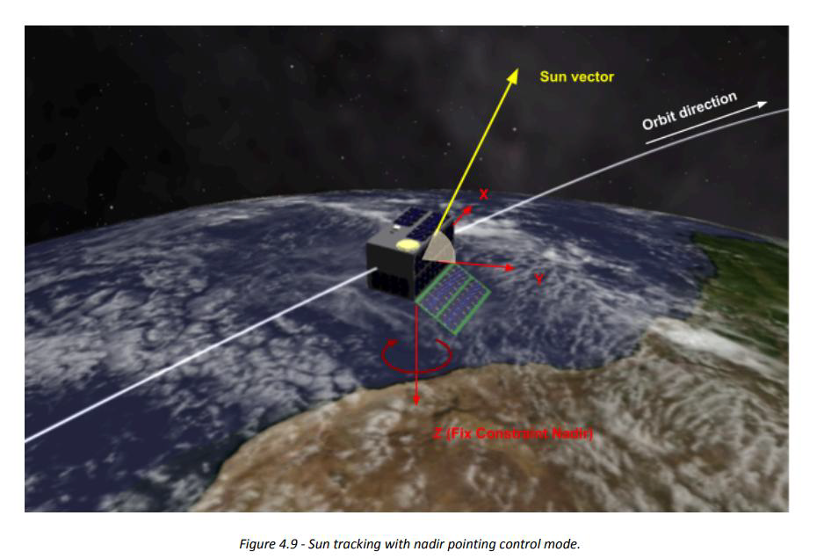
LPNTSAT-001 is the first satellite of the Celeste LEO-PNT (Low Earth Orbit – Position, Navigation, & Timing) in-orbit demonstrator mission, which will feature an 11-satellite constellation that will fly close to Earth to test innovative signals across various frequency bands, including L Band and S Band.
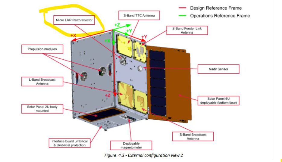
One of the objectives of this mission is to assess the PNT (Position, Navigation, & Timing) performance that a future constellation of LEO satellites can achieve, augmenting existing systems like Galileo and Egnos. A key step is to assess the performance of the orbits computed by the IOD system. SLR measurements will be used on a ground system which computes precise the reference orbits of the LEO satellites (in post-processing).
All satellites in the constellation will operate in a quasi polar orbit at an altitude between 500 and 600 km, to demonstrate critical technology, including:
- Autonomous precise orbit determination independent of ground infrastructure.
- Assessment of on-board timing stability and synchronization performance without atomic clocks.
- Verification of radionavigation service provision in the UHF, L , S and C-bands.
For more information: https://www.esa.int/Applications/Satellite_navigation/Celeste
Mission Parameters
| Satellite: | LPNTSAT-001 |
| Sponsor: | ESA |
| Expected Life: | 6 months |
| Primary Application: | Navigation, assessing performance of a future constellation. |
| COSPAR ID/ILRS ID: | 2026-065A/2606501 |
| SIC Code: | 8013 |
| Satellite Catalog (NORAD) Number: | 68408 |
| Launch Date: | 2026-03-28 |
| NP Bin Size: | 5 seconds |
| RRA Shape: | Hemispherical/Pyramid |
| Cube Diameter: | 12.7 mm; 10.16 mm height |
| Reflectors: | |
| Inclination: | 97.41 degrees |
| Eccentricity: | 0.00133331 |
| Altitude: | 510 km |
| Orbital Period: | 94.84 Minutes |
| Weight: |