
GFO-1
Jump to: Mission Objectives, Mission Instrumentation, Mission Parameters, Additional Information
Mission Photos:
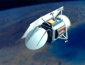
Courtesy of GFO-1 Home Page
Mission Objectives:
The GEOSAT Follow-On 1 (GFO-1) program is the U.S. Navy's initiative to develop an operational family of radar altimeters satellites to maintain continuous ocean observation from the GEOSAT exact repeat orbit. GFO-1 data are used for precise measurement of both mesoscale and basin-scale oceanography. The length and time scales of these processes are too large for conventional in-the-water oceanographic instrumentation configurations to measure. Satellite altimetry is the only known method by which oceanographers can precisely measure sea surface topography. The shape of the sea surface is the only physical variable directly measurable from space that is directly and simply connected to the large-scale movement of water and the total mass and volume of the ocean.
Satellite laser ranging and GPS data were to be combined to determine a precise orbit. These tracking data used in combination can support orbit accuracies approaching those achieved by TOPEX/Poseidon (3cm in the radial component) despite the lower altitude and increased atmospheric drag modeling errors. These precise orbits are be used to calibrate the onboard radar altimeter. However, soon after launch, it was realized that the four on-board GPS receivers were not producing operationally acceptable precision orbits and the GFO mission has relied on POD from SLR.
On about September 25, 2008, the GFO-1 went into safe mode, and into a non-nadir pointing attitude. The spacecraft team attempted to recover the satellite, but the aged condition of the batteries and other spacecraft systems have made the recovery and return to normal operations impossible. Mission operations have terminated.
Mission Instrumentation:
GFO-1 has the following instrumentation onboard:
- Radar altimeter
- Water vapor radiometer
- Doppler beacon
- Four GPS receivers
- Retroreflector array
Mission Parameters:
| Sponsor: | United States Navy |
| Expected Life: | 10 years |
| Primary Applications: | oceanography |
| Primary SLR Applications: | calibrate satellite altimeter |
| COSPAR ID: | 9800701 |
| SIC Code: | 8501 |
| Satellite Catalog (NORAD) Number: | 25157 |
| Launch Date: | February 10, 1998 |
| RRA Diameter: | 16 cm |
| RRA Shape: | hemispherical |
| Reflectors: | 9 corner cubes |
| Orbit: | circular |
| Inclination: | 108 degrees |
| Eccentricity: | 0.001 |
| Perigee: | 800 km |
| Period: | 100 minutes |
| Weight: | 300 kg |
Additional Information:
Web sites:
Publications:
- Moore, P., and Kilby, G.T., "Orbital inferences from GFO with applications to GEOSAT", Adv. Space Res., v 30, num 2, pp. 393-399, 2002.
- Lemoine, F., Zelensky, N., Chinn, D., Beckley, B., Lillibridge, J., "Orbit Determination Goals of High Accurac and Near-Real-Time Processing" (presentation | paper), AIAA/AAS Astrodynamics Conference, Keystone, Colorado, August 21-24, 2006.
