
ICESat
Jump to: Mission Objectives, Mission Instrumentation, Mission Parameters, Additional Information
Mission Photos:
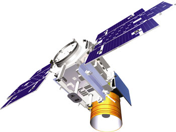
Courtesy of ICESat
Science Team
Mission Objectives:
The Ice, Cloud, and land Elevation Satellite (ICESat) is part of NASA's Earth Observing System (EOS) program, which includes a series of satellites beginning in 1998 to measure Earth's atmosphere, oceans, land, ice, and biosphere for 15 years.
ICESat primary objectives are to determine the mass balance of the polar ice sheets and their contributions to global sea level change and to obtain essential data for prediction of future changes in ice volume and sea-level. Secondary objectives are to measure cloud heights and the vertical structure of clouds and aerosols in the atmosphere; to map the topography of land surfaces; and to measure roughness, reflectivity, vegetation heights, snow-cover, and sea-ice surface characteristics. The primary instrument onboard ICESat is the Geoscience Laser Altimeter System (GLAS).
GLAS is a descoped version of the geoscience Laser Ranging System (GLRS), focusing solely on the laser altimetry science mission. For ice-sheet applications, the laser altimeter will measure height from the spacecraft to the ice sheet, with an intrinsic precision of better than 10 cm with a 70-m surface spot size. The height measurement, coupled with knowledge of the radial orbit position, provided by a combination of satellite laser ranging and GPS data, will provide the determination of topography.
Mission Instrumentation:
ICESat has the following instrumentation:
- Geoscience Laser Altimeter System (GLAS)
- Star-tracker attitude-determination system
- GPS receiver
- Retroreflector array
Mission Parameters:
| Sponsor: | United States |
| Expected Life: | 3-5 years |
| Primary Applications: | ice sheet mass balance and sea level |
| Primary SLR Applications: | precision orbit determination |
| COSPAR ID: | 0300201 |
| SIC Code: | 8201 |
| Satellite Catalog (NORAD) Number: | 27642 |
| Launch Date: | 13-Jan-03 |
| RRA Diameter: | 18 cm |
| RRA Shape: | hemispherical |
| Reflectors: | 9 corner cubes |
| Orbit: | circular, near polar, 183 day repeat orbit, 8 day repeat (first 120 days for calibration) |
| Inclination: | 94 degrees |
| Eccentricity: | 0.001 |
| Perigee: | 600 km |
| Period: | 101 minutes |
| Weight: | 970 Kg |
Additional Information:
Web sites:
Publications:
- Luthcke, S. B., Rowlands, D. D., Carabajal, C. C., Harding, D., Bufton, J., Williams, T, "ICESAT Laser Altimeter Pointing, Ranging and Timing Calibration from Integrated Residual Analysis", AGU Fall Meeting Abstracts 2, 2003.
- Rim, H., Yoon, S., Webb, C. E., Kim, Y., Schutz, B. E., "ICESat Precision Orbit Determination", AGU Fall Meeting Abstracts A430, 2003.
- Schutz, B., "NASA ICESat Mission Status (Poster)", 14th International Laser Ranging Workshop, San Fernando, Spain, June 7-11, 2004.
- Schutz, B. E., Webb, C., Bae, S., Urban, T., "Laser Pointing Determination for ICESat Altimetry", AGU Fall Meeting Abstracts 2, 2004.
- Shelus, P. J., Schutz, B. E., Webb, C. E., Rim, H., Ricklefs, R. L., Yoon, S., Ries, J. G., "SLR Observations of ICESat", AGU Fall Meeting Abstracts 80, 2004.
