
KOMPSAT-5
Jump to: Mission Objectives, Mission Instrumentation, Mission Parameters, Additional Information
Mission Photos:
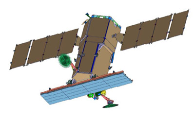
Courtesy of KARI
Mission Objectives:
The main mission objectives of KOMPSAT-5 are to provide the following applications (GOLDEN mission):
- Geographic Information System (GIS)
- Ocean Management
- Land Management
- Disaster Monitoring
- ENvironment Monitoring
The KOMPSAT-5 satellite will be delivered to low Earth orbit for all-weather day/night monitoring of the Korean peninsula.
The primary mission of the KOMPSAT-5 system is to provide high resolution mode SAR images of 1 meter resolution, standard mode SAR images of 3 meter resolution and wide swath mode SAR images of 20 meter resolution with viewing conditions of the incidence angle of 45 degrees using the COSI (COrea SAR Instrument) payload, for meeting GOLDEN mission objectives.
The secondary mission of KOMPSAT-5 is to generate the atmospheric sounding profile and support radio occultation science using AOPOD (atmospheric occultation and precision orbit determination) secondary payload which is composed of a dual frequency GPS receiver and a laser retroreflector array (LRRA).
Mission Instrumentation:
KOMPSAT-5 will have the following instrumentation onboard:
- Synthetic Aperture Radar (SAR)
- GPS
- Retroreflector Array
Mission Parameters:
| Satellite: | KOMPSAT-5 |
| Sponsor: | Korea Aerospace Research Institute |
| Expected Life: | 5 years |
| Primary Applications: | Earth sensing |
| Primary SLR Applications: | Precision orbit determination |
| COSPAR ID: | 1304201 |
| SIC Code: | 3803 |
| Satellite Catalog (NORAD) Number: | 39227 |
| Launch Date: | Aug. 23, 2013 |
| NP Bin Size: | TBD |
| RRA Diameter: | 5 cm |
| RRA Shape: | Rectangular |
| Reflectors: | 4 corner cubes |
| Inclination: | 97.6 degrees |
| Eccentricity: | 0 |
| Altitude: | 550 km |
| Weight: |
Additional Information:
Web sites:
- KARI home page
