Quick Links
- Network Map
- List of Stations
- Monthly Report Card
- Quarterly Report Card
- Network Status Page
- Potsdam CPF time bias service
- Procedure for estimating laser beam divergence
- Recent Station Upgrades
- Network station application form
- Revised ILRS station screening process at ILRS Operations Centers (NASA and EDC)

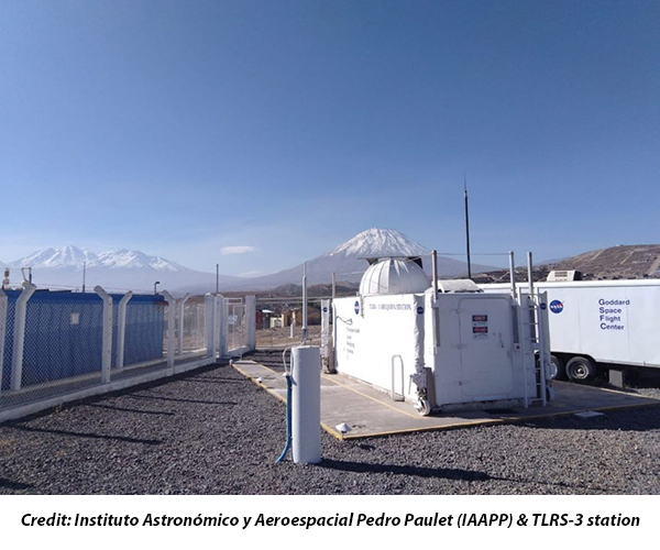
Arequipa
Jump to: Photo, Contact, Coordinates, News, Links
Arequipa Contact:
| Agency | UNSA |
| Mailing Address | Cerro San Francisco s/n, Observatorio de Characato UNSA - Arequipa |
| Primary Contact | |
| Contact Name | Dr. Pablo Raul Yanyachi |
| Telephone (primary) | 51-54-448211 |
| Telephone (secondary) | 51-54-959626624 |
| Fax | 51-54-448418 |
| t3mgr@unsa.edu.pe, raulpab@unsa.edu.pe | |
| Secondary Contact | |
| Contact Name | |
| Telephone (primary) | |
| Telephone (secondary) | |
| Fax | |
Arequipa Coordinates:
Approximate Position:
| X coordinate | [m] | 1942808.1 |
| Y coordinate | [m] | -5804069.7 |
| Z coordinate | [m] | -1796915.4 |
| Latitude | [deg] | 16.4657 S |
| Longitude | [deg] | 71.4930 W |
| Elevation | [m] | 2489.05 |
| Survey Method | ||
| Date Measured | ||
| Additional Information | (Measured against Mean Sea Level, ITRF2008, WGS84) |
|
Arequipa News:
Local Events:
| Date | 2001-06-23 20 |
| Event | EARTHQUAKE |
| Additional Information | 8.4 earthquake was centered 180Km west of site |
| Date | 2001-07-07 09 |
| Event | EARTHQUAKE |
| Additional Information | (7.6 aftershock of the June 23rd earthquake was centered 100Km South of the site) |
| Date | 2017-07-18 02 |
| Event | EARTHQUAKE |
| Additional Information | 6.4 98km WNW of Camana, Peru was centered 200Km West of the site |
| Date | 2018-01-14 09 |
| Event | EARTHQUAKE |
| Additional Information | 7.1 40km SSW of Acari, Peru was centered 355km WNW of the site |
SLRMail Messages:
No SLRMail mesages found.Arequipa Link:

- NASA Official: Frank Lemoine
- Web Developers: 610 Web Dev
- Contact Us
- Last modified date: Nov 17, 2025
- Privacy Policy & Important Notices