Primary
GLONASS-131, -134, -136, -137
Galileo-102, -202, -209, -210
Compass-G1, -I3, -M3, -MS1
Quick Links

Past News
2023
 NASA Laser Reflecting Instruments to Help Pinpoint Earth Measurements Release Date: 12/08/2023
The best known use of GPS satellites is to help people know their location whether driving a car, navigating a ship or plane, or trekking across remote territory. Another important, but lesser-known, use is to distribute information to other Earth-viewing satellites to help them pinpoint measurements of our planet.
NASA Laser Reflecting Instruments to Help Pinpoint Earth Measurements Release Date: 12/08/2023
The best known use of GPS satellites is to help people know their location whether driving a car, navigating a ship or plane, or trekking across remote territory. Another important, but lesser-known, use is to distribute information to other Earth-viewing satellites to help them pinpoint measurements of our planet.
NASA and several other federal agencies, including the U.S. Space Force, U.S. Space Command, the U.S. Naval Research Laboratory, and the National Geospatial-Intelligence Agency are improving the location accuracy of these measurements down to the millimeter with a new set of laser retroreflector arrays, or LRAs.
"The primary benefit of laser ranging and LRAs is to improve the geolocation of all of our Earth observations," said Stephen Merkowitz, project manager for NASA's Space Geodesy Project at NASA's Goddard Space Flight Center in Greenbelt, Maryland.
Read more on nasa.gov...
 2023 Virtual International Workshop on Laser RangingRelease Date: 09/27/2023
The 2023 Virtual International Workshop on Laser Ranging will take place during the week of October 16th-20th, 2023. This year, due to unforeseen circumstances, we are not able to hold the Specialized International Workshop on Laser Raging in Arequipa, Peru as planned. However, we do think it will be advantageous to give the community an opportunity to get together to discuss updates on pertinent topics, and exchange ideas. Sessions are being organized primarily around invited talks, but presentations on new concepts and new technologies are welcome.
2023 Virtual International Workshop on Laser RangingRelease Date: 09/27/2023
The 2023 Virtual International Workshop on Laser Ranging will take place during the week of October 16th-20th, 2023. This year, due to unforeseen circumstances, we are not able to hold the Specialized International Workshop on Laser Raging in Arequipa, Peru as planned. However, we do think it will be advantageous to give the community an opportunity to get together to discuss updates on pertinent topics, and exchange ideas. Sessions are being organized primarily around invited talks, but presentations on new concepts and new technologies are welcome.
The Workshop's Theme is "New Developments in Satellite Laser Ranging", and it will be focused on new materials and new results.
Program Organizing Committee:
Michael Pearlman, ILRS Central Bureau Director
Claudia Carabajal, ILRS Central Bureau Secretary
Matt Wilkinson, Networks and Engineering Standing Committee Co-Chair
José Rodriguez, Missions Standing Committee Co-Chair
Robert Sherwood, Missions Standing Committee Co-Chair
Michael Steindorfer, Space Debris Study Group Chair
Emiliano Cordelli, European Space Agency (ESA) Space Debris Study Group
Clément Courde, LLR and Transponders Standing Committee Chair
Nicholas Colmenares, LLR and Transponders Standing Committee
Stephen Merkowitz, LLR and Transponders Standing Committee
Mathis Blossfeld, Analysis Standing Committee Co-Chair
David Sarrocco, Analysis Standing Committee
Frank Lemoine, NASA ILRS Central Bureau
Jeff Dorman, NASA Networks Manager
Program topics will include Missions & Applications, New technology/Systems and Operations, Analysis, including available analysis tools, error modeling, etc., Space Debris and Lunar Laser Ranging (LLR) and Transponders.
There are no registration fees.
Participants interested in presenting should register by September 29th, 2023.
Non-Presenters' Registrations will be accepted until October 6th, 2023.
Details on the Program will be published at a later date, as the sessions are being organized. Invitations for the Virtual Sessions using Microsoft Teams will be sent to registrants.
Visit the 2023 Virtual IWLR Website for updates: https://ilrs.gsfc.nasa.gov/lw23/index.html
![]() Film titled "Terrestrial Reference Frames --- Connecting the World Through Geodesy" releasedRelease Date: 09/12/2023
The Global Geodetic Observing System (GGOS) Coordinating Office, together with the International Association of Geodesy (IAG) have released a new educational film, titled "Terrestrial Reference Frames --- Connecting the World Through Geodesy", which shows the great importance of the International Terrestrial Reference Frame (ITRF) for society. The film is available in English, Spanish, Portuguese, French, German, Japanese, Dutch and Bulgarian. Many colleagues of the geodetic services contributed to this video led by Zuheir Altamimi (IGN, France), Allison Craddock (NASA Jet Propulsion Laboratory, USA), & Martin Sehnal (Federal Office of Metrology and Surveying (BEV), Austria).
Film titled "Terrestrial Reference Frames --- Connecting the World Through Geodesy" releasedRelease Date: 09/12/2023
The Global Geodetic Observing System (GGOS) Coordinating Office, together with the International Association of Geodesy (IAG) have released a new educational film, titled "Terrestrial Reference Frames --- Connecting the World Through Geodesy", which shows the great importance of the International Terrestrial Reference Frame (ITRF) for society. The film is available in English, Spanish, Portuguese, French, German, Japanese, Dutch and Bulgarian. Many colleagues of the geodetic services contributed to this video led by Zuheir Altamimi (IGN, France), Allison Craddock (NASA Jet Propulsion Laboratory, USA), & Martin Sehnal (Federal Office of Metrology and Surveying (BEV), Austria).
Terrestrial Reference Frames film - You Tube link: https://bit.ly/trf-film
Please share this video with your colleagues, friends and family and on social media to highlight the work of the geodetic services, including the International Laser Ranging Service (ILRS) on the definition of the International Terrestrial Reference Frame (ITRF).
 IUGG/IAG NewsRelease Date: 08/01/2023
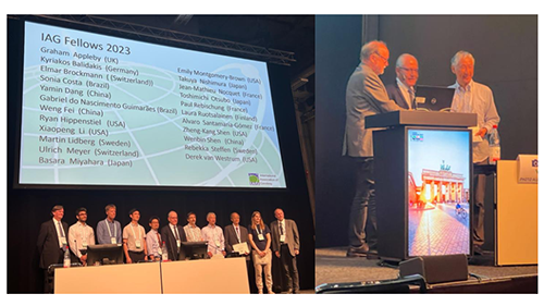
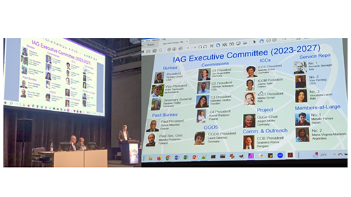
During the recent International Union of Geodesy and Geophysics (IUGG) held in Berlin, Germany, at the International Association of Geodesy (IAG) Closing Session, Dr. Graham Appleby and Dr. Toshimichi Otsubo, both former ILRS GB Chairs, were inducted as 2023 Fellows of the IAG.
IUGG/IAG NewsRelease Date: 08/01/2023
During the recent International Union of Geodesy and Geophysics (IUGG) held in Berlin, Germany, at the International Association of Geodesy (IAG) Closing Session, Dr. Graham Appleby and Dr. Toshimichi Otsubo, both former ILRS GB Chairs, were inducted as 2023 Fellows of the IAG.
Dr. Vincenza Luceri, Chair of the ILRS Analysis Center Standing Committee, was elected as a member of the IAG Executive Committee for the 2023-2027 Term.
Our congratulations to all three, and our thanks for their continued contribution to the IAG and the geodetic community.
 The SLR-tailored version of ITRF2020, the SLRF2020, has been released to the publicRelease Date: 07/25/2023
The long-awaited SLR-tailored version of ITRF2020, the SLRF2020, has been released to the public, along with the associated Data Handling File required for proper and accurate reduction of SLR data. Both files contain notes that are important to users, especially to those requiring the highest quality results in their work; it is imperative that users read these notes before implementing the new TRF in their production lines.
The SLR-tailored version of ITRF2020, the SLRF2020, has been released to the publicRelease Date: 07/25/2023
The long-awaited SLR-tailored version of ITRF2020, the SLRF2020, has been released to the public, along with the associated Data Handling File required for proper and accurate reduction of SLR data. Both files contain notes that are important to users, especially to those requiring the highest quality results in their work; it is imperative that users read these notes before implementing the new TRF in their production lines.
The two files can be accessed from the ILRS website pages:
https://ilrs.gsfc.nasa.gov/science/dataAnalysisResources/index.html
https://ilrs.gsfc.nasa.gov/network/site_information/index.html
CDDIS Landing pages with the appropriate DOIs are here:
https://cddis.nasa.gov/Data_and_Derived_Products/SLR/slrf_2020.html
https://cddis.nasa.gov/Data_and_Derived_Products/SLR/slrf_2020_DHF.html
 Journal article on ITRF2020 published by the Journal of Geodesy Release Date: 06/22/2023
The journal article full citation is:
Journal article on ITRF2020 published by the Journal of Geodesy Release Date: 06/22/2023
The journal article full citation is:
Altamimi, Z., Rebischung, P., Collilieux, X., Métivier L., Chanard K. (2023). "ITRF2020: an augmented reference frame refining the modeling of nonlinear station motions". Journal of Geodesy, 97, 47. https://doi.org/10.1007/s00190-023-01738-w
The SLR contribution to ITRF2020 consists of 244 fortnightly SINEX solutions for 1983.0—1993.0, based on LAGEOS-1, and 1459 weekly solutions afterwards based on the LAGEOS 1 & 2 and ETALON 1 & 2 satellites. The paper acknowledges the contributions of the Geodetic Observatories and stations, the funding agencies, mapping agencies and space agencies that support space geodesy, and the IAG technique services (including the ILRS) for their contributions.
"The International Terrestrial Reference Frame (ITRF) is the result of a global collaboration of hundreds of institutions around the worlds: from the build-up of geodetic observatories, satellite missions, data collection, analysis and combination, to the ITRF generation, thanks to the investment of national mapping agencies, space agencies and universities. We are indebted to all Analysis and Combination Centers of the IAG Technique Services of the four techniques who constantly provide data for ITRF solutions which would not exist without their valuable contributions."
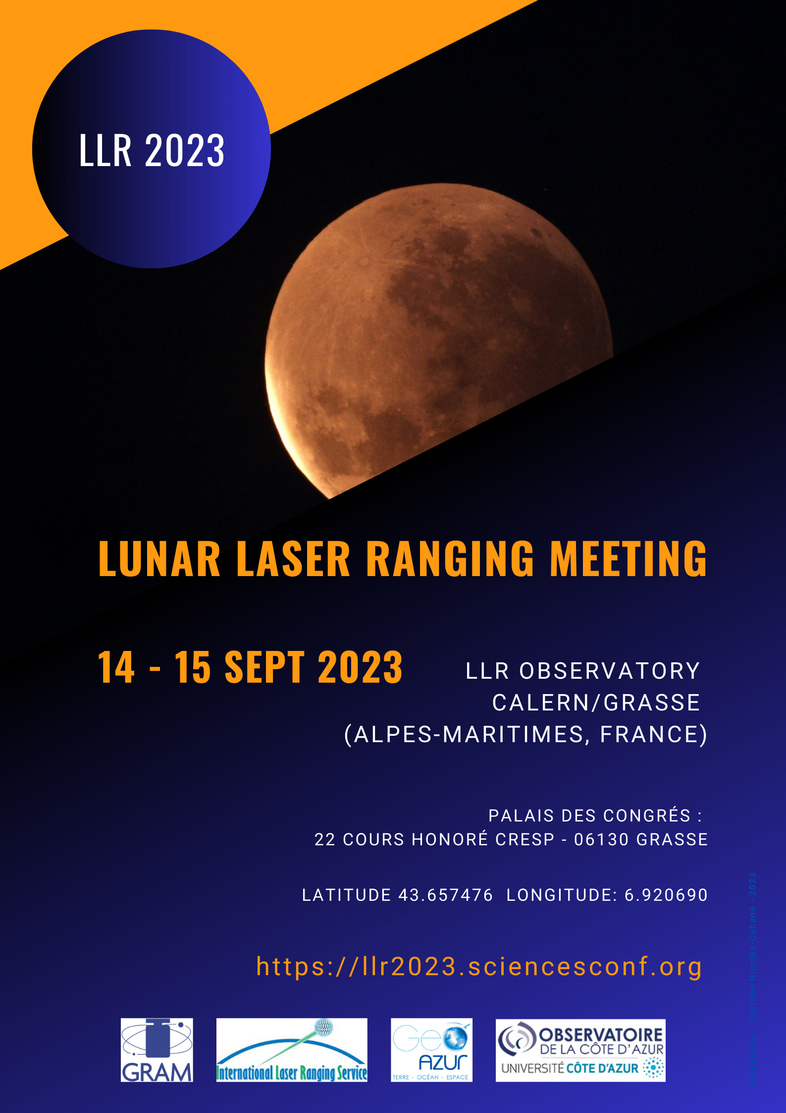 First Lunar Laser Ranging (LLR) Meeting, September 14th and 15th, 2023, Pole Astronomie Géoazur,
Observatoire de la Côte d'Azur (OCA), CNRS - INSU, Université Côte d'Azur (UCA), France Release Date: 05/10/2023
The first LLR meeting wishes to bring both the producers, the users and the science behind lunar laser ranging together in order to join efforts and resources, to define goals and enhance the visibility for a LLR community, and to identify synergies and to plan for the future. The goal is to encourage every group to help and form a visible global community.
First Lunar Laser Ranging (LLR) Meeting, September 14th and 15th, 2023, Pole Astronomie Géoazur,
Observatoire de la Côte d'Azur (OCA), CNRS - INSU, Université Côte d'Azur (UCA), France Release Date: 05/10/2023
The first LLR meeting wishes to bring both the producers, the users and the science behind lunar laser ranging together in order to join efforts and resources, to define goals and enhance the visibility for a LLR community, and to identify synergies and to plan for the future. The goal is to encourage every group to help and form a visible global community.
Clément Courde
courde@geoazur.unice.fr
Julien Chabé
chabe@geoazur.unice.fr
 SLR & DORIS Support the Discovery of 19,000 Undersea Volcanos Using Satellite AltimetryRelease Date: 04/21/2023
A team of scientists has published a new catalog of undersea volcanos, or seamounts, that are derived using ocean radar altimetry data from the satellites Jason-1, Envisat CryoSat-2, and Saral/AltiKa. The altimeter data for this study were obtained primarily from the geodetic missions for these satellites. In the geodetic missions, the satellites flew so that successive ground tracks were aligned close together. This facilitated the mapping of the ocean geoid.The data from these most recent satellite missions have improved the ability to find previously undetected seamounts, from how the mass of the seamounts perturbs the shape of the ocean surface.
SLR & DORIS Support the Discovery of 19,000 Undersea Volcanos Using Satellite AltimetryRelease Date: 04/21/2023
A team of scientists has published a new catalog of undersea volcanos, or seamounts, that are derived using ocean radar altimetry data from the satellites Jason-1, Envisat CryoSat-2, and Saral/AltiKa. The altimeter data for this study were obtained primarily from the geodetic missions for these satellites. In the geodetic missions, the satellites flew so that successive ground tracks were aligned close together. This facilitated the mapping of the ocean geoid.The data from these most recent satellite missions have improved the ability to find previously undetected seamounts, from how the mass of the seamounts perturbs the shape of the ocean surface.
The new map will aid studies of marine tectonics, geology, ecology and ocean mixing.
This discovery was supported by Precise Orbit Determination (POD), including Satellite Laser Ranging (SLR), and DORIS for Jason-1, Envisat, CryoSat-2, and Saral/ALtiKa whose altimeter data contributed to the results of this new study.
More information:
Overview article in Science magazine, April 19, 2023:
https://www.science.org/content/article/it-s-just-mind-boggling-more-19-000-undersea-volcanoes-discovered
Scientific publication, published March 20, 2023:
Gevorgian J., Sandwell D., Yu Y., Kim S.-S. and Wessel P. (2023). "Global distribution and morphology of small seamounts". Earth and Space Science, 10, e2022EA002331.
https://doi.org/10.1029/2022EA002331
 Opening ceremony held at the SLR Station in Tsukuba, Japan (ID: 7306, Code: TKBL)Release Date: 04/06/2023
Shinichi Nakamura, the manager of the new JAXA Tsukuba SLR station reports that the development phase has been completed. The new SLR station is located in Tsukuba, southern Ibaraki Prefecture, about 50 km from central Tokyo. JAXA held the opening ceremony of the station on March 30, 2023. A total of 36 people attended the ceremony, including representatives of the Japanese Coast Guard, Hitotsubashi University, the University of Tokyo, the JAXA director, and many JAXA satellite project managers. Dr. Stephen Merkowitz, Chair of the ILRS Governing Board, gave a congratulatory speech on the opening of the station, which added to the festivities. With the guidance of the ILRS, the SLR Tsukuba station was assigned the station ID: 7306, and Code: TKBL. The JAXA Tsukuba station staff are proud that the new station will be a member of the ILRS network and look forward to contributing to space development and science through SLR operations. In April, 2023, trial operation will be held to familiarize JAXA staff and full operation is scheduled to start in May 2023.
Opening ceremony held at the SLR Station in Tsukuba, Japan (ID: 7306, Code: TKBL)Release Date: 04/06/2023
Shinichi Nakamura, the manager of the new JAXA Tsukuba SLR station reports that the development phase has been completed. The new SLR station is located in Tsukuba, southern Ibaraki Prefecture, about 50 km from central Tokyo. JAXA held the opening ceremony of the station on March 30, 2023. A total of 36 people attended the ceremony, including representatives of the Japanese Coast Guard, Hitotsubashi University, the University of Tokyo, the JAXA director, and many JAXA satellite project managers. Dr. Stephen Merkowitz, Chair of the ILRS Governing Board, gave a congratulatory speech on the opening of the station, which added to the festivities. With the guidance of the ILRS, the SLR Tsukuba station was assigned the station ID: 7306, and Code: TKBL. The JAXA Tsukuba station staff are proud that the new station will be a member of the ILRS network and look forward to contributing to space development and science through SLR operations. In April, 2023, trial operation will be held to familiarize JAXA staff and full operation is scheduled to start in May 2023.
The ILRS congratulates the JAXA team on the commissioning of this new SLR station.
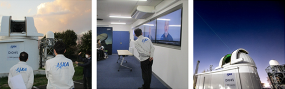
Opening ceremony of the SLR Station in Tsukuba, Japan (ID: 7306, Code: TKBL), held on March 30, 2023 [Images courtesy JAXA/Shinichi Nakamura].
 Removal of Satellite Daily and Hourly Files older than 6 months - data holdings clean-upRelease Date: 03/31/2023
Dear ILRS Community,
Removal of Satellite Daily and Hourly Files older than 6 months - data holdings clean-upRelease Date: 03/31/2023
Dear ILRS Community,
The CDDIS has been working to provide clarity to new users of the archive and to reduce redundant data. With this effort, the CDDIS plans to take the following steps over the next few weeks:
Please let us know if you have any questions about these changes. Thank you!
Justine Woo (she/her)
SLR Operations, Software Development
Crustal Dynamics Data Information System (CDDIS)
NASA GSFC, Code 61A
Greenbelt, MD 20771, USA
justine.y.woo@nasa.gov
![]() 22nd International Workshop on Laser Ranging (IWLR) in Guadalajara, Spain - November 7-11, 2022 - Session Videos Available for viewingRelease Date: 03/03/2023
We are pleased to announce that the recordings for the 22nd International Workshop on Laser Ranging (IWLR) held in Guadalajara, Spain, are available for viewing. This is the first time that a full ILRS workshop is made available in video. This, together with the ILRS Virtual World Tours 2020 and 2021, all the events organized by the ILRS in the last three years are publicly accessible to everyone.
22nd International Workshop on Laser Ranging (IWLR) in Guadalajara, Spain - November 7-11, 2022 - Session Videos Available for viewingRelease Date: 03/03/2023
We are pleased to announce that the recordings for the 22nd International Workshop on Laser Ranging (IWLR) held in Guadalajara, Spain, are available for viewing. This is the first time that a full ILRS workshop is made available in video. This, together with the ILRS Virtual World Tours 2020 and 2021, all the events organized by the ILRS in the last three years are publicly accessible to everyone.
The 22nd IWLR was organized by the Observatory of Yebes, the National Geographic Institute of Spain (IGN/CNIG), and the ILRS. Over 170 delegates from 20 different countries participated in the conference, which took place on 7–11 November 2022. With the theme "Reconnecting the ILRS community", this event was for the first time in a hybrid in person/online format. The conference was a great opportunity for the experts in the various SLR-related fields to meet, discuss, and exchange ideas and new developments.
The video recordings of the conference include the talks from all the 10 Main Sessions; the presentations kindly given by the invited speakers; and the meetings of the ILRS Standing Committees on Data Formats & Proceedings, Networks & Engineering, and Missions. The Opening and Closing sessions, including the SLR Pioneers Awards, are all available for viewing as well.
You can access the recording here: https://www.youtube.com/@22ndIWLR
We thank the Local Organizing Committee for making and sharing the recordings of the conference possible.
 "Leaders in Lidar" Video Series Release Date: 02/03/2023
For those interested in the Legacy of Goddard's lead role in laser altimetry, you can view the recently released "Leaders in Lidar" Series (All Episodes – Youtube).
"Leaders in Lidar" Video Series Release Date: 02/03/2023
For those interested in the Legacy of Goddard's lead role in laser altimetry, you can view the recently released "Leaders in Lidar" Series (All Episodes – Youtube).
"In this series, we dive into the legacy of Goddard's lead role in developing laser altimetry, which has revolutionized the way we map our planet, the Moon and other planets. Each chapter looks at the successes and failures of these lidar instruments, beginning with the Mars Observer Laser Altimeter in the late 1980s, through the current generation of laser altimeters on ICESat-2 and GEDI. Through dozens of interviews and archival footage, the history, challenges and legacy of lidar are uncovered."
https://www.youtube.com/watch?v=w06s8x-0smE
![]() Announcing the 2023-2024 ILRS Governing BoardRelease Date: 02/03/2023
Elections for the 2023-2024 ILRS Governing Board (GB) concluded in December of 2022.
Announcing the 2023-2024 ILRS Governing BoardRelease Date: 02/03/2023
Elections for the 2023-2024 ILRS Governing Board (GB) concluded in December of 2022.
The new ILRS GB took office on January 01, 2023
These are the eighteen members of the Board
Newly elected ILRS GB Chairperson: Stephen Merkowitz (NASA/GSFC, USA)
Four ex-officio/appointed members of the Board:
Director of the Central Bureau - Mike Pearlman (Harvard U., USA)
Secretary of the Central Bureau - Claudia Carabajal (SSAI @ NASA/GSFC, USA)
Representative of IAG Commission - Urs Hugentobler (TUM, Germany)
IERS Representative - Daniela Thaller (BKG, Germany)
Twelve elected members of the Board:
EUROLAS Network Representatives - Sven Bauer (DIGOS, Germany), Jose Rodriquez (Yebes Observatory, IGN, Spain)
NASA Network Representatives - Evan Hoffman (NASA/GSFC, USA), Stephen Merkowitz (NASA/GSFC, USA)
WPLTN Representatives - James Bennett (EOS Space Systems Pty. Ltd., Australia), Zhang Zhongping (SHAO, China)
Data Center Representative – Justine Woo (SSAI @ NASA/GSFC, USA)
LLR Representative – Clément Courde (Geoazur, France)
Analysis Representatives – Vincenza Luceri (E-GOST, Italy), Mathis Blossfeld (TUM, Germany)
At-Large Representatives – Matthew Wilkinson (NERC/NSGF, UK), Christian Schwatke (TUM, Germany)
Two appointed At-Large Representatives of the Board:
Randall Carman (Geoscience Australia), Takehiro Matsumoto (JAXA, Japan)
Congratulations to all those elected!
We thank Toshimichi Otsubo for his dedication as the ILRS GB Chair for the 2021-2022 term.
We also thank all previous members of the ILRS GB for your service to the ILRS.
We look forward to your continued participation on ILRS activities and Workshops, Standing Committees and Study Groups.
![]() Data centers ceased accepting CRD and CPF Format V1 files January 1, 2023Release Date: 01/25/2023
The ILRS DF&PSC announced at the International Workshop on Laser Ranging (IWLR) that the data centers would cease accepting CRD and CPF Format V1 files beginning January 1, 2023. The CPF files transitioned from version 1 to version 2 on March 1, 2022 and CRD files transitioned from version 1 to version 2 on August 1, 2022. If you have not had the chance to change over your scripts, please find the new files available at:
Data centers ceased accepting CRD and CPF Format V1 files January 1, 2023Release Date: 01/25/2023
The ILRS DF&PSC announced at the International Workshop on Laser Ranging (IWLR) that the data centers would cease accepting CRD and CPF Format V1 files beginning January 1, 2023. The CPF files transitioned from version 1 to version 2 on March 1, 2022 and CRD files transitioned from version 1 to version 2 on August 1, 2022. If you have not had the chance to change over your scripts, please find the new files available at:
CRD
Documentation https://ilrs.gsfc.nasa.gov/docs/2022/crd_v2.01e3.pdf
Archive Location NPT:
FRD:
CPF
Documentation https://ilrs.gsfc.nasa.gov/docs/2006/cpf_1.01.pdf
Archive Location
2022
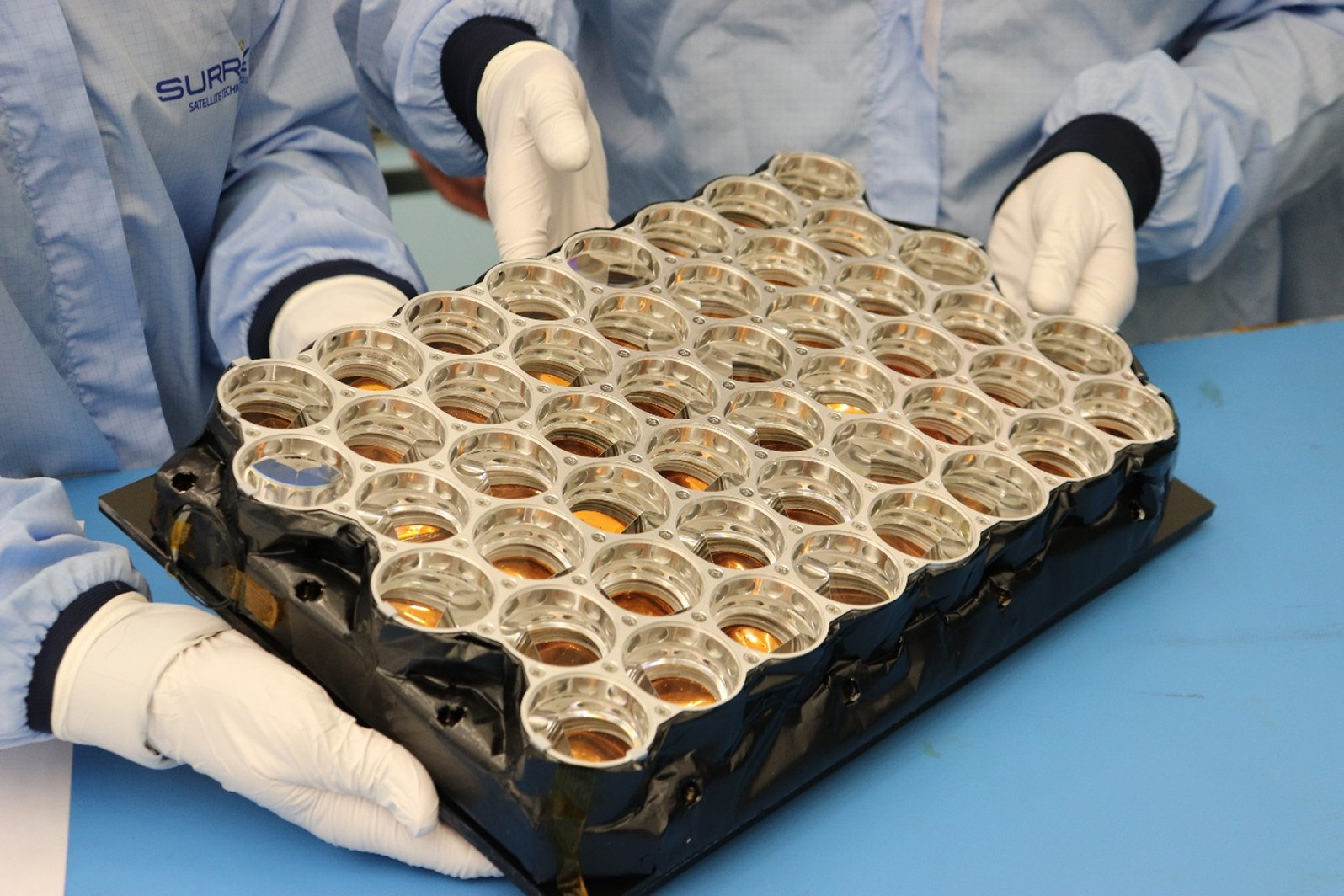
NASA's laser retroreflector array arriving for inspection and approval (Credit: Surrey Satellite Technology Ltd.)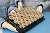 NASA Delivers First Flight Hardware to ESA for Lunar PathfinderRelease Date: 12/02/2022
NASA delivered the first flight hardware for the Lunar Pathfinder mission to ESA (European Space Agency), which formally accepted the instrument on Nov. 4. NASA's Goddard Space Flight Center in Greenbelt, Maryland, developed the instrument, a laser retroreflector array, which will test new navigation techniques for lunar missions.
NASA Delivers First Flight Hardware to ESA for Lunar PathfinderRelease Date: 12/02/2022
NASA delivered the first flight hardware for the Lunar Pathfinder mission to ESA (European Space Agency), which formally accepted the instrument on Nov. 4. NASA's Goddard Space Flight Center in Greenbelt, Maryland, developed the instrument, a laser retroreflector array, which will test new navigation techniques for lunar missions.
NASA and ESA plan to launch Lunar Pathfinder via a future Commercial Lunar Payload Services delivery. In addition to testing navigation capabilities, Lunar Pathfinder will operate as a commercial communications relay satellite and provide communications services for exploration missions on the lunar surface.
The Lunar Pathfinder mission is led by Surrey Satellite Technology Ltd (SSTL), and ESA arranged for the mission to provide communications services to NASA. NASA Space Geodesy Project Manager Stephen Merkowitz, along with teams from ESA and SSTL, completed inspections when the laser retroreflector array arrived at SSTL's facility in Guildford, U.K., where it will be installed in the satellite.
Read more on nasa.gov
From left to right: Ron Noomen, Jean-Marie Torre, Graham Appleby, and Toshimichi Otsubo (ILRS GB Chair 2019-2022) Pioneer Awards presented at the 22nd IWLR in Guadalajara, SpainRelease Date: 12/02/2022
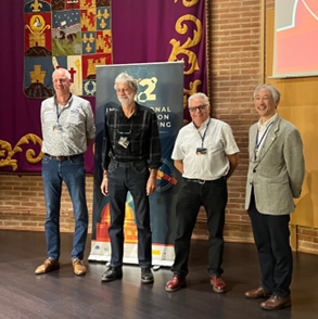
Ron Noomen - "In recognition of his pioneering scientific achievements ranging from the WEGENER campaign to the first ILRS combination products"
Dr. Jean-Marie Torre - "In recognition of his achievements and efforts in enhancing the productivity of precise lunar laser ranging and contributions to challenging space missions"
Dr. Graham Appleby - "In recognition of his pursuit of the single-photon regime to improve measurement accuracy and geodetic parameters"
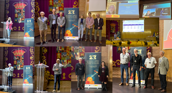
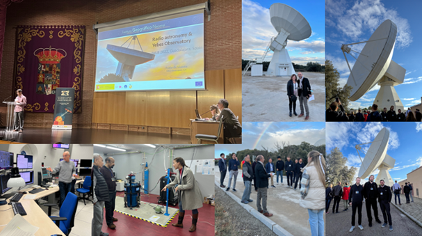
22nd International Workshop on Laser Ranging, Guadalajara, Spain, November 7-11, 2022. (Photos credit: 22nd IWLR Local Organizing Committee, Claudia Carabajal, SSAI/NASA.) 22nd International Workshop on Laser Ranging, Guadalajara, Spain, November 7-11, 2022. Visit to the Yebes Observatory, Spain. (Photos credit: Claudia Carabajal, SSAI/NASA)![]() 22nd International Workshop on Laser Ranging (IWLR): Reconnecting the ILRS CommunityRelease Date: 12/02/2022
The 22nd International Workshop on Laser Ranging took place in Guadalajara, Spain, November 7-11, 2022, hosted by the Yebes Observatory, the National Geographic Institute of Spain (IGN), with the support of National Centre for Geographic Information (CNIG), and in collaboration with the International Laser Ranging Service (ILRS). Being the first in-person ILRS meeting since the start of the COVID-19 pandemic, the theme of the meeting was "Reconnecting the ILRS community". In person and online attendees participated in an exciting program, which included sessions on ILRS Contributions to Earth Orientation Parameters (EOP); Laser Ranging Applications to Precision Orbit Determination (POD); Science Applications of Satellite Laser Ranging (SLR); Errors in SLR detection, mitigation, and modeling; Current and Future Missions; Ground Networks and Operations; Space Debris, Technology and Developments, and New Applications; and Lunar Laser Ranging and Deep Space. Participation in the workshop included 170 delegates from 20 different countries, and approximately 30-40 persons attending online each day from throughout the world, with 77 oral talks and 32 posters presented. Invited talks were given by Dr. Nick Brown (Geosciences Australia), Dr. Pablo de Vicente (Yebes Observatory, IGN/CNIG, Spain), Dr. Rüdiger Haas (University of Technology, Onsala Space Observatory, Sweden), and Dr. Tim Flohrer (ESOC, European Space Agency). The program included a visit to Yebes Observatory with a tour of the facilities, including the new Satellite Laser Ranging (SLR) station at Yebes, set to become operational in 2023. Ron Noomen (TU Delft, The Netherlands), Jean-Marie Torre (Observatoire de la Côte d'Azur, France) and Graham Appleby (Herstmonceux Geodetic Observatory, U.K.) were presented with ILRS Pioneer Awards. Stephen Merkowitz (NASA Goddard Space Flight Center, U.S.A.) was elected as the Chairperson of the ILRS Governing Board (GB) for the period 2023-2024.
22nd International Workshop on Laser Ranging (IWLR): Reconnecting the ILRS CommunityRelease Date: 12/02/2022
The 22nd International Workshop on Laser Ranging took place in Guadalajara, Spain, November 7-11, 2022, hosted by the Yebes Observatory, the National Geographic Institute of Spain (IGN), with the support of National Centre for Geographic Information (CNIG), and in collaboration with the International Laser Ranging Service (ILRS). Being the first in-person ILRS meeting since the start of the COVID-19 pandemic, the theme of the meeting was "Reconnecting the ILRS community". In person and online attendees participated in an exciting program, which included sessions on ILRS Contributions to Earth Orientation Parameters (EOP); Laser Ranging Applications to Precision Orbit Determination (POD); Science Applications of Satellite Laser Ranging (SLR); Errors in SLR detection, mitigation, and modeling; Current and Future Missions; Ground Networks and Operations; Space Debris, Technology and Developments, and New Applications; and Lunar Laser Ranging and Deep Space. Participation in the workshop included 170 delegates from 20 different countries, and approximately 30-40 persons attending online each day from throughout the world, with 77 oral talks and 32 posters presented. Invited talks were given by Dr. Nick Brown (Geosciences Australia), Dr. Pablo de Vicente (Yebes Observatory, IGN/CNIG, Spain), Dr. Rüdiger Haas (University of Technology, Onsala Space Observatory, Sweden), and Dr. Tim Flohrer (ESOC, European Space Agency). The program included a visit to Yebes Observatory with a tour of the facilities, including the new Satellite Laser Ranging (SLR) station at Yebes, set to become operational in 2023. Ron Noomen (TU Delft, The Netherlands), Jean-Marie Torre (Observatoire de la Côte d'Azur, France) and Graham Appleby (Herstmonceux Geodetic Observatory, U.K.) were presented with ILRS Pioneer Awards. Stephen Merkowitz (NASA Goddard Space Flight Center, U.S.A.) was elected as the Chairperson of the ILRS Governing Board (GB) for the period 2023-2024.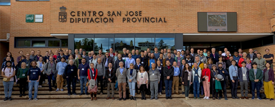
Splinter meetings for the ILRS Governing Board, Analysis, Missions, Networks and Engineering Special Committees, the Transponders & Lunar Laser Ranging and Space Debris Study Groups were also held, and reports presented.
https://congreso-yebes.ign.es/web/portal/home
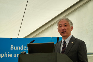
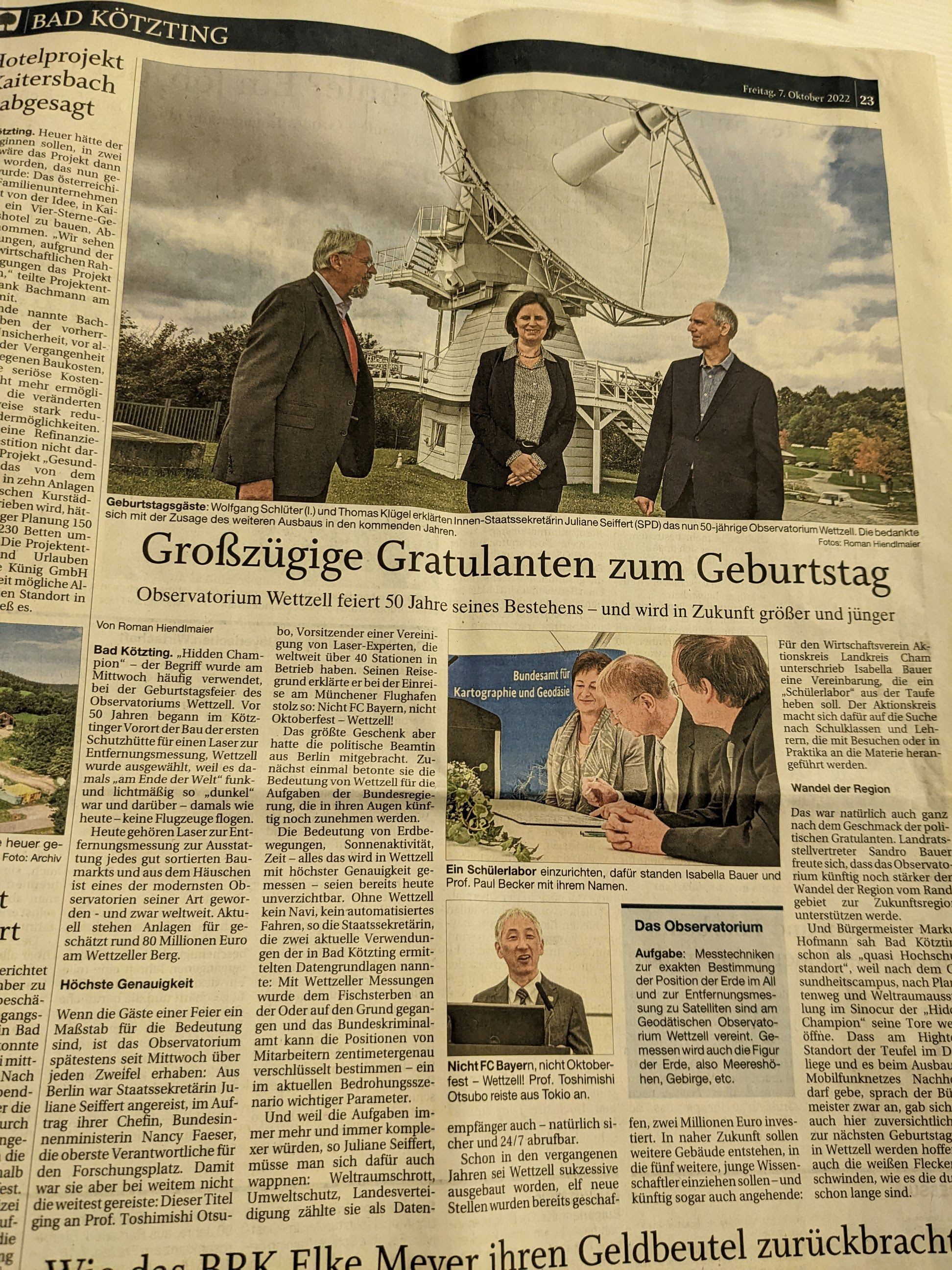
Toshimichi Otsubo delivered a short speech on behalf of ILRS (photo: Ulrich Schreiber). Local newspaper on the following day, 8 Oct 2022 50-year anniversary of Wettzell ObservatoryRelease Date: 10/14/2022
Since 1972, various stages of geodetic instrumentation have been
introduced to Wettzell (Germany) which is today regarded as the
best-equipped geodetic observatory in the world. BKG and TUM jointly
celebrated their 50 years milestone on 7 Oct 2022, with about 100
attendees from Germany and foreign countries. A series of welcome
notes and talks were presented by the hosts, the local politicians,
government representatives and the IAG Services. Congratulations!
50-year anniversary of Wettzell ObservatoryRelease Date: 10/14/2022
Since 1972, various stages of geodetic instrumentation have been
introduced to Wettzell (Germany) which is today regarded as the
best-equipped geodetic observatory in the world. BKG and TUM jointly
celebrated their 50 years milestone on 7 Oct 2022, with about 100
attendees from Germany and foreign countries. A series of welcome
notes and talks were presented by the hosts, the local politicians,
government representatives and the IAG Services. Congratulations!
![]() Transition to CRD V2 formatRelease Date: 08/16/2022
The ILRS CB and ILRS DF&PSC announced in June that the transition from the Consolidated laser Ranging Data (CRD) format version 1 to version 2 was to occur on August 1, 2022. This transition has occurred and CRD v2 data can be downloaded from the desired data center:
Transition to CRD V2 formatRelease Date: 08/16/2022
The ILRS CB and ILRS DF&PSC announced in June that the transition from the Consolidated laser Ranging Data (CRD) format version 1 to version 2 was to occur on August 1, 2022. This transition has occurred and CRD v2 data can be downloaded from the desired data center:
NASA CDDIS:
Users who have not transitioned should do so immediately. Although we have requested that stations continue to provide data in the old and new formats for a limited time longer, we cannot guarantee their compliance.
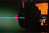
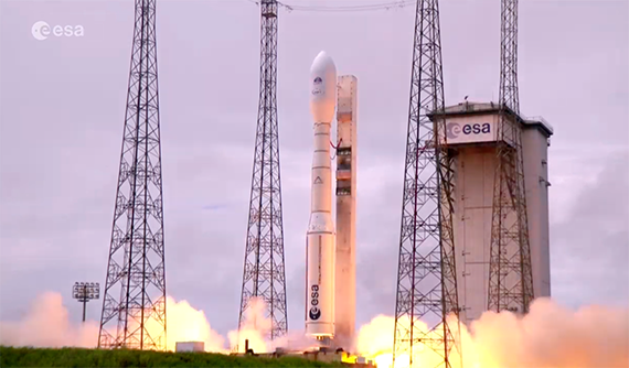
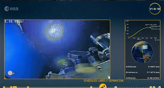
 Successful Launch of LARES-2 – 13 July 2022 at 13:13:17 UTCRelease Date: 07/15/2022
LARES-2 was successfully launched from Kourou, FR Guiana, on July 13, 2022, at 13:13 UTC on the inaugural VEGA-C launch VV21. It was inserted in the designed orbit (without spin!) about an hour and a half later. Following the lucky tradition set by LARES in 2012, the launch date was picked again to be the 13th of the month! The release was done over Yarragadee; as soon as ESA provides initial elements, CPF prediction files will be generated and delivered to ILRS. Following that we will wait to hear which of our systems will get it first!
Successful Launch of LARES-2 – 13 July 2022 at 13:13:17 UTCRelease Date: 07/15/2022
LARES-2 was successfully launched from Kourou, FR Guiana, on July 13, 2022, at 13:13 UTC on the inaugural VEGA-C launch VV21. It was inserted in the designed orbit (without spin!) about an hour and a half later. Following the lucky tradition set by LARES in 2012, the launch date was picked again to be the 13th of the month! The release was done over Yarragadee; as soon as ESA provides initial elements, CPF prediction files will be generated and delivered to ILRS. Following that we will wait to hear which of our systems will get it first!
https://www.nasaspaceflight.com/2022/07/vega-c-debut-launch/
For those who missed the launch, you can see the entire program on ESA WEB YouTube channel:
English: https://www.youtube.com/watch?v=sJTm-3QxDQc
French: https://www.youtube.com/watch?v=XnijRbDBxZE
Below is a picture of the moment LARES-2 is released:
 The Second LARES 2 and fifth LARES International Science WorkshopRelease Date: 05/26/2022
Rome, Italy, May 31 –June 3 , 2022
The Second LARES 2 and fifth LARES International Science WorkshopRelease Date: 05/26/2022
Rome, Italy, May 31 –June 3 , 2022
General Relativity, Time and Time Travel in General Relativity, Space Research and John Archibald Wheeler.
Preliminary list of invited speakers: Kip Thorne (Caltech), Roger Penrose (Oxford University) and Igor Novikov (Lebedev Institute)
View program.
![]() ESA Lunar Pathfinder mission to include Lunar Laser RangingRelease Date: 04/28/2022
The European Space Agency (ESA) announced that a test version of unique satellite navigation receiver has been delivered for the Lunar Pathfinder spacecraft, scheduled for launch in 2024. The receiver will receive GNSS-signals from the Galileo and GPS constellations for position, navigation and timing around the Moon. The Lunar Pathfinder spacecraft will also carry a laser retroreflector array for lunar laser ranging, and an X-Band transponder for ranging and communications using conventional deep space tracking facilities.
ESA Lunar Pathfinder mission to include Lunar Laser RangingRelease Date: 04/28/2022
The European Space Agency (ESA) announced that a test version of unique satellite navigation receiver has been delivered for the Lunar Pathfinder spacecraft, scheduled for launch in 2024. The receiver will receive GNSS-signals from the Galileo and GPS constellations for position, navigation and timing around the Moon. The Lunar Pathfinder spacecraft will also carry a laser retroreflector array for lunar laser ranging, and an X-Band transponder for ranging and communications using conventional deep space tracking facilities.
The laser retroreflector array on Lunar Pathfinder will be an evolution of the retroreflector array designed for NASA's Lunar Reconnaissance Orbiter (LRO). The LRO retroreflector array is a 15 × 18 × 5 cm, 650-g array of twelve 32-mm diameter solid corner cubes mounted on the LRO anti-nadir deck. In 2020, NASA scientists and colleagues from the ILRS station at Grasse, France, conducted successful two-way laser ranging to the LRO spacecraft.
Lunar Pathfinder will relay signals from lunar orbital and lunar surface missions, and provide navigation information for lunar orbiting and surface assets. The Lunar Pathfinder spacecraft is being built by SSTL (Surrey Satellite Technology Limited) in the U.K.
Link for ESA news story: https://www.esa.int/Applications/Navigation/The_Moon_where_no_satnav_has_gone_before
Description of Lunar Laser Ranging to NASA's Lunar Reconnaissance Orbiter (LRO)
Mazarico E., Sun X., Torre JM. et al (2020). "First two-way laser ranging to a lunar orbiter: infrared observations from the Grasse station to LRO's retro-reflector array". Earth Planets Space 72, 113. doi:10.1186/s40623-020-01243-w
 GGOS Coordinating Office Develops Film to Promote GeodesyRelease Date: 04/28/2022
The Global Geodetic Observing System (GGOS) Coordinating Office has helped to organize a general ∼8 minute video that explains geodesy, the geodetic observations and products that are available from the different IAG services, and the benefits of geodesy to science and society.
GGOS Coordinating Office Develops Film to Promote GeodesyRelease Date: 04/28/2022
The Global Geodetic Observing System (GGOS) Coordinating Office has helped to organize a general ∼8 minute video that explains geodesy, the geodetic observations and products that are available from the different IAG services, and the benefits of geodesy to science and society.
The GGOS video so far is available in English, Spanish, German, French & Japanese.
Contributors included Allison Craddock (IGS, NASA/JPL, USA), Detlef Angermann (GGOS, TU München, Germany), Basara Miyahara (GGOS, Geospatial Information Authority of Japan), Laura Sánchez (GGOS, TU München, Germany), Martin Sehnal (GGOS, BEV Federal Office of Metrology and Surveying, Austria), Michael Pearlman (ILRS, Harvard Center for Astrophysics, USA), Riccardo Barzaghi (IAG, Politecnico di Milano, Italy), Adrian Jäggi (IAG, AIUB, Switzerland), Zuheir Altamimi (IAG, Institut Géographique National, France), Richard Gross (GGOS, NASA/JPL, USA), Kosuke Heki (GGOS, Hokkaido University, Japan), Toshimichi Otsubo (ILRS, Hitotsubashi University, Japan), Laurent Soudarin (IDS, CLS, France), Alexandre Couhert (IDS, CNES, France), Pascale Ferrage (IDS, CNES, France), Frank Lemoine (IDS & ILRS, NASA GSFC, USA), Kayako Hori, Shinobu Kurihara, William Martínez, and Katharina Sehnal.
Check out the videos on YouTube:
English: https://www.youtube.com/watch?v=Jwqz097N2IY
Spanish: https://www.youtube.com/watch?v=biqkQ8Iy5rI
French: https://www.youtube.com/watch?v=9CLlDXIl_aI
German: https://www.youtube.com/watch?v=6sjp4cGbKT8
Japanese: https://www.youtube.com/watch?v=SQ6k64IkQ1g
Please share the video(s) in your home institutes and on social media.
If you would like to contribute to GGOS by translating the video into another language, please contact the GGOS Coordinating Office (email: co AT ggos.org).
![]() The IERS ITRS Center at the IGN (Institut Géographique National, France) announced the availability of the ITRF2020 solution Release Date: 04/21/2022
On April 15, 2022, the IERS ITRS Center at the IGN (Institut Géographique National, France) announced the availability of the ITRF2020 solution at their dedicated web site:
The IERS ITRS Center at the IGN (Institut Géographique National, France) announced the availability of the ITRF2020 solution Release Date: 04/21/2022
On April 15, 2022, the IERS ITRS Center at the IGN (Institut Géographique National, France) announced the availability of the ITRF2020 solution at their dedicated web site:
https://itrf.ign.fr/en/solutions/ITRF2020
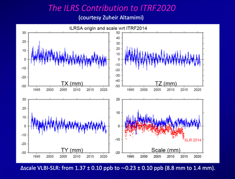
The new reference frame realization includes the contributions of all the IAG Geodetic Services (IVS, ILRS, IDS, IGS) and their Analysis Centers and Combination Centers. The ILRS contribution was based on a reprocessing of SLR data to the LAGEOS, LAGEOS-2 & the two Etalon satellites from 1993.0 to 2020.0 and to LAGEOS only from 1983.0 to 1993.0. As part of the reprocessing, the ILRS Analysis Standing Committee (ASC) conducted a 5-year effort of systematic analysis, to determine systematic errors in the SLR data. The reanalysis incorporated an improved "target signature" model (CoG) for better separation of true systematic errors from errors in describing the target's signature (Rodriguez et al., 2019; Pavlis et al., 2021). A major result is that the scale difference with VLBI in ITRF2020 is ~1.4 mm (0.23 ppb) compared to ITRF2014 where the SLR-VLBI scale difference was ~8.8 mm (1.37 ppb). While SLR defines the origin of the ITRF, both SLR & VLBI are used to define the scale of the ITRF. We show the characteristics of the ILRS contribution to ITRF2020 in the figure below, with the ITRF2020 SLR scale in blue and the ITRF2014 SLR scale in red (Pavlis et al., 2021).
The ILRS ASC is working on an ILRS extended version, the SLRF2020, which will include the SLR stations that were not part of the ITRF2020 solution and will provide instructions on how to get the highest accuracy results when implementing this extended model in SLR data analysis.
In the meantime, users should visit the ITRF website to update their procedures with the new files and software that have been released with the ITRF2020, and should implement the new Post-Seismic Displacement model and other related enhancements.
The ITRS solutions by the other ITRS centers, DTRF2020 from DGFI-TUM (Deutsches Geodätisches Forschungsinstitut, Technische Universität München), and JTRF2020 from JPL (the NASA Jet Propulsion Laboratory), are being finalized and should be available in the near future (e.g. Glomsda et al., 2021).
References:
Glomsda M., Seitz M., Bloßfeld M. et al. (2021). "DTRF2020: the ITRS2020 realization of DGFI-TUM", Frontiers of Geodetic Science (virtual meeting, Sept. 22, 2021). (https://mediatum.ub.tum.de/doc/1625232/1625232.pdf)
Pavlis E., Luceri V., Basoni A. et al. (2021). "ITRF2020: The International Laser Ranging Service (ILRS) Contribution, AGU 2021 Fall Meeting , 13-17 December 2021, doi:10.1002/essoar.10509208.1
Rodriguez, J., Appleby, G., Otsubo, T. (2019). "Upgraded modelling for the determination of centre of mass corrections of geodetic SLR satellites: impact on key parameters of the terrestrial reference frame", J. Geodesy, 93(12), 2553-2568, doi:10.1007/s00190-019-01315-0.
 New ILRS Station Izaña (7701, IZ1L) in Tenerife (Canary Islands, Spain) is now OperationalRelease Date: 04/14/2022
Izaña (7701) has completed the requirements to be an operational station in the ILRS network and its data has been released from quarantine. The Analysis Standing Committee has approved the release of data collected since 2021-11-28.
New ILRS Station Izaña (7701, IZ1L) in Tenerife (Canary Islands, Spain) is now OperationalRelease Date: 04/14/2022
Izaña (7701) has completed the requirements to be an operational station in the ILRS network and its data has been released from quarantine. The Analysis Standing Committee has approved the release of data collected since 2021-11-28.
We thank our station colleagues Andrea Di Mira, Jens Steinborn for their efforts, and congratulate them on this achievement!
 ILRS Stations Participate in Tracking Campaign for the IRNSS SatellitesRelease Date: 04/12/2022
From April 17-30, 2022 at the request of ISRO (Indian Space Research Organization), the ILRS Central Bureau is organizing a tracking campaign for the IRNSS Indian constellation of GNSS satellites. The objective is for the network to provide an even distribution of SLR normal points around the orbit, for the satellites that are the focus of the campaign. The IRNSS satellites are located in geosynchronous (24-hr) orbits over the Indian Ocean region and their ground track makes a 'figure-8' on the surface of the Earth.
ILRS Stations Participate in Tracking Campaign for the IRNSS SatellitesRelease Date: 04/12/2022
From April 17-30, 2022 at the request of ISRO (Indian Space Research Organization), the ILRS Central Bureau is organizing a tracking campaign for the IRNSS Indian constellation of GNSS satellites. The objective is for the network to provide an even distribution of SLR normal points around the orbit, for the satellites that are the focus of the campaign. The IRNSS satellites are located in geosynchronous (24-hr) orbits over the Indian Ocean region and their ground track makes a 'figure-8' on the surface of the Earth.
Seven satellites (IRNSS-1A,1B,1C,1D,1E,1F and IRNSS-1I) make up the IRNSS constellation, and are on the ILRS tracking roster. The distance to the geosynchronous orbit altitude (35786 km) makes these satellites challenging objects to track for the ILRS stations. Each IRNSS satellite is equipped with a retroreflector array consisting of 40 corner cubes, where each cube is 29.7 mm in height and 38 mm in diameter. These cubes were designed, manufactured and tested in India. The retroreflector arrays underwent thermo-optical characterization at the National Institute of Nuclear Physics/National Laboratory of Frascati facility in Italy (Porcelli et al., 2017). The current tracking campaign is a follow-on to an earlier ILRS campaign in 2018.
During the current campaign ILRS stations in the Eastern Region of the Indian Ocean (Asia, Australia) will track IRNSS 1C plus IRNSS -1D. ILRS stations in the Western Region of the Indian Ocean (Europe, Africa) will track IRNSS 1C plus IRNSS- 1I. While stations may try to track in the daytime, but it is expected that most data will be obtained during nighttime passes.
The IRNSS tracking data from the campaign will be used to assess the performance of these IRNSS satellites, in a similar way to how SLR data are used to validate the performance of other GNSS constellations such as Galileo.
References:
IRNSS constellation home page: https://www.isro.gov.in/IRNSS_Programme.html
Kogure S., Ganeshan A.S., and Montenbruck O. (2017). "Regional systems", in Springer Handbook of Global Navigation Satellite Systems, pp. 305-337, I Teunissen, P.J., Montenbruck, O. (eds). Springer-Verlag, Cham. doi:10.1007/978-3-319-42928-1_11.
Porcelli, L., et al. (2017). "Thermo-optical vacuum testing of IRNSS laser retroreflector array qualification model", Adv. Space Res., 60(5), 1054-1061, doi: 10.1016/j.asr.2017.05.012.
Sen J.R., Lakshimi K.T. Mukundun M. et al. (2020). "IRNSS information for beginners", Remote Sensing of Clouds and the Atmosphere XXV, Proceedings of SPIE, 11531, 115310O.
![]() Definitions of Pass, Pass-Segment, and SessionRelease Date: 04/11/2022
The CDDIS, EDC, and NASA DOC provide statistics for the ILRS community including the monthly report cards, verification counts, and statistics for presentations and reports. These groups have worked together to standardize their definitions of a pass and a pass-segment.
Definitions of Pass, Pass-Segment, and SessionRelease Date: 04/11/2022
The CDDIS, EDC, and NASA DOC provide statistics for the ILRS community including the monthly report cards, verification counts, and statistics for presentations and reports. These groups have worked together to standardize their definitions of a pass and a pass-segment.
The following definitions have been agreed to:
A pass includes all data taken on a satellite during one transit over the station. The pass-segment is just a magnification of how the data was taken and submitted.
 Call for Papers for IAG REFAG2022 Meeting Release Date: 04/04/2022
The primary scope of REFAG 2022 is to address today's theoretical concepts of reference systems and their practical implementation by space geodetic techniques and their combination. Contributions for the meeting may include, global reference frames by individual space geodetic techniques and their combination; space geodetic measurements and mitigation of their systematic errors; geocenter motion and non-tidal loading effects; terrestrial and space geodetic ties for multi-technique combination; regional reference frames and related applications; Celestial reference frames; comparison and combination of Earth Orientation parameters; and use and challenges of geodetic reference frames for Earth science applications. The scientific program of the symposium will also cover initiatives and projects that endorse the role of geodetic reference frames for scientific exploration, sustainable development, climate monitoring, and satellite navigation.
Call for Papers for IAG REFAG2022 Meeting Release Date: 04/04/2022
The primary scope of REFAG 2022 is to address today's theoretical concepts of reference systems and their practical implementation by space geodetic techniques and their combination. Contributions for the meeting may include, global reference frames by individual space geodetic techniques and their combination; space geodetic measurements and mitigation of their systematic errors; geocenter motion and non-tidal loading effects; terrestrial and space geodetic ties for multi-technique combination; regional reference frames and related applications; Celestial reference frames; comparison and combination of Earth Orientation parameters; and use and challenges of geodetic reference frames for Earth science applications. The scientific program of the symposium will also cover initiatives and projects that endorse the role of geodetic reference frames for scientific exploration, sustainable development, climate monitoring, and satellite navigation.
Key Dates:
For more information, check the URL for the meeting: www.refag2022.org
ESA's new Izaña (IZ1L) laser ranging station in Tenerife, Canary Islands, SpainNew ILRS Station (Izaña, IZ1L) in Tenerife (Canary Islands, Spain) undergoing acceptance testingRelease Date: 03/28/2022
The new SLR station Izaña (IZ1L, Tenerife, Canary Islands, Spain) is undergoing acceptance testing. The station is providing tracking data to LAGEOS-1, LAGEOS-2 and LARES which are being analyzed by the ILRS Analysis Standing Committee (ASC) to verify the performance prior to its acceptance as an operational station of the ILRS. The station Izaña (IZ1L) is built for the European Space Agency (ESA) by a consortium of European companies and institutes under the lead of DiGOS Potsdam GmbH (Germany).
A recent article in the online space news periodical "spaceref.com" provides news of and a description of the station.
(URL: https://spaceref.com/space-commerce/new-laser-station-lights-the-way-to-space-debris-reduction/)

![]() CPF v1 format discontinuedRelease Date: 03/10/2022
On March 1, 2022, the ILRS officially discontinued predictions in the CPF v1 format and have switched to the CPF v2 format. Please find the most recent predictions available at https://cddis.nasa.gov/archive/slr/cpf_predicts_v2/current/
CPF v1 format discontinuedRelease Date: 03/10/2022
On March 1, 2022, the ILRS officially discontinued predictions in the CPF v1 format and have switched to the CPF v2 format. Please find the most recent predictions available at https://cddis.nasa.gov/archive/slr/cpf_predicts_v2/current/
IAG Statement on UkraineRelease Date: 03/04/2022
The International Association of Geodesy, a parent organization of the IVS/ILRS, has posted a statement on Ukraine. Read the statement.
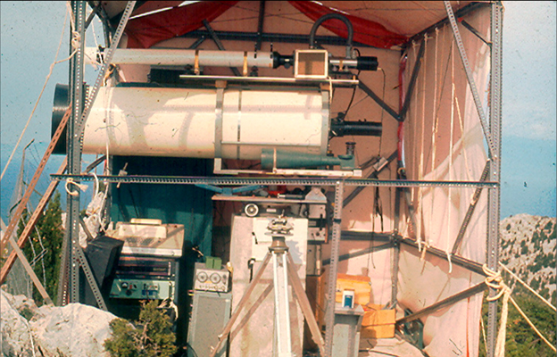
Dionysos laser system deployed on the island of Othoni northeast of Corfu, Greece, in October of 1973 (D. Balodimos personal archive).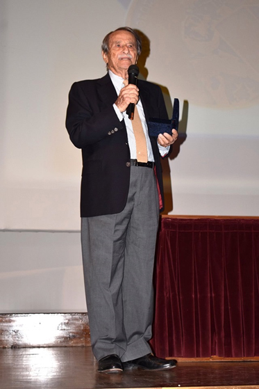 The Passing of Professopr George Veis (based on a bio written by Ivan Mueller)Release Date: 01/31/2022
It is with great sadness that we convey the passing of George Veis, scientist, teacher, and a good friend to all of us; truly one of the fathers of Space Geodesy.
The Passing of Professopr George Veis (based on a bio written by Ivan Mueller)Release Date: 01/31/2022
It is with great sadness that we convey the passing of George Veis, scientist, teacher, and a good friend to all of us; truly one of the fathers of Space Geodesy.
George was born in Athens in 1929. In 1951 he graduated in Surveying Engineering from the National Technical University of Athens (NTUA). In 1955 he was the recipient of a Greek state fellowship for advanced studies in Paris at the Sorbonne and the Ecole Nationale des
Sciences Geographiques. He then spent some time at the Observatoire de Paris and the Bureau Gravimetrique International. Starting in 1957 he continued his postgraduate studies at the Ohio State University, where he was awarded with his PhD in 1958, after defending his famous dissertation on the "Geodetic Applications of Observations of the Moon, Artificial Satellites and Rockets".
George was one of the framers of the early Satellite Geodesy Program at the Smithsonian Astrophysical Observatory, which itself was a fundamental element of the early NASA Space Geodesy Activity.
George joined the Smithsonian Astrophysical Observatory (SAO), (later the Harvard Smithsonian Center for Astrophysics) in 1959 at the beginning of satellite geodesy era and the deployment of the Baker Nunn Satellite Tracking Cameras for geodetic and other scientific research. Over two decades as principal scientific consultant at SAO, he helped guide activities as the satellite geodesy program evolved with the Baker Nunn Camera and the emergence of Satellite Laser Ranging (SLR). He worked with the engineers on the design of the SAO SLR systems and the retroreflectors on satellites.
While at SAO, George contributed the early concept and evolution of the Differential Orbit Improvement (DOI) Program, which became the main analysis tool for satellite tracking, geopotential estimation, station coordinate determination, and satellite drag research. He defined the fundamental reference system used for many years, which now forms the basis of modern models of earth rotation, precession, and nutation. He also initiated the SAO Star Catalogue project, which provided a uniform all-sky catalogue for precision camera observations, and was used for many years all over the world.
Keeping his connection with SAO, George returned to NTUA, where he was elected Professor of Surveying (renamed later Higher Geodesy and Cartography) to develop satellite geodesy in Greece.
In 1969 he established the tracking station at Dionysos, installed a Baker-Nunn camera there, and began developing a laser ranging system. He had the vision of a complete geophysical observatory with, of course, satellite tracking, a meteorological observatory, earth tide monitoring, strain gauges, etc. He also developed surveys based on Transit Doppler measurements and GPS when the equipment became available. As an early mobile SLR deployment, George transported the Dionysos laser system to the remote island of Othoni, north of Corfu, Greece, and used it in October of 1973 to measure the distance to an Italian target at Specchia, Cristi at the tip of the boot. This measurement enabled for the first time the accurate connection of the Greek geodetic network with main Europe (Balodimos D., Geodetic Connection between Greece and Italy, Anno xxxvi, Bollettino di Geodesia e scienze Affini, 1977).
George's department at NTUA was a major source of young geodesists for the global community. George Veis during his last visit to the USA in 2014, while attending the ILRS Annapolis Workshop.
The Dionysos station contributed to the MERIT, MEDLAS, WEGENER and other programs. Between 1965 and 1984 George also organised the famous series of international symposia, in Lagonissi and Athens, on the "Use of Artificial Satellites for Geodesy and Geodynamics". The five volumes of the proceedings of these symposia document a great part of 20 years of
geodetic history.
George's career as a science-administrator was also rich. As a member of the NTUA's senate and the Dean of the Faculty of Surveying Engineering, he suffered a short, but painful imprisonment by the military dictatorship in Greece, because of his proper academic comportment during students protest which caused the furious reaction of the regime. He was the Secretary General of the Hellenic Committee for Geodesy and Geophysics, its President from 1982 to 1990. He was President of the Board of the Athens National Observatory and the President of the Observatory's Scientific Council. He was the President of the Cadastre and Mapping Organization of Greece and the President of the National Consultative Council for Research. He also presided over several IAG/IUGG and COSPAR organizations. George retired from the NTUA in 1997. The ETH of Zurich honored him with an Honorary Doctor's degree.
George continued to be active in a key position as the President of the important Supreme Council for Personnel Selection, a state authority responsible for the selection of personnel for the public administration in Greece. George was awarded the Levallois Medal in 2003 in recognition of his distinguished service to the science of geodesy.
George Veis continued to be endlessly creative, engaging, seducing, elegant, modern and forever young scientist, who shared his ideas with enthusiasm, and helped everyone with whom he had contact. He witnessed the birth of space geodesy, its evolution from many meters to mm's, and continued to think about its future until his death. He had celebrated his 92nd birthday last September 8th, 2021.
George is survived by his wife Katerina, and children Konstandinos, Alexandros, Ino, Nico and Maria, and his grandchildren. His funeral is set for January 31, at noon.
May his memory be an abiding blessing.
2021
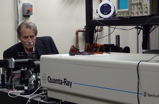
 The passing of Thomas ClarkRelease Date: 10/05/2021
Space Geodesy lost a longtime colleague and friend with the passing of Thomas Arvid Clark on September 28, 2021. Tom was a pioneer in Space Geodesy and Very Long Baseline Interferometry (VLBI), and a founding member of the NASA Crustal Dynamics Project.
The passing of Thomas ClarkRelease Date: 10/05/2021
Space Geodesy lost a longtime colleague and friend with the passing of Thomas Arvid Clark on September 28, 2021. Tom was a pioneer in Space Geodesy and Very Long Baseline Interferometry (VLBI), and a founding member of the NASA Crustal Dynamics Project.
Tom received his B.S. in Engineering Physics and his Ph.D. in Astro-Geophysics from the University of Colorado in 1961 and 1967 respectively. From 1966 to 1968, he served as Chief of the Astronomy Branch at NASA Marshall Space Flight Center and as Project Scientist on the Spacelab Coronagraph. At GSFC, where he moved in 1968, Tom received numerous NASA awards for his pioneering work on Radio Astronomy Explorer 1 and 2 and several generations of Very Long Baseline Interferometry systems. Tom developed the Totally Accurate Clock (TAC), an inexpensive GPS timing receiver that found widespread use in a number of global networks. Tom was named a Fellow of the American Geophysical Union (AGU) in 1991 and a Fellow of the International Association of Geodesy (IAG) in 1999. Tom was also a pioneer in amateur and digital radio; he designed and flew several low cost satellites for relaying amateur radio messages around the globe and is a past president of AMSAT. He was one of only 50 initial inductees into the CQ Amateur Radio Hall of Fame, a list which included such engineering luminaries and inventors as Guglielmo Marconi (radio), Samuel Morse (telegraph), Nikola Tesla (HF generators and radio), and John Bardeen and William Schockley (transistor). Tom retired from GSFC in 2001 but remained active in Amateur Radio activities.
Those of us who worked with Tom during the Crustal Dynamics period remember him as a brilliant mind, a very interesting and sometimes caustic character, but someone who was kind, supportive, and very helpful to those of us around him. We will miss him.
![]() Third circular for ILRS Virtual World Tour 2021 releasedRelease Date: 09/30/2021
Dear Colleagues:
Third circular for ILRS Virtual World Tour 2021 releasedRelease Date: 09/30/2021
Dear Colleagues:
We look forward to seeing you at "ILRS Virtual World Tour 2021". Progress has been made at the five tour hosts and by the session chairs. Now we have just opened the registration form. Please visit the event website below and find the link.
https://ilrs.gsfc.nasa.gov/ILRS_Virtual_World_Tour_2021/index.html
Registration period: October 1 to 15, 2021
Participants are encouraged to register as a group if possible, due to the limit of Microsoft Teams individual participants allowed. The URL links will be sent only to the registered people.
See you in a month!
ILRS Virtual World Tour 2021 Organizers:
Claudia Carabajal/SSAI, Inc, NASA Goddard Space Flight Center, USA
Evan Hoffman/NASA Goddard Space Flight Center, USA
Igor Ignatenko/VNIIFTRI, Russia
Jason Laing/Peraton NSGN Operations Lead, USA
Toshimichi Otsubo/Hitotsubashi University, Japan (Chair)
Michael Pearlman/ Harvard-Smithsonian Center for Astrophysics, USA
Ulrich Schreiber/Geodetic Observatory Wettzell, Germany
Zhang Zhongping/Shanghai Astronomical Observatory, China
![]() Second circular for ILRS Virtual World Tour 2021 releasedRelease Date: 08/31/2021
Dear Colleagues:
Second circular for ILRS Virtual World Tour 2021 releasedRelease Date: 08/31/2021
Dear Colleagues:
We are happy to report the updates on this year's "ILRS Virtual World Tour". In addition to the virtual visits to the stations (∼120 min), short special add-on sessions (30-60 min) are planned with the help of the Standing Committee Chairs. We look forward to seeing you in the last week of October.
Schedule (tentative; in UTC):
Monday, October 25
12:00 Opening session with reports from ILRS CB and Geodetic Community
12:45 Virtual Tour of Herstmonceux, UK
Tuesday, October 26
13:00 Virtual Tour of Wettzell, Germany
15:00 Special Session on Network & Engineering, LLR and Space Debris Ranging
Wednesday, October 27
13:00 Virtual Tour of Mendeleevo, Russia
15:00 Special Session on Analysis
Thursday, October 28
06:00 Virtual Tour of Shanghai, China
08:00 Special Session on Missions (1)
Friday, October 29
16:00 Virtual Tour of Monument Peak, USA
18:00 Special Session on Data Format and Missions (2), and Closing
Workshop website:
https://ilrs.gsfc.nasa.gov/ILRS_Virtual_World_Tour_2021/index.html
Logistics:
Microsoft Teams will be used for all of these sessions.
The Third Circular will be issued later with details on registration.
ILRS Virtual World Tour 2021 Organizers:
Claudia Carabajal/SSAI, Inc @ NASA Goddard Space Flight Center, USA
Evan Hoffman/NASA Goddard Space Flight Center, USA
Igor Ignatenko/VNIIFTRI, Russia
Jason Laing/Peraton NSGN Operations Lead, USA
Toshimichi Otsubo/Hitotsubashi University, Japan (Chair)
Michael Pearlman/Center for Astrophysics, USA
Ulrich Schreiber/Geodetic Observatory Wettzell, Germany
Zhang Zhongping/Shanghai Astronomical Observatory, China
 The Passing of Prof. Vladimir VasilievRelease Date: 08/11/2021
Prof. Vladimir Vasiliev, a Russian scientist who made a huge personal contribution to the development of radio-laser systems, died on August 10, 2021 from coronavirus at the age of 90.
In 1962, on his initiative, work began to assess the possibilities of using lasers in space technology. Vasiliev is the ancestor and ideologist of domestic optical-laser topics in such areas as precision geodetic; radio and optical range finders; onboard laser range finders for space systems; laser gyroscopes; spacecraft docking systems; optical communication; and navigation systems. Under his leadership, the necessary design and technological base was formed for the creation of on-board and ground laser information-measuring systems for various purposes, Vasiliev's ideas for calculating high-performance optical retroreflective antennas have been successfully used in the creation of the global GLONASS system and in many other domestic and international satellite laser ranging systems.
The Passing of Prof. Vladimir VasilievRelease Date: 08/11/2021
Prof. Vladimir Vasiliev, a Russian scientist who made a huge personal contribution to the development of radio-laser systems, died on August 10, 2021 from coronavirus at the age of 90.
In 1962, on his initiative, work began to assess the possibilities of using lasers in space technology. Vasiliev is the ancestor and ideologist of domestic optical-laser topics in such areas as precision geodetic; radio and optical range finders; onboard laser range finders for space systems; laser gyroscopes; spacecraft docking systems; optical communication; and navigation systems. Under his leadership, the necessary design and technological base was formed for the creation of on-board and ground laser information-measuring systems for various purposes, Vasiliev's ideas for calculating high-performance optical retroreflective antennas have been successfully used in the creation of the global GLONASS system and in many other domestic and international satellite laser ranging systems.
Vasiliev is the ideologist of the creation of passive precision optical mini-satellites operating on the principle of the Luneberg lens. These laser passive mini-satellites open up the possibility of studying geodeformations with a sub-millimeter accuracy. In 2002, an experimental model of the retroreflector ball was manufactured, installed on the Meteor-3M spacecraft and successfully passed flight tests. In 2009, the world's first full-scale autonomous glass laser mini-satellite BLITS was launched and successfully operated together with the global network of ILRS laser stations. As a result of many years of fruitful scientific and pedagogical activity, V. Vasiliev created a well known scientific school, which enjoys the well-deserved authority of specialists in our country and abroad. V. Vasiliev has been awarded many state and departmental awards.
He is the author of over 250 scientific works and 6 monographs, one of which is "Electro-optical and radio measurements", adopted as a textbook for higher educational institutions.
The passing of Vladimir Vasiliev is a great loss to all of us. We send our condolences to Professor Vasiliev's family.
![]() New schedule of ILRS Workshop Kunming on Laser RangingRelease Date: 08/10/2021
Dear Colleagues:
New schedule of ILRS Workshop Kunming on Laser RangingRelease Date: 08/10/2021
Dear Colleagues:
After discussion with our local colleagues in Kunming, the new date of the 22nd International Workshop on Laser Ranging has now been decided to be October 31 - November 4, 2022.
In view of the covid pandemic, further announcements will be updated ASAP. You can also find new information at: 22ndilrs2020.csp.escience.cn
 ILRS Virtual World Tour 2021- October 25-29, 2021Release Date: 07/22/2021
Dear Colleagues,
ILRS Virtual World Tour 2021- October 25-29, 2021Release Date: 07/22/2021
Dear Colleagues,
Due to the COVID 19, we have had to postpone our laser workshops, our annual seminal events, in 2020 and 2021. The ILRS again wishes to provide the opportunity for our worldwide community to meet, at least virtually, and share. We are now planning the "2021" version of "Virtual World Tour" following the success of last year.
This online event will be held October 25-29, 2021, to virtually visit 5 stations in 5 days, stopping at: Herstmonceux, UK, Mendeleevo, Russia, Monument Peak, USA, Shanghai, China and Wettzell, Germany.
The time table details are now in process. We are also planning short add-on session each dayto allow us to provide updates and some opportunity for discussion on issues important to the ILRS community.
Please highlight the dates on your calendar. More details will follow.
Dan O'Gara, featured at the center of the picture, accompanied by SGP folks during a site visit in 2015. From left to right: Jan McGarry, Stephen Merkowitz, Dan O'Gara, Jim Long, Scott Wetzel, and David Stowers. (Photo credit: Scott Wetzel)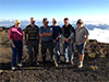 Dan O'Gara retired after 37 years of dedicated support to the International Geodetic Community Release Date: 05/12/2021
The International Laser Ranging Service (ILRS) and the NASA Space Geodesy Project (SGP) express our appreciation and congratulations to Dan O'Gara for his 37 years of service to the international geodetic community. Dan retired from the University of Hawaii (UH) on April 30, 2021.
Dan O'Gara retired after 37 years of dedicated support to the International Geodetic Community Release Date: 05/12/2021
The International Laser Ranging Service (ILRS) and the NASA Space Geodesy Project (SGP) express our appreciation and congratulations to Dan O'Gara for his 37 years of service to the international geodetic community. Dan retired from the University of Hawaii (UH) on April 30, 2021.
Much of Dan O'Gara's work at UH was with the Lunar Ranging Experiment (LURE) observatory. The University of Hawaii's LURE was installed on Haleakala in 1973. Dan joined the team in the early 1980s, performing maintenance and developing the software to control the LURE beam director and operating the system. The station became known as HOLLAS by the ILRS community as it gained the capability to track satellites and took on the 4-character code of HALL (for Haleakala Laser), but the locals always referred to it as LURE. Dan eventually became the station manager for LURE while he continued to develop the software and operate the system.
See https://ilrs.gsfc.nasa.gov/network/stations/inactive/HALL_station_info.html and http://koa.ifa.hawaii.edu/Lure/#:~:text=The%20Lure%20Observatory%20is%20located,Maui%20in%20the%20Hawaiian%20archipelago.&text=The%20Lunar%20Ranging%20Experiment%20(LURE,and%20reflectors%20on%20the%20Moon
The LURE facility was decommissioned in 1990 to make room for another experiment. In 2006, NASA installed the TLRS-4 Satellite Laser Ranging station at a different location on the top of the mountain. Dan continued his work as station manager, operator, and laser ranging software expert for TLRS-4.
Dan is well known and liked by everyone in the ILRS and SGP. He continued his interest in the lunar community even after the UH lunar laser ranging program ended. He participated in multiple ILRS Workshops including the Workshop in Annapolis which celebrated the 50th anniversary of SLR. He hosted numerous site visits to Haleakala by many groups and supported the Space Geodesy Project's preliminary work to deploy a next generation SLR station and new GNSS stations on the top of Haleakala, helping the SGP team find a good location for the new SLR system and supporting the team's site visit in 2015.
The Maui SLR stations have played a critical role in the international SLR network by covering satellite tracking over the Pacific. The station team under the leadership and management of Dan O'Gara has done a great job. His calm demeanor and sense of humor has been much appreciated.
Dan was the face of Hawaii laser ranging for many decades. He will be greatly missed by his colleagues and friends in the Space Geodesy Project and the International Laser Ranging Service. We wish Dan a healthy and happy retirement, and great success in his future plans!

![]() ILRS Workshops Cancelled/Postponed Release Date: 04/09/2021
Dear Colleagues,
ILRS Workshops Cancelled/Postponed Release Date: 04/09/2021
Dear Colleagues,
In view of the continued threat of the current pandemic, the ILRS and the members of the Kunmimg Station have decided that it would be best to postpone the 22nd International Workshop on Laser Ranging until 2022. We know that it is a disappointment to skip another year, but we really have no choice. The date for the 2022 workshop at Kunming, China has yet to be decided.
Plans are being formulated to have another program of virtual station tours, with perhaps some talks on pertinent ILRS subjects in late 2021, in place of the workshop.
As a consequence, the Technical Workshop scheduled for Arequipa, Peru will also be postponed another year, until 2023.
We thank both the Kunming and Arequipa teams for their patience and preparation to date. We know that both workshops will be great successes.
Looking on the bright side, our community should have much to report when these workshops are finally held.
We hope that you and your community will continue to act in safety.
With best wishes,
Mike Pearlman
Director, ILRS Central Bureau
![]() New Software for ILRS Station Plots Release Date: 02/05/2021
The ILRS has been generating global report cards monthly including meteorological data, LAGEOS performance, and satellite data information. The software to create these plots have been recently upgraded through the efforts of the Station Plots Working Group, formulated by the ILRS Central Bureau in 2020. The start date of the new charts begin in 2012/05, when the CRD format was released.
New Software for ILRS Station Plots Release Date: 02/05/2021
The ILRS has been generating global report cards monthly including meteorological data, LAGEOS performance, and satellite data information. The software to create these plots have been recently upgraded through the efforts of the Station Plots Working Group, formulated by the ILRS Central Bureau in 2020. The start date of the new charts begin in 2012/05, when the CRD format was released.
With this upgrade, some plots were combined and additions were made. For more information on the changes made to the report cards, please see:
If you notice any discrepancies on a webpage please feel free to contact us at support-cddis@earthdata.nasa.gov.
![]() Two-way ranging to the Hayabusa 2 spacecraft is succesfulRelease Date: 02/05/2021
In JAXA's press conference on 4 Feb 2021, Prof Takahide Mizuno of JAXA and Prof Toshimichi Otsubo of Hitotsubashi University announced the success of two-way ranging to the Hayabusa 2 spacecraft. During the post-flyby period in December 2020, a two-way link was established with Grasse, and one-way links were confirmed with Koganei and Mt Stromlo.
Two-way ranging to the Hayabusa 2 spacecraft is succesfulRelease Date: 02/05/2021
In JAXA's press conference on 4 Feb 2021, Prof Takahide Mizuno of JAXA and Prof Toshimichi Otsubo of Hitotsubashi University announced the success of two-way ranging to the Hayabusa 2 spacecraft. During the post-flyby period in December 2020, a two-way link was established with Grasse, and one-way links were confirmed with Koganei and Mt Stromlo.
Read the results of the experiment...
2020
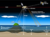 Precise Orbit Determination is a critical part of measuring sea level riseRelease Date: 11/15/2020
Precise Orbit Determination (POD) is a geodetic technique that enables knowing the exact position of a satellite above a stable reference point on Earth. Determining the exact position of the satellite when an observation is acquired is crucial in measuring sea level height. As noted by Dr. Frank Lemoine, a geodesist with NASA's Space Geodesy Project and a member of NASA's Ocean Surface Topography science team, "If you don't do POD right, you're not going to get any sea level results."
Precise Orbit Determination is a critical part of measuring sea level riseRelease Date: 11/15/2020
Precise Orbit Determination (POD) is a geodetic technique that enables knowing the exact position of a satellite above a stable reference point on Earth. Determining the exact position of the satellite when an observation is acquired is crucial in measuring sea level height. As noted by Dr. Frank Lemoine, a geodesist with NASA's Space Geodesy Project and a member of NASA's Ocean Surface Topography science team, "If you don't do POD right, you're not going to get any sea level results."
Read the full article on nasa.gov...
 Publication of the 2016-2019 ILRS ReportRelease Date: 11/03/2020
The ILRS is pleased to announce the publication of the 2016-2019 ILRS Report, the seventh published volume for the International Laser Ranging Service (ILRS). This publication once again concentrates on achievements and work in progress. This 2016-2019 ILRS Technical Report is available through the ILRS website at URL:
Publication of the 2016-2019 ILRS ReportRelease Date: 11/03/2020
The ILRS is pleased to announce the publication of the 2016-2019 ILRS Report, the seventh published volume for the International Laser Ranging Service (ILRS). This publication once again concentrates on achievements and work in progress. This 2016-2019 ILRS Technical Report is available through the ILRS website at URL:
https://ilrs.gsfc.nasa.gov/about/reports/annualrpts/ilrsreport_2016.html.
The ILRS would like to thank all contributors to this latest issue.
![]() ILRS Virtual World Tour 2020 third circularRelease Date: 10/13/2020
Registration for the virtual tours is now open. Attendance for each session will be limited to 250 connections and will be available on a first come, first served basis. We encourage group attendance where possible; only one person is required to register for the group. Interested parties can register at:
ILRS Virtual World Tour 2020 third circularRelease Date: 10/13/2020
Registration for the virtual tours is now open. Attendance for each session will be limited to 250 connections and will be available on a first come, first served basis. We encourage group attendance where possible; only one person is required to register for the group. Interested parties can register at:
https://cddis.nasa.gov/ILRS_Virtual_World_Tour_2020/Registration/
Attendees are required to register for each session they plan to attend. There is no fee for registering and attending any of the tours. Registration will be closed on October 26, 2020.
![]() New ILRS AACRelease Date: 09/29/2020
The Instituto Geográfico Nacional, Observatorio de Yebes (IGN Yebes) in Spain, has been accepted as a new ILRS AAC under the direction of Dr. José Rodríguez. The group will focus on providing CoG values for spherical geodetic satellites.
New ILRS AACRelease Date: 09/29/2020
The Instituto Geográfico Nacional, Observatorio de Yebes (IGN Yebes) in Spain, has been accepted as a new ILRS AAC under the direction of Dr. José Rodríguez. The group will focus on providing CoG values for spherical geodetic satellites.
![]() ILRS Virtual World Tour 2020 second circularRelease Date: 09/25/2020
In place of the planned Workshop this November, the ILRS wanted to take the
opportunity to try something different and look in detail at a selection
of stations in the global network. The online 'Virtual World Tour', to
be held November 2-6, 2020, will visit 5 stations in 5 days, stopping at:
ILRS Virtual World Tour 2020 second circularRelease Date: 09/25/2020
In place of the planned Workshop this November, the ILRS wanted to take the
opportunity to try something different and look in detail at a selection
of stations in the global network. The online 'Virtual World Tour', to
be held November 2-6, 2020, will visit 5 stations in 5 days, stopping at:
Each two-hour session will consist of an introductory presentation about
the station followed by a tour of the site highlighting instrumentation,
software, safety, automation, operations, as well as current issues and
future plans. These tours will include a mixture of pre-recorded and
live presentations with an opportunity for questions.
More information about the workshop can be found on the website:
https://cddis.nasa.gov/ILRS_Virtual_World_Tour_2020/index.html
and in the second circular.
![]() ILRS Virtual World Tour 2020Release Date: 09/02/2020
In place of an ILRS Workshop this November, the ILRS wanted to take the opportunity to try something different and look in detail at a selection of stations in the global network. Therefore, the ILRS is planning an online 'Virtual World Tour', to be held November 2-6, 2020, to virtually visit 5 stations around the world in 5 days. To learn more about the event please visit the workshop website: https://cddis.nasa.gov/ILRS_Virtual_World_Tour_2020/index.html
ILRS Virtual World Tour 2020Release Date: 09/02/2020
In place of an ILRS Workshop this November, the ILRS wanted to take the opportunity to try something different and look in detail at a selection of stations in the global network. Therefore, the ILRS is planning an online 'Virtual World Tour', to be held November 2-6, 2020, to virtually visit 5 stations around the world in 5 days. To learn more about the event please visit the workshop website: https://cddis.nasa.gov/ILRS_Virtual_World_Tour_2020/index.html
 Passing of Ron Beard/NRLRelease Date: 07/22/2020
We are sad to report the recent passing of Ron Beard. Ron Beard was the past Head of the Advanced Space PNT Branch (formerly the Space Applications Branch) at the Naval Research Laboratory (NRL) where he has made significant contributions to the generation and dissemination of precise time from space over the course of his 50-year career.
Passing of Ron Beard/NRLRelease Date: 07/22/2020
We are sad to report the recent passing of Ron Beard. Ron Beard was the past Head of the Advanced Space PNT Branch (formerly the Space Applications Branch) at the Naval Research Laboratory (NRL) where he has made significant contributions to the generation and dissemination of precise time from space over the course of his 50-year career.
Mr. Beard joined the Navy and later NRL as the DoD was beginning to explore new concepts for a second-generation satellite-based navigation system. At NRL he worked for Roger Easton, who proposed "passive ranging" from satellites with synchronized clocks in what became the TIMATION project. There was very limited experience with precise clocks in the space environment during those early days.
From 1968-1971, he was the Project Officer for Navigation Satellites in the Naval Air Systems Command's Astronautics Division and was the TIMATION project officer. In 1971 he joined the NRL and their early GPS development (1971-1979) as the project scientist in the NRL's GPS Program Office that developed Navigation Technology Satellites One and Two and operated the first atomic clocks in space. From 1979- 1983, he was the Deputy Project Manager for the Naval Space Surveillance System Modernization Program. From 1983 until 2004 he was the Program Manager of the NRL NAVSTAR GPS Clock Development Program that developed alternative sources of space qualified atomic clocks and hydrogen masers for the GPS program. He was the originator and principal investigator for the Laser Retro-Reflector Experiment, included as secondary payload on NAVSTAR 35 and 36 satellites to investigate clock and orbit error separation. Mr. Beard was a longtime advocate for hosting retroreflectors on GPS III satellites, and has been a key member of the NRL-NGA-NASA GPS Laser Retroreflector Array team.
Mr. Beard has participated in numerous technical groups including the Air Force Scientific Advisory Board Study Group into Global Air Navigation, Navy representative on Project Reliance Frequency Control Panel, Head of the DoD PNT Focus Team for Space Technology, past chair of the ITU-R Special Rapporteur Group on the future of the UTC Time Scale, and served as International Chair of the ITU-R Working Party 7A, Precise Time and Frequency Broadcast Services. He has authored or coauthored over 50 papers, including a dozen papers presented at various ION meetings. He has been an organizer of the Annual PTTI conference and the Joint Navigation Conference, and has served as a Government Liaison to the ION's Military Division. He was selected as an ION Fellow in 2013.
Condolences may be shared with Ron's longtime colleague and friend, Dr. Ken Senior, at ken.senior@nrl.navy.mil
From: https://www.ion.org/awards/2013-ionfellow-beard.cfm and Linda Thomas/NRL
![]() ILRS workshops scheduled for 2020 and 2021 postponedRelease Date: 07/14/2020
As the ILRS community continues to deal with the impacts from the global coronavirus outbreak, the ILRS and the local organizers in Kunming have concluded that it is no longer possible to hold the 22nd International Workshop on Laser Ranging in October 2020 as planned. The ILRS Governing Board, in consultation with our colleagues in Kunming, has decided that we will delay this workshop until the fall of 2021; final dates for the event will be announced soon. Furthermore, the ILRS and UNSA will postpone the next ILRS Technical/Specialty Workshop, to be held in Arequipa Peru, until the fall of 2022.
ILRS workshops scheduled for 2020 and 2021 postponedRelease Date: 07/14/2020
As the ILRS community continues to deal with the impacts from the global coronavirus outbreak, the ILRS and the local organizers in Kunming have concluded that it is no longer possible to hold the 22nd International Workshop on Laser Ranging in October 2020 as planned. The ILRS Governing Board, in consultation with our colleagues in Kunming, has decided that we will delay this workshop until the fall of 2021; final dates for the event will be announced soon. Furthermore, the ILRS and UNSA will postpone the next ILRS Technical/Specialty Workshop, to be held in Arequipa Peru, until the fall of 2022.
We will keep the community informed of additional details as soon as practical.
![]() Change to location of POS+EOP products in the CDDIS archiveRelease Date: 05/13/2020
The ILRS DCs have updated the archive location of the pos+eop products. Until today, the current year's products were archived in daily subdirectories at /slr/products/pos+eop/YYMMDD/. Beginning today, May 13, 2020, the products are now archived at /slr/products/pos+eop/YYYY/YYMMDD/.
Change to location of POS+EOP products in the CDDIS archiveRelease Date: 05/13/2020
The ILRS DCs have updated the archive location of the pos+eop products. Until today, the current year's products were archived in daily subdirectories at /slr/products/pos+eop/YYMMDD/. Beginning today, May 13, 2020, the products are now archived at /slr/products/pos+eop/YYYY/YYMMDD/.
![]() 2021 ILRS Technical/Specialty WorkshopRelease Date: 04/02/2020
The ILRS Governing Board is pleased to announce that the 2021 ILRS Technical/Specialty Workshop will be held in the October 2021 timeframe in Arequipa, Peru. The workshop will be hosted by the Astronomical and Aerospace Institute at the University of San Agustin.
2021 ILRS Technical/Specialty WorkshopRelease Date: 04/02/2020
The ILRS Governing Board is pleased to announce that the 2021 ILRS Technical/Specialty Workshop will be held in the October 2021 timeframe in Arequipa, Peru. The workshop will be hosted by the Astronomical and Aerospace Institute at the University of San Agustin.
At this time, the ILRS continues planning for the 22nd International Workshop on Laser Ranging in November 2020 with the local hosts in Kunming, China.
![]() New members of the ILRS Governing BoardRelease Date: 03/01/2020
Toshi Otsubo has announced that Jose Rodriguez (IGN Yebes) and Sven Bauer (GFZ Potsdam) have been elected by their EUROLAS colleagues as their representatives on the ILRS Governing Board. The change is effective 1 March 2020.
New members of the ILRS Governing BoardRelease Date: 03/01/2020
Toshi Otsubo has announced that Jose Rodriguez (IGN Yebes) and Sven Bauer (GFZ Potsdam) have been elected by their EUROLAS colleagues as their representatives on the ILRS Governing Board. The change is effective 1 March 2020.
Toshi has sent his thanks to the former EUROLAS representatives Georg Kirchner and Pippo Bianco acknowledging that they worked not just for Europe on the Board but for the world-wide community for a long time. The ILRS hopes Georg and Pippo will stay actively involved in the ILRS.
![]() New Software for ILRS Gloal Report CardsRelease Date: 02/12/2020
The ILRS has been generating global report cards on a quarterly and monthly basis since 2012. A new version of the report card software is now available with changes that provide more accurate pass and NP counts, satellite RMS, and LAGEOS bias information. In addition, the table summarizing LLR data (Table 1 L) has been split into two parts (Table L1 and L2) to provide individual lunar retroreflector information. The report cards are available at: https://ilrs.cddis.eosdis.nasa.gov/network/system_performance/global_report_cards/monthly/.
New Software for ILRS Gloal Report CardsRelease Date: 02/12/2020
The ILRS has been generating global report cards on a quarterly and monthly basis since 2012. A new version of the report card software is now available with changes that provide more accurate pass and NP counts, satellite RMS, and LAGEOS bias information. In addition, the table summarizing LLR data (Table 1 L) has been split into two parts (Table L1 and L2) to provide individual lunar retroreflector information. The report cards are available at: https://ilrs.cddis.eosdis.nasa.gov/network/system_performance/global_report_cards/monthly/.
For more information on the changes made to the report cards, please see:
https://ilrs.eosdis.nasa.gov/network/system_performance/global_report_cards/report_card_differences_Jan01_2020.html.
Using the new software, data for the report cards between 2013 and 2020 has been regenerated and may be downloaded. The files are comma-delimited and available at https://ilrs.eosdis.nasa.gov/network/system_performance/global_report_cards/data_for_previous_report_cards.html.
![]() New ILRS Governing Board MemberRelease Date: 01/22/2020
As of January 01, 2020, Evan Hoffman/NASA GSFC has replaced Jan McGarry as one of the NASA Representatives on the ILRS Governing Board. The ILRS thanks Jan, an active and responsive member of the Board; we look forward to continued interactions with Jan and welcome Evan to the Board.
New ILRS Governing Board MemberRelease Date: 01/22/2020
As of January 01, 2020, Evan Hoffman/NASA GSFC has replaced Jan McGarry as one of the NASA Representatives on the ILRS Governing Board. The ILRS thanks Jan, an active and responsive member of the Board; we look forward to continued interactions with Jan and welcome Evan to the Board.
![]() First announcement of the 22nd International Workshop on Laser RangingRelease Date: 01/08/2020
The 22nd International Workshop on Laser Ranging will be held in Kunming, China November 02 - 06, 2020. There will be five days of interesting presentations, a lot of time for formal and informal discussions, meeting project partners and paving the road for the future development of satellite laser ranging.
First announcement of the 22nd International Workshop on Laser RangingRelease Date: 01/08/2020
The 22nd International Workshop on Laser Ranging will be held in Kunming, China November 02 - 06, 2020. There will be five days of interesting presentations, a lot of time for formal and informal discussions, meeting project partners and paving the road for the future development of satellite laser ranging.
During the workshop there will also be a chance to visit the laser ranging station in Kunming. Theme and session topics for the workshop are currently under discussion. The organizers are open for ideas and suggestions, so please contact the local organizing committee at ilrs.workshop@ynao.ac.cn if you would like to see specific topics included in the workshop.
Additional announcements will be made when registration and abstract submission are opened.
 BLITS-M UpdateRelease Date: 01/02/2020
The BLITS-M satellite was launched on December 27, 2019. Mission contacts report that the spacecraft has not separated from the orbital insertion unit. Investigations are underway regarding this issue.
BLITS-M UpdateRelease Date: 01/02/2020
The BLITS-M satellite was launched on December 27, 2019. Mission contacts report that the spacecraft has not separated from the orbital insertion unit. Investigations are underway regarding this issue.
![]() Missions Standing Committee UpdateRelease Date: 01/02/2020
Effective January 01, 2020, Rob Sherwood is serving as the co-chair of the Missions Standing Committee.
Missions Standing Committee UpdateRelease Date: 01/02/2020
Effective January 01, 2020, Rob Sherwood is serving as the co-chair of the Missions Standing Committee.
Welcome Rob!
2019
 Journal of Geodesy "Special Issue: Satellite Laser Ranging" now publishedRelease Date: 11/25/2019
The Journal of Geodesy has recently published the "Special Issue: Satellite Laser Ranging" (Volume 93, Issue 11, November 2019, editors Erricos Pavlis, Vincenza Luceri, Toshimichi Otsubo, Ulrich Schreiber). This issue consists of twenty papers detailing recent developments in SLR:
Journal of Geodesy "Special Issue: Satellite Laser Ranging" now publishedRelease Date: 11/25/2019
The Journal of Geodesy has recently published the "Special Issue: Satellite Laser Ranging" (Volume 93, Issue 11, November 2019, editors Erricos Pavlis, Vincenza Luceri, Toshimichi Otsubo, Ulrich Schreiber). This issue consists of twenty papers detailing recent developments in SLR:
Preface to the second special issue on Laser Ranging, Pavlis, E.C., Luceri, V., Otsubo, T. et al. J Geod (2019) 93: 2159. https://doi.org/10.1007/s00190-019-01305-2
The ILRS: approaching 20 years and planning for the future, Pearlman, M.R., Noll, C.E., Pavlis, E.C. et al. J Geod (2019) 93: 2161. https://doi.org/10.1007/s00190-019-01241-1
Laser geodetic satellites: a high-accuracy scientific tool, Pearlman, M., Arnold, D., Davis, M. et al. J Geod (2019) 93: 2181. https://doi.org/10.1007/s00190-019-01228-y
Lunar Laser Ranging: a tool for general relativity, lunar geophysics and Earth science, Müller, J., Murphy, T.W., Schreiber, U. et al. J Geod (2019) 93: 2195. https://doi.org/10.1007/s00190-019-01296-0
Information resources supporting scientific research for the international laser ranging service, Noll, C.E., Ricklefs, R., Horvath, J. et al. J Geod (2019) 93: 2211. https://doi.org/10.1007/s00190-018-1207-2
The next generation of satellite laser ranging systems, Wilkinson, M., Schreiber, U., Procházka, I. et al. J Geod (2019) 93: 2227. https://doi.org/10.1007/s00190-018-1196-1
NASA’s satellite laser ranging systems for the twenty-first century, McGarry, J.F., Hoffman, E.D., Degnan, J.J. et al. J Geod (2019) 93: 2249. https://doi.org/10.1007/s00190-018-1191-6
Modernizing and expanding the NASA Space Geodesy Network to meet future geodetic requirements, Merkowitz, S.M., Bolotin, S., Elosegui, P. et al. J Geod (2019) 93: 2263. https://doi.org/10.1007/s00190-018-1204-5
Future SLR station networks in the framework of simulated multi-technique terrestrial reference frames, Glaser, S., König, R., Neumayer, K.H. et al. J Geod (2019) 93: 2275. https://doi.org/10.1007/s00190-019-01256-8
Impact of network constraining on the terrestrial reference frame realization based on SLR observations to LAGEOS, Zajdel, R., Sośnica, K., Drożdżewski, M. et al. J Geod (2019) 93: 2293. https://doi.org/10.1007/s00190-019-01307-0
Satellite laser ranging to low Earth orbiters: orbit and network validation, Arnold, D., Montenbruck, O., Hackel, S. et al. J Geod (2019) 93: 2315. https://doi.org/10.1007/s00190-018-1140-4
Rapid response quality control service for the laser ranging tracking network, Otsubo, T., Müller, H., Pavlis, E.C. et al. J Geod (2019) 93: 2335. https://doi.org/10.1007/s00190-018-1197-0
Transitioning the NASA SLR network to Event Timing Mode for reduced systematics, improved stability and data precision, Varghese, T., Ricklefs, R.L., Pavlis, E.C. et al. J Geod (2019) 93: 2345. https://doi.org/10.1007/s00190-019-01326-x
Systematic errors in SLR data and their impact on the ILRS products, Luceri, V., Pirri, M., Rodríguez, J. et al. J Geod (2019) 93: 2357. https://doi.org/10.1007/s00190-019-01319-w
Time bias service: analysis and monitoring of satellite orbit prediction quality, Bauer, S. & Steinborn, J. J Geod (2019) 93: 2367. https://doi.org/10.1007/s00190-019-01304-3
Operating two SLR systems at the Geodetic Observatory Wettzell: from local survey to space ties, Riepl, S., Müller, H., Mähler, S. et al. J Geod (2019) 93: 2379. https://doi.org/10.1007/s00190-019-01243-z
Time and laser ranging: a window of opportunity for geodesy, navigation, and metrology, Exertier, P., Belli, A., Samain, E. et al. J Geod (2019) 93: 2389. https://doi.org/10.1007/s00190-018-1173-8
Laser and radio tracking for planetary science missions—a comparison, Dirkx, D., Procházka, I., Bauer, S. et al. J Geod (2019) 93: 2405. https://doi.org/10.1007/s00190-018-1171-x
Assessment of the impact of one-way laser ranging on orbit determination of the Lunar Reconnaissance Orbiter, Löcher, A. & Kusche, J. J Geod (2019) 93: 2421. https://doi.org/10.1007/s00190-018-1200-9
Version of a glass retroreflector satellite with a submillimeter "target error", Sokolov, A.L., Akentyev, A.S., Vasiliev, V.P. et al. J Geod (2019) 93: 2429. https://doi.org/10.1007/s00190-019-01260-y
Studies on the materials of LARES 2 satellite, Paolozzi, A., Sindoni, G., Felli, F. et al. J Geod (2019) 93: 2437. https://doi.org/10.1007/s00190-019-01316-z
 The 2019 ILRS Technical Workshop presentations and other information now availableRelease Date: 11/06/2019
The 2019 ILRS Technical Workshop was held October 21-24, 2019 in Stuttgart, Germany. In addition, the first "SLR School" was held prior to the workshop on October 20. All abstracts, presentations, posters, and summary information from the workshop and the SLR School are available on the website:
The 2019 ILRS Technical Workshop presentations and other information now availableRelease Date: 11/06/2019
The 2019 ILRS Technical Workshop was held October 21-24, 2019 in Stuttgart, Germany. In addition, the first "SLR School" was held prior to the workshop on October 20. All abstracts, presentations, posters, and summary information from the workshop and the SLR School are available on the website:
https://cddis.nasa.gov/2019_Technical_Workshop
SLR Pioneer Certificates presented by Toshi Otsubo at the 2019 ILRS Technical WorkshopRelease Date: 11/01/2019
During the 2019 ILRS Technical Workshop, Toshi Otsubo, chair of the ILRS Governing Board, presented the "SLR Pioneer Certificate" to the following recipients:
Victor Shargorodskiy (Research-and-Production Corporation «Precision Systems and Instruments«/ Moscow, Russia)
"In recognition of his role in the building and deploying of the ROSCOSMOS SLR network"
John McK. Luck (Geoscience Australia, retired/Canberra, Australia)
"In recognition of his work in establishing SLR activities in Australia and Western Pacific Laser Tracking Network"
Carey Noll (NASA GSFC/Greenbelt MD, USA)
"In recognition of her dedication, vision and creativity in supporting all aspects of the ILRS"
At the conclusion of the workshop, a "Recognition of Appreciation" certificate was presented to:
Daniel Hampf (DLR, Stuttgart, Germany)
"In recognition of the outstanding support provided in organizing and hosting the 2019 ILRS Technical Workshop, Stuttgart, Germany"
Congratulations to the recipients!
 The Jason-2 mission has endedRelease Date: 10/04/2019
The Jason-2/Ocean Surface Topography Mission (OSTM), the third in a U.S.-European series of satellite missions designed to measure sea surface height, successfully ended its science mission on Oct. 1. NASA and its mission partners made the decision to end the mission after detecting deterioration in the spacecraft's power system.
The Jason-2 mission has endedRelease Date: 10/04/2019
The Jason-2/Ocean Surface Topography Mission (OSTM), the third in a U.S.-European series of satellite missions designed to measure sea surface height, successfully ended its science mission on Oct. 1. NASA and its mission partners made the decision to end the mission after detecting deterioration in the spacecraft's power system.
Read more about the Jason-2 mission...
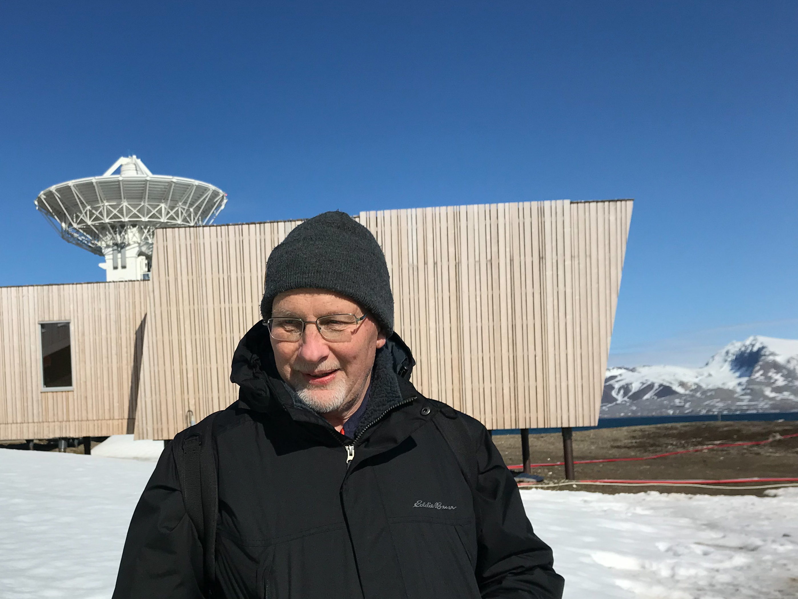 Passing of James Leroy Long (1955 - 2019)Release Date: 09/30/2019
The Space Geodesy Project and the ILRS community is mourning the loss of our dear friend and colleague James Leroy Long who passed away on September 21, 2019 from prostate cancer complications.
Passing of James Leroy Long (1955 - 2019)Release Date: 09/30/2019
The Space Geodesy Project and the ILRS community is mourning the loss of our dear friend and colleague James Leroy Long who passed away on September 21, 2019 from prostate cancer complications.
Jim was a leader and essential contributor to the nation's space geodesy programs over the past 40 years. Jim began his career in 1978 as a Commissioned Officer within the US Department of Commerce NOAA Corps. For two years, Jim was the Party Chief for the transportable 5-meter antenna system collecting Very Long Baseline Interferometry (VLBI) data in support of the NASA Crustal Dynamics Program and the NOAA National Crustal Motion Network. These measurements led to the first measurements of continental drift. Jim also spent several years on mobile field duty for the U.S. Coast & Geodetic Survey performing precise horizontal control surveys and special project surveys. He also spent 2.5 years on board a NOAA National Ocean Service hydrographic survey ship performing horizontal and vertical control surveys, collecting hydrographic survey data for updating navigational charts, and ship board operations.
In 1984, Jim went to work for what eventually became Honeywell Technology Solutions as the Lead Civil Engineer for a multi-disciplinary group providing architectural and engineering services to the Federal Government, including NASA. He was responsible for precise geodetic surveys in support of the NASA Satellite Laser Ranging (SLR) Program, the NASA VLBI Program, as well as NOAA, USAF, and USN satellite tracking and communications stations. He was also responsible for precise geodetic surveys for installation and/or refurbishment of 9-meter unified S-band antennae at NASA STDN satellite tracking stations located all around the world.
In 2009, Jim came to GSFC as the Lead Civil Engineer in the Facilities Engineering Branch. Jim's experience and expertise in VLBI and SLR was quickly recognized by the Space Geodesy Project (SGP), so he started splitting his time between his Facilities duties and becoming the lead for the SGP Vector Tie System (VTS). Jim led the development of an automated system for monitoring the stability of a geodetic site. He successfully implemented a prototype of the system at the Goddard Geophysical and Astronomical Observatory, which is the basis for the VTS being implemented at all next-generation SGP sites. Jim's unique expertise and passion for space geodesy led him to transition full time to SGP within the Sciences and Exploration Directorate where he took on multiple roles as the VLBI Operations Manager, VTS Lead, and the Site Development Lead.
One of Jim's particularly notable accomplishments is the production of geodetic site ties for numerous NASA geodetic sites. These ties are essential for combining the measurements from the different geodetic techniques in the realizations of the International Terrestrial Reference Frame (ITRF) that is used by all Earth Observation satellites to geolocate their measurements on the Earth’s surface. The location of the origin of all of NASA's global geodetic stations on the ITRF is now known to within 1.5 mm thanks to Jim's expertise and dedication to the grueling task of global surveying. Without the precision geodetic surveys and analysis that Jim led, the quality of the ITRF would not be as good as it is today. Jim's accomplishments to geodetic site ties are internationally recognized and Jim was a critical member of the International Earth Rotation and Reference Systems Service Working Group on Site Survey and Co-location.
A memorial gathering to celebrate Jim's life will take place on Saturday, November 9, 2019 at St. Joseph Catholic Community in the Formation and Fellowship Center in Sykesville, MD from 2:30 pm – 5:30 pm. All are welcome to attend this Celebration of Life.
![]() New guidelines for proposing and planning ILRS workshops releasedRelease Date: 09/30/2019
The ILRS sponsors International Workshops on Laser Ranging (IWLR) which are typically held every two years. In addition, the ILRS organizes focused technical or specialized workshops in years between the International Workshops on Laser Ranging. Recently, the ILRS has created guidelines for the community to propose future workshops and for the ILRS in planning these workshops.
New guidelines for proposing and planning ILRS workshops releasedRelease Date: 09/30/2019
The ILRS sponsors International Workshops on Laser Ranging (IWLR) which are typically held every two years. In addition, the ILRS organizes focused technical or specialized workshops in years between the International Workshops on Laser Ranging. Recently, the ILRS has created guidelines for the community to propose future workshops and for the ILRS in planning these workshops.
 Lightning strikes the McDonald Laser Ranging Station (MLRS) in TexasRelease Date: 09/30/2019
Lightning struck the McDonald Laser Ranging Station (MLRS) in Texas on September 12, 2019 rendering it inoperable. The SGP is currently building a next generation SGSLR station next to the MLRS, and has decided to not repair the 37-year-old MLRS. The MLRS first started operating in 1982 and quickly became a premiere satellite and lunar laser ranging station. Data from this station was used for the most stringent tests of General Relativity, studies of the interior structure of the moon, and countless other geodetic and spacecraft tracking applications. The SGP looks forward to continuing the legacy of laser ranging from the McDonald Observatory and entering a new chapter with the recently completed VGOS station located just down the hill from the MLRS.
Lightning strikes the McDonald Laser Ranging Station (MLRS) in TexasRelease Date: 09/30/2019
Lightning struck the McDonald Laser Ranging Station (MLRS) in Texas on September 12, 2019 rendering it inoperable. The SGP is currently building a next generation SGSLR station next to the MLRS, and has decided to not repair the 37-year-old MLRS. The MLRS first started operating in 1982 and quickly became a premiere satellite and lunar laser ranging station. Data from this station was used for the most stringent tests of General Relativity, studies of the interior structure of the moon, and countless other geodetic and spacecraft tracking applications. The SGP looks forward to continuing the legacy of laser ranging from the McDonald Observatory and entering a new chapter with the recently completed VGOS station located just down the hill from the MLRS.
![]() 2019 ILRS Technical WorkshopRelease Date: 08/06/2019
The 2019 ILRS Technical Workshop will take place in Stuttgart, Germany, October 21-25. If you plan to attend, please register by August 15 (next Thursday) on the workshop website:
2019 ILRS Technical WorkshopRelease Date: 08/06/2019
The 2019 ILRS Technical Workshop will take place in Stuttgart, Germany, October 21-25. If you plan to attend, please register by August 15 (next Thursday) on the workshop website:
If you have any trouble registering, please send an email to ilrs.workshop@dlr.de.
If you plan to present at the workshop, we ask that you also upload your abstract as soon as possible so we can commence planning the program.
We are looking forward to seeing you all in Stuttgart!
![]() Results of the 2019 Etalon-1 and -2 tracking campaign relasedRelease Date: 08/02/2019
The results from the actual data analysis of the Etalon campaign period, focusing on the EOP improvement have been collected. Data from the same timeframe in 2018 were reanalyzed in order to have results compared to exactly the same IERS C04 series.
Results of the 2019 Etalon-1 and -2 tracking campaign relasedRelease Date: 08/02/2019
The results from the actual data analysis of the Etalon campaign period, focusing on the EOP improvement have been collected. Data from the same timeframe in 2018 were reanalyzed in order to have results compared to exactly the same IERS C04 series.
As can be seen in this report, the additional Etalon data makes a significant difference, bringing the ILRS EOP product a lot closer to the "final" IERS series (which is ∼90% a GNSS product). The ILRS Analysis Coordinators have requested that the network do their best to increase their collection of Etalon data on a permanent basis.
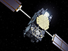 GNSS Tracking StrategyRelease Date: 08/01/2019
The ILRS has been working with the IGS and other interested parties to settle on a GNSS tracking strategy that would satisfy both mission and user requirements. For some applications, users want denser tracking on a few satellites. For other applications, users want some tracking on the full complex of GNSS satellites, even if that tracking is sparse. In addition, there are also requests for focused campaigns, in particular, for tracking GNSS satellites while going through Earth shadow to study the effects of radiation pressure. We presently have over 60 GNSS satellites (GLONASS, Galileo, BeiDou) on the ILRS roster. More will be added in the near future. The total could reach nearly 100 when GPS is added in the 2024 timeframe.
GNSS Tracking StrategyRelease Date: 08/01/2019
The ILRS has been working with the IGS and other interested parties to settle on a GNSS tracking strategy that would satisfy both mission and user requirements. For some applications, users want denser tracking on a few satellites. For other applications, users want some tracking on the full complex of GNSS satellites, even if that tracking is sparse. In addition, there are also requests for focused campaigns, in particular, for tracking GNSS satellites while going through Earth shadow to study the effects of radiation pressure. We presently have over 60 GNSS satellites (GLONASS, Galileo, BeiDou) on the ILRS roster. More will be added in the near future. The total could reach nearly 100 when GPS is added in the 2024 timeframe.
The strategy that the ILRS has agreed to implement is the following:
- GNSS tracking will continue to be prioritized with the other ILRS satellites by the standard ILRS priority scheme (by altitude and inclination);
- Four GNSS satellites will be identified by each constellation (Galileo, GLONASS, and BeiDou) for intensive tracking, with three sectors (at least 2 normal points each) spaced widely apart over the pass. If stations cannot obtain three sectors they should try to get two sectors. These four satellites per constellation would be selected by the constellation and would have the highest priority among the GNSS satellites.
- All of the remaining GNSS satellites would be tracked by the stations on an as time available basis; selection of targets should be determined by the stations for data yield, but stations are asked to try to diversify among all three constellations because we need some data on all three.
- There may be some special tracking periods (e.g. satellite eclipses, etc.) that may need other scheduling.
- BeiDou3-M2, 3-M3, 3-M9, and 3-M10
- Galileo-102, -202, -209, -210
- GLONASS-131, -134, -138, and -139
![]() Updated data screening process at the ILRS Operations Centers (OCs) at EDC and NASARelease Date: 08/01/2019
The ILRS Operations Centers (OCs) at EDC and NASA are updating their data screening process in order to coordinate data quality control (QC) and provide feedback on data issues to the stations. Incoming data will be screened and characterized as:
Updated data screening process at the ILRS Operations Centers (OCs) at EDC and NASARelease Date: 08/01/2019
The ILRS Operations Centers (OCs) at EDC and NASA are updating their data screening process in order to coordinate data quality control (QC) and provide feedback on data issues to the stations. Incoming data will be screened and characterized as:
- "errors" if they will adversely impact the quality of the data and the derived data products (e.g., invalid date, invalid satellite, erroneous calibration, etc.)
- "warnings" if the impact on the quality of the data is minor, or if there are format errors that make processing or QC evaluation more difficult.
In order to streamline this procedure, some issues that may seem rather minor will need to be cleaned up in the data format to expedite data flow.
A list of the new data QC to be implemented at the OCs (categorized as errors or warnings) is attached and can be found at:
https://ilrs.gsfc.nasa.gov/network/site_procedures/data_screening_procedure.html
Please let us know if any of the diagnostics are not clear.
Tests have been run at the OCs on the incoming data for May 2019. We will be reaching out to individual stations with their specific results, to give a sense of what the QC will provide.
Let us know if you have any questions. It is our plan to try to get this operational by August 15, 2019.
![]() Stephen Merkowitz now the chair of the Missions Standing CommitteeRelease Date: 08/01/2019
Effective August 01, 2019, Stephen Merkowitz (NASA GSFC) will chair the ILRS Missions Standing Committee, with Toshi Otsubo (Hitotsubashi University and former chair) serving as co-chair.
Stephen Merkowitz now the chair of the Missions Standing CommitteeRelease Date: 08/01/2019
Effective August 01, 2019, Stephen Merkowitz (NASA GSFC) will chair the ILRS Missions Standing Committee, with Toshi Otsubo (Hitotsubashi University and former chair) serving as co-chair.
 Reflectors placed on the moon by Apollo 11 astronauts 50 years ago continue to provide fresh lunar laser ranging dataRelease Date: 07/31/2019
Fifty years ago, Neil Armstrong, Buzz Aldrin and Michael Collins left behind arrays of prisms that reflect light back toward its source; the Apollo 14 and 15 astronauts also did so. Four telescopes at observatories in New Mexico, France, Italy and Germany fire lasers at them, measuring the time that it takes for a laser pulse to bounce off the reflectors and return to Earth. This allows the distance to be measured to within a fraction of an inch (a few millimeters), and scientists at the Jet Propulsion Laboratory analyze the results. Lunar laser ranging measurements have deepened our understanding of the dance between the Moon and Earth.
Reflectors placed on the moon by Apollo 11 astronauts 50 years ago continue to provide fresh lunar laser ranging dataRelease Date: 07/31/2019
Fifty years ago, Neil Armstrong, Buzz Aldrin and Michael Collins left behind arrays of prisms that reflect light back toward its source; the Apollo 14 and 15 astronauts also did so. Four telescopes at observatories in New Mexico, France, Italy and Germany fire lasers at them, measuring the time that it takes for a laser pulse to bounce off the reflectors and return to Earth. This allows the distance to be measured to within a fraction of an inch (a few millimeters), and scientists at the Jet Propulsion Laboratory analyze the results. Lunar laser ranging measurements have deepened our understanding of the dance between the Moon and Earth.
Read more...
![]() Michael Lefebvre, French pioneer and major actor in satellite geodesy, passes awayRelease Date: 07/26/2019
Michel Lefebvre has passed away at his home on July 21, 2019 after a long illness.
Michael Lefebvre, French pioneer and major actor in satellite geodesy, passes awayRelease Date: 07/26/2019
Michel Lefebvre has passed away at his home on July 21, 2019 after a long illness.
He was one of the French pioneers and a major actor in satellite geodesy.
He contributed enormously to training the researchers and engineers of today in this discipline, at the time of the formation of GRGS (Groupe de Recherche de Geodesie Spatiale), which resulted from the cooperation of research teams at CNES (Michele’s team), Meudon Observatory and others. This was also the time of international satellite observing campaigns (ISAGEX, Trapol, Medoc, etc.) in which Michel was deeply involved.
Michel always was eager to debate on new ideas, his energy and enthusiasm were incredible, which were essential to the development of our projects and our works over fifty years, also to the rising of vocations in our field. He had a strong charisma, though a warm personality, respectful of everyone’s viewpoint. His constructive spirit and creativity were striking and he was carefully listened to within national (CNES, GRGS, Bureau des Longitudes) and international (NASA, DLR, ESA) organizations.
As a leading expert, he had a prominent and determining role in the realization of the first satellite altimetry missions, especially TOPEX-Poseidon. Michel set the stage for the creation of the Laboratoire d’Etude en Geophysique et Oceanographie Spatiale (LEGOS), and had decisive actions in changing the French oceanographic community. He established the Club of Argonauts, in which oceanographers and climatologists discuss scientific and societal aspects of climate change. He also was at the origin of GODAE (Global Ocean Data Assimilation Experiment) and of Mercator Ocean (the French center for ocean predictions and analysis).
Michel has left his mark on many young people who started their career with him. They went their own way but kept good and fruitful relationship with him. His death brings back lots of memories to all of us. A strong personality has left us.
Our thoughts are with his wife Claude and their children and grandchildren.
Journal of Geodesy Special Issue on Laser RangingRelease Date: 07/24/2019The following peer-reviewed Journal of Geodesy articles were recently published online at the journal site. These are all part of the Special Issue on Laser Ranging which is preparation. Several more articles are in the review process and upon completion the printed version will be published.
In the meantime we invite you to peruse all of these with the latest information on Laser Ranging and the ILRS:
Information Resources Supporting Scientific Research for the International Laser Ranging Service, Noll, C.E., Ricklefs, R., Horvath, J. et al. J Geod (2018). https://doi.org/10.1007/s00190-018-1207-2
Modernizing and Expanding the NASA Space Geodesy Network to Meet Future Geodetic Requirements, Merkowitz, S.M., Bolotin, S., Elosegui, P. et al. J Geod (2018). https://doi.org/10.1007/s00190-018-1204-5
Assessment of the impact of one-way laser ranging on orbit determination of the Lunar Reconnaissance Orbiter, Löcher, A. & Kusche, J. J Geod (2018). https://doi.org/10.1007/s00190-018-1200-9
Rapid Response Quality Control Service for the Laser Ranging Tracking Network, Otsubo, T., Müller, H., Pavlis, E.C. et al. J Geod (2018). https://doi.org/10.1007/s00190-018-1197-0
The Next Generation of Satellite Laser Ranging Systems, Wilkinson, M., Schreiber, U., Procházka, I. et al. J Geod (2018). https://doi.org/10.1007/s00190-018-1196-1
NASA's Satellite Laser Ranging Systems for the 21st Century, McGarry, J.F., Hoffman, E.D., Degnan, J.J. et al. J Geod (2018). https://doi.org/10.1007/s00190-018-1191-6
Time and laser ranging: A window of opportunity for geodesy, navigation and metrology, Exertier, P., Belli, A., Samain, E. et al. J Geod (2018). https://doi.org/10.1007/s00190-018-1173-8
Laser and Radio Tracking for Planetary Science Missions - A Comparison, Dirkx, D., Procházka, I., Bauer, S. et al. J Geod (2018). https://doi.org/10.1007/s00190-018-1171-x
Satellite Laser Ranging to Low Earth Orbiters - Orbit and Network Validation, Arnold, D., Montenbruck, O., Hackel, S. et al. J Geod (2018). https://doi.org/10.1007/s00190-018-1140-4
The ILRS: Approaching 20 years and planning for the future, Pearlman, M.R., Noll, C.E., Pavlis, E.C. et al. J Geod (2019). https://doi.org/10.1007/s00190-019-01241-1
Laser geodetic satellites: a high‐accuracy scientific tool, Pearlman, M., Arnold, D., Davis, M. et al. J Geod (2019). https://doi.org/10.1007/s00190-019-01228-y
Future SLR station networks in the framework of simulated multi-technique terrestrial reference frames, Glaser, S., König, R., Neumayer, K.H. et al. J Geod (2019). https://doi.org/10.1007/s00190-019-01256-8
Operating two SLR systems at the Geodetic Observatory Wettzell: from local survey to space ties, Riepl, S., Müller, H., Mähler, S. et al. J Geod (2019). https://doi.org/10.1007/s00190-019-01243-z
Version of a glass retroreflector satellite with a submillimeter "target error", Sokolov, A.L., Akentyev, A.S., Vasiliev, V.P. et al. J Geod (2019). https://doi.org/10.1007/s00190-019-01260-y
The SAO and the CNES contributions to the International Laser Ranging Network, Pearlman, M., Brachet, G., Lefebvre, M. et al. J Geod (2019) 93: 869. https://doi.org/10.1007/s00190-018-1209-0
![]() Introductory and Refresher Course on Satellite and Lunar Laser RangingRelease Date: 07/11/2019The ILRS has scheduled a one-day introductory course to give non-practitioners in SLR an opportunity to broaden their knowledge about laser ranging to Earth-orbiting satellites and the Moon. The course will also provide those with some experience in the field an opportunity to refresh and strengthen their knowledge and increase their appreciation of this powerful measurement technique that supports geoscience and applications. The course is scheduled for Sunday, October 20, 2019, in Stuttgart, Germany, just prior to the 2019 ILRS Technical Workshop. The program for this one-day "SLR School" is available.
Introductory and Refresher Course on Satellite and Lunar Laser RangingRelease Date: 07/11/2019The ILRS has scheduled a one-day introductory course to give non-practitioners in SLR an opportunity to broaden their knowledge about laser ranging to Earth-orbiting satellites and the Moon. The course will also provide those with some experience in the field an opportunity to refresh and strengthen their knowledge and increase their appreciation of this powerful measurement technique that supports geoscience and applications. The course is scheduled for Sunday, October 20, 2019, in Stuttgart, Germany, just prior to the 2019 ILRS Technical Workshop. The program for this one-day "SLR School" is available.
Talks will be given in a tutorial format, with time for questions and discussion. Interested parties can attend the school with or without participating in the Workshop. Attendees will be charged an entrance fee of 30 Euros to cover lunch and breaks.
Tutorials will differ in length depending on the topic, but each session should leave ample time for questions and discussion. Seminars will be given at the level of a non-expert, recognizing that we expect people to attend who are not currently working in the field, but are curious, as well as people who are newly involved in laser ranging, but need to broadening their current level of understanding.
The one-day SLR School will be a great way for attendees to get an overview of an important component of the space geodesy measurement constellation. Please see the attached PDF for the topics to be covered in the program.
Participants in the 2019 ILRS Technical Workshop can indicate their plans to attend the SLR School during registration (see http://dlr.de/ilrs2019). Those wishing to attend only the SLR School should contact the workshop’s local organizing committee (ilrs.workshop@dlr.de); arrangements are being made for payment of the one-day fee.
This one-day event is an opportunity for participants to get an overall view of satellite laser ranging and is the first time that such a school has been offered. The school will be held at the:
Pullman Stuttgart Fontana Hotel
Vollmoellerstraße 5, 70563 Stuttgart, Germany
More Information on hotels, transportation, etc., is available on the workshop website at: http://dlr.de/ilrs2019.
 New ILRS monthly station performance maps releasedRelease Date: 05/23/2019The CDDIS has started supplying monthly ILRS network and station performance assessment maps on the ILRS website as a supplement to the system performance tools we currently provide. These maps were presented at the 21st International Workshop on Laser Ranging and changes were incorporated based on inputs from the station clinic attendees. Due to limitations based on the software packages used to build these maps, CDDIS is not able to incorporate all features at this time. In addition, LLR was added (not as a requirement) while GNSS Pass parameters were removed for reassessment. The maps are available on the ILRS website within the System Performance section at https://ilrs.cddis.eosdis.nasa.gov/network/system_performance/monthly_station_performance_maps/index.html
![]() 2019 ILRS Technical Workshop First Circular ReleasedRelease Date: 05/13/2019The first circular for the 2019 ILRS Technical Works hophas been released. The workshop will take place October 21-25 in Stuttgart, Germany.
2019 ILRS Technical Workshop First Circular ReleasedRelease Date: 05/13/2019The first circular for the 2019 ILRS Technical Works hophas been released. The workshop will take place October 21-25 in Stuttgart, Germany.
 Second Circular for the 2019 LARES/LARES-2 Workshop ReleasedRelease Date: 04/25/2019The Second Circular for the meeting has been released and conatins information on registration, conference fees, partial support, awards, conference location and hotels. The workshop will take place in Rome, Italy July 01-05. Please visit the workshop website for the information contained in the circular.
![]() Jan McGarry gives SGSLR presentation to GSFC Astronomy ClubRelease Date: 04/09/2019Jan McGarry, NASA GSFC, gave a presentation to the GSFC Astronomy Club on April 09, 2019 highlighting the initial development and testing of the SGSLR system at Goddard’s Geophysical and Astronomical Observatory (GGAO). The talk also included background on SLR and NASA’s legacy SLR network, as well as the ILRS and SGP and future plans for the global deployment of SGSLR systems.
Jan McGarry gives SGSLR presentation to GSFC Astronomy ClubRelease Date: 04/09/2019Jan McGarry, NASA GSFC, gave a presentation to the GSFC Astronomy Club on April 09, 2019 highlighting the initial development and testing of the SGSLR system at Goddard’s Geophysical and Astronomical Observatory (GGAO). The talk also included background on SLR and NASA’s legacy SLR network, as well as the ILRS and SGP and future plans for the global deployment of SGSLR systems.
 Commercial power to TLRS-4 at Haleakala restoredRelease Date: 03/14/2019A winter storm damaged commercial power transmission lines to the observatories on Haleakala, Hawaii, USA on February 10, 2019. Commercial power to TLRS-4 at Haleakala has been restored.
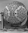 Etalon-1 and -2 tracking campaignRelease Date: 03/13/2019SLR has the opportunity to play a more significant role on the determination of Earth Orientation Parameters (EOP), an important element in the reference frame and parameters for many of our customers. With our improving ability to track GNSS satellites, we are conducting a 3-month Etalon campaign, from February 15 through May 15, 2019. Weekly reports are now available.
TLRS-4 at Haleakala without powerRelease Date: 02/19/2019A winter storm damaged commercial power transmission lines to the observatories on Haleakala, Hawaii, USA. Since February 10, TLRS-4 has been without power.
The local electric power company estimates repair to take a minimum of 4 weeks and as long as 8 weeks. The team is exploring ways to power the site with a backup generator or by connecting to a nearby observatory that has backup power.
![]() New Site Log Version and ProcedureRelease Date: 02/13/2019As you may be aware, there is a new version of the ILRS site log and a new procedure for submitting it. The procedure is documented on the ILRS web site at https://ilrs.cddis.eosdis.nasa.gov/network/site_procedures/site_logs.html. It involves creating or updating the site log via an on-line editor based at EDC. Submissions of text versions of the site log will no longer be accepted.
New Site Log Version and ProcedureRelease Date: 02/13/2019As you may be aware, there is a new version of the ILRS site log and a new procedure for submitting it. The procedure is documented on the ILRS web site at https://ilrs.cddis.eosdis.nasa.gov/network/site_procedures/site_logs.html. It involves creating or updating the site log via an on-line editor based at EDC. Submissions of text versions of the site log will no longer be accepted.
The version 1 site logs were converted automatically to version 2, but many have errors that need to be corrected. If you have not done so yet, please follow the procedures on the web site and update your site log to correct errors and add information in the new fields by May 10 of this year.
There is also a similar on-line editor at EDC to create or update your station change history log. Please see the instruction at https://ilrs.cddis.eosdis.nasa.gov/network/site_procedures/configuration_files.html.
![]() Planning for the 2019 ILRS Technical Workshop has begunRelease Date: 02/12/2019Planning for the 2019 ILRS Technical Workshop has begun!
We ask that you mark your calendars and reserve the date for the next gathering of the ILRS community:
Planning for the 2019 ILRS Technical Workshop has begunRelease Date: 02/12/2019Planning for the 2019 ILRS Technical Workshop has begun!
We ask that you mark your calendars and reserve the date for the next gathering of the ILRS community:
Dates: October 21-25, 2019
Location: Stuttgart, Germany
The workshop will be sponsored by the DLR in Stuttgart, Germany. The program committee is actively working on the defining the theme and session topics for the workshop while the local organizers are planning the workshop logistics.
The first circular for the workshop will be issued in the very near future.
We hope you will consider attending the workshop!
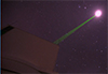 Lunar Laser Ranging featured on the "Today" showRelease Date: 02/11/2019NBC Sunday Today recently reported on lunar laser ranging activities at the APOLLO system in Sunspot NM.
 The Passing of Richard BiancaleRelease Date: 02/08/2019It is with profound sadness that we must announce to you the passing our colleague, Dr. Richard Biancale, geodesist, recently retired from the CNES in September 2018, and most recently working at the GFZ (Oberpfaffenhofen) with Dr. Frank Flechtner on GRACE Follow-On. We were informed of his death on Monday February 4, 2019 from a heart attack while skiing in the Alps.
Richard had a long and distinguished career in Space Geodesy. He received his Ph.D. in 1978 from the University Pierre and Marie Curie in Paris (France) while working under Professor Cristoph Reigber at the Technical University of Munich (Germany). He worked as a research scientist at the University of São Paulo, at the DGFI (Deutsches Geodãtisches Forschungsinstitut) in Munich (Germany), and at CERGA (Centre d'Etudes et de Recherches en Géodynamique et Astronométrie) Grasse (France), before joining the French Space Agency, the CNES (Toulouse, France) in 1982 as a scientific engineer.
Under the direction of Michel Lefebvre, one of his first jobs at the CNES was to define the DORIS tracking system for the TOPEX/Poseidon mission. Since 1984, he was very involved in the French-German cooperation on gravity field modeling, first with the GRIM models, and then with the EIGEN models after the launches of CHAMP and GRACE. He served as the scientific manager of the Stella laser geodetic satellite, launched in 1993. Under the direction of Dr. Georges Balmino, he became chief of the "Terrestrial and Planetary Geodetic Department" of the CNES in 1992. He received his "Habilitation" in 2006 and, starting in 2008, served as Executive Director of the Groupe de Recherche de Géodésie Spatiale (GRGS), a French national group that gathers 120 researchers from organizations involved in Space Geodesy studies.
Over the course of his career he has supervised and inspired more than a dozen Ph.D students and served as a mentor to many colleagues and young scientists. Understanding the importance of training the next generation of scientists in satellite geodesy, he has taught geodesy for over 25 years at engineer schools (e.g. ENSG [École de la Géomatique/National School of Geographic Sciences], ENSTA [École Nationale Supérieure de Techniques Avancées]), at universities (e.g. Paris VI), and short training courses (e.g. GRGS Summer School).
Throughout his career he has worked assiduously to improve the quality of geodetic data, and to advance the science obtained from these data. He was a strong proponent of the need for improving the International Terrestrial Reference Frame (ITRF), supporting the contributions to the IDS, IGS, ILRS, IVS and IERS. He has participated and led national and international proposals for new innovative space missions that would continue to advance the contribution of geodesy to science and society. Most recently, before and after his retirement from CNES, he worked to advance the proposal for the Tahiti Geodetic Observatory, a fundamental station including VLBI, SLR, GNSS and DORIS whose geographic location would be of prime importance to the ITRF and to the mm-level goals of the Global Geodetic Observing System (GGOS) in the next decade.
As many of his colleagues noticed, Richard Biancale had a joie de vivre. He was a charming, free, passionate and cheerful man who embraced life whether it was in a fine restaurant after a scientific meeting, sailing around the Mediterranean or across the Atlantic on his catamaran, "RaphyO2", or visiting interesting cultural or natural locales. As his colleagues, we were all privileged to enjoy his friendship. We lament this tragic loss.
To his family, including wife, Irmtraud, and four children, Raphaël, Philipp, Johannes & Jocelyne, we extend our deepest sympathy and most heartfelt condolences.
(NASA Goddard Space Flight Center, Greenbelt, Maryland, U.S.A)
Laurent Soudarin(Collecte Localisation Satellites, Ramonvile-Saint Agne, FRANCE)
Jean-Michel Lemoine & Pascale Ferrage
(Centre Nationale d' Études Spatiales, Toulouse, FRANCE)
Jean-Paul Boy(EOST, University of Strasbourg, Strasbourg, FRANCE)
![]() Election of the two Board-appointed members to the ILRS Governing BoardRelease Date: 02/11/2019
The ILRS Governing Board is pleased to announce that the election of the two Board-appointed members to the ILRS Governing Board has been completed. We were fortunate to have had many qualified candidates participate in the election process. The members of the ILRS Governing Board have elected Ulli Schreiber (Technische Universität München) and Krzysztof Sośnica (Wrocław University of Environmental and Life Sciences) to these two positions.
Election of the two Board-appointed members to the ILRS Governing BoardRelease Date: 02/11/2019
The ILRS Governing Board is pleased to announce that the election of the two Board-appointed members to the ILRS Governing Board has been completed. We were fortunate to have had many qualified candidates participate in the election process. The members of the ILRS Governing Board have elected Ulli Schreiber (Technische Universität München) and Krzysztof Sośnica (Wrocław University of Environmental and Life Sciences) to these two positions.
2019 Etalon Tracking CampaignRelease Date: 02/07/2019
SLR has the opportunity to play a more significant role on the determination of Earth Orientation Parameters (EOP), an important element in the reference frame and parameters for many of our customers. With our improving ability to track GNSS satellites, the ILRS has asked the network stations to participate in a 3-month Etalon tracking campaign from February 15 through May 15, 2019. For more information: https://ilrs.cddis.eosdis.nasa.gov/science/awg/awgActivities/proposedTrackingEtalon1_and_2_Feb2019.html
![]() New guidelines for missions seeking ILRS support for SLR trackingRelease Date: 02/04/2019
The ILRS Missions Standing Committee (MSC) and Governing Board have recently approved new guidelines for missions seeking ILRS support for SLR tracking. Mission contacts should consult the "Guidelines for Submitting an ILRS New Mission Support Request" documentation prior to submitting a completed ILRS Missions Support Request to the ILRS Central Bureau.
New guidelines for missions seeking ILRS support for SLR trackingRelease Date: 02/04/2019
The ILRS Missions Standing Committee (MSC) and Governing Board have recently approved new guidelines for missions seeking ILRS support for SLR tracking. Mission contacts should consult the "Guidelines for Submitting an ILRS New Mission Support Request" documentation prior to submitting a completed ILRS Missions Support Request to the ILRS Central Bureau.
2018
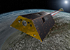 GRACE-FO Tracking Campaign - December 15, 2018 through January 15, 2019Release Date: 12/07/2018
The ILRS has scheduled a tracking campaign from December 15, 2018 through January 15, 2019 for the GRACE-FO mission. During this 30-day period, the mission will be collecting data for future analysis of the performance of the inter-satellite laser ranging interferometer (LRI) under various conditions. Thus, SLR tracking is requested on a best efforts basis to support this data collection for future analysis. The ILRS will move the two satellites to the top of the ILRS priority list.
GRACE-FO Tracking Campaign - December 15, 2018 through January 15, 2019Release Date: 12/07/2018
The ILRS has scheduled a tracking campaign from December 15, 2018 through January 15, 2019 for the GRACE-FO mission. During this 30-day period, the mission will be collecting data for future analysis of the performance of the inter-satellite laser ranging interferometer (LRI) under various conditions. Thus, SLR tracking is requested on a best efforts basis to support this data collection for future analysis. The ILRS will move the two satellites to the top of the ILRS priority list.
 Proceedings website for the 21st International Workshop on Laser Ranging now availableRelease Date: 11/27/2018
The proceedings website for the 21st International Workshop on Laser Ranging, held November 05-09 in Canberra Australia is now available with links to presentations, posters, and papers. Summary information is also available at the website.
Proceedings website for the 21st International Workshop on Laser Ranging now availableRelease Date: 11/27/2018
The proceedings website for the 21st International Workshop on Laser Ranging, held November 05-09 in Canberra Australia is now available with links to presentations, posters, and papers. Summary information is also available at the website.
 Dr. Toshimichi Otsubo elected Chair of the ILRS Governing BoardRelease Date: 11/27/2018
Dr. Toshimichi Otsubo from the Hitotsubashi University was elected Chair of the ILRS Governing Board for the 2019-2020 term at the Board meeting on November 08, 2018. Congratulations to Toshi.
Dr. Toshimichi Otsubo elected Chair of the ILRS Governing BoardRelease Date: 11/27/2018
Dr. Toshimichi Otsubo from the Hitotsubashi University was elected Chair of the ILRS Governing Board for the 2019-2020 term at the Board meeting on November 08, 2018. Congratulations to Toshi.
![]() The Space Geodesy Project awards contract to KBRwyle Technology Solutions, LLCRelease Date: 10/05/2018The Space Geodesy Project awarded a contract to KBRwyle Technology Solutions, LLC in Columbia, Maryland, for the construction, deployment and commissioning of the agency’s next-generation Space Geodesy Satellite Laser Ranging (SGSLR) stations. https://www.nasa.gov/press-release/nasa-awards-contract-for-space-geodesy-satellite-laser-ranging-stations
The Space Geodesy Project awards contract to KBRwyle Technology Solutions, LLCRelease Date: 10/05/2018The Space Geodesy Project awarded a contract to KBRwyle Technology Solutions, LLC in Columbia, Maryland, for the construction, deployment and commissioning of the agency’s next-generation Space Geodesy Satellite Laser Ranging (SGSLR) stations. https://www.nasa.gov/press-release/nasa-awards-contract-for-space-geodesy-satellite-laser-ranging-stations
![]() Elections completed for the 2018-2020 term of the ILRS Governing BoardRelease Date: 10/04/2018
The ILRS recently completed elections for the 2018-2020 term of the ILRS Governing Board. The members for the next term of the Board, taking office in November 2018 are:
Elections completed for the 2018-2020 term of the ILRS Governing BoardRelease Date: 10/04/2018
The ILRS recently completed elections for the 2018-2020 term of the ILRS Governing Board. The members for the next term of the Board, taking office in November 2018 are:
Director of the Central Bureau
Secretary of the Central Bureau
Representative of IAG Commission 1
IERS Representative
EUROLAS Network Representatives
NASA Network Representatives
WPLTN Representatives
Analysis Representatives
LLR Representative
Data Center Representative
At-Large Representatives
Secretary of the Central Bureau
Representative of IAG Commission 1
IERS Representative
EUROLAS Network Representatives
NASA Network Representatives
WPLTN Representatives
Analysis Representatives
LLR Representative
Data Center Representative
At-Large Representatives
Mike Pearlman (appointed)
Carey Noll (appointed)
Urs Hugentobler (appointed)
Daniela Thaller (appointed)
Pippo Bianco, Georg Kirchner
Jan McGarry, Stephen Merkowitz
James Bennett, Zhang Zhongping
Cinzia Luceri, Erricos Pavlis
Jean-Marie Torre
Christian Schwatke
Toshi Otsubo, Matt Wilkinson
Carey Noll (appointed)
Urs Hugentobler (appointed)
Daniela Thaller (appointed)
Pippo Bianco, Georg Kirchner
Jan McGarry, Stephen Merkowitz
James Bennett, Zhang Zhongping
Cinzia Luceri, Erricos Pavlis
Jean-Marie Torre
Christian Schwatke
Toshi Otsubo, Matt Wilkinson
Two additional members of the Board will be appointed by the Governing Board, bringing total membership to 18 members. The chair will be elected at a meeting of the Board held in conjunction with the 21st International Workshop on Laser Ranging in November.
Congratulations to the newly elected representatives and thank you
to all the excellent candidates who participated in the ILRS
Governing Board election process. We were fortunate to have many
very qualified candidates.
![]() NASA Earth Science Data and Services Survey for 2018Release Date: 10/01/2018
Recently, some of you may have received an email from the CFI Group on behalf of NASA. This message asked you to complete a survey for users of NASA Earth science data and services, which includes the Crustal Dynamics Data Information System (CDDIS). The CDDIS is one of twelve NASA Earth Observing System Data and Information System (EOSDIS) science data centers evaluated by this survey. The purpose of this survey is to help NASA and the DAACs assess customer satisfaction and improve future services. Suggestions from past surveys have been implemented to improve the tools and services offered by the CDDIS.
NASA Earth Science Data and Services Survey for 2018Release Date: 10/01/2018
Recently, some of you may have received an email from the CFI Group on behalf of NASA. This message asked you to complete a survey for users of NASA Earth science data and services, which includes the Crustal Dynamics Data Information System (CDDIS). The CDDIS is one of twelve NASA Earth Observing System Data and Information System (EOSDIS) science data centers evaluated by this survey. The purpose of this survey is to help NASA and the DAACs assess customer satisfaction and improve future services. Suggestions from past surveys have been implemented to improve the tools and services offered by the CDDIS.
Please participate! Your feedback affects our future performance and helps to identify science needs. You will be able to take the survey for each DAAC you use. This is your opportunity to influence the priorities of the DAACs, including CDDIS.
If you did not receive a survey and wish to complete one or know of someone who uses CDDIS and/or EOSDIS data and services who did not receive a survey, please contact
NASASurvey@cfigroup.com.
The American Customer Satisfaction Index (ACSI) is the only national cross-industry measure of customer satisfaction in the United States. NASA commissioned the CFI Group, an independent research and consulting organization, to conduct a brief survey to rate the products and services NASA currently provides from NASA's EOSDIS data centers. Please consider responding to this survey; your input will help us to better serve our user community.
Presentations of these results given to NASA Earth science are available at:
https://earthdata.nasa.gov/about/system-performance/american-customer-satisfaction-index-reports
Thank you in advance to all of you who are willing to spend a few minutes to complete the survey.
Deadline for Abstract Submission Extended for 21st IWLRRelease Date: 07/02/2018The 21st International Workshop on Laser Ranging will be
held in Canberra Australia, November 05-09, 2018. The deadline for abstract submission has been extended to Wednesday August 01, 2018.
We encourage you to submit your abstracts and complete your registration as soon as possible. Please explore the workshop website at http://www.iwlr2018.serc.org.au/ for updated information, including the workshop program,
links to registration and abstract submission, and information about the venue and hotel booking.
![]() Second LARGE campaign of 2018Release Date: 06/27/2018The second LARGE campaign of 2018 will take place from July 1 through September 30, 2018.
Second LARGE campaign of 2018Release Date: 06/27/2018The second LARGE campaign of 2018 will take place from July 1 through September 30, 2018.

Image credit:
NASA, JPL
Dear Colleagues,
Our friend and scientific colleague Jean Dickey passed away on May 9, 2018.
Jean was a brilliant and highly valued member of the geodetic research community. She started her career first studying engineering and later switching to physics at a small liberal arts college, now St. Francis University. In her senior year, she entered an honors program at the U.S. Department of Energy's Argonne National Laboratory. Jean completed her Ph.D. at Rutgers University in 1976 in high-energy physics. As a postdoc at Caltech, she analyzed data from particle experiments that were performed at Fermilab.
She joined JPL in 1980, initially studying the round-trip travel time of lasers shot between observatories on Earth and reflectors left on the moon by the Apollo astronauts. Jean made seminal contributions on Earth rotation, including polar motion and length of day, and how small variations can have big impacts on weather, sea level and even space exploration. Jean's groundbreaking work ranged from El Niño events to the Earth's core. She has published more than 70 well cited peer-reviewed papers, many in high impact journals. Jean served as group supervisor at JPL from 1983 to 2005, was appointed Principal Scientist in 2005 and Senior Research Scientist in 2007. Jean chaired the National Research Council Committee on "Earth Gravity from Space" in 1996-7. Her leadership contributed significantly to the selection and later launch of the GRACE mission, to be followed a week from now by GRACE-FO. A prominent and pioneering geophysicist, in 1993 she was the first woman to give the American Geophysical Union's (AGU) Bowie Lecture, speaking on Earth's rotation as an interdisciplinary approach to Earth System science. Jean was the first woman to serve as President of the AGU Geodesy Section, from 1994 to 1995.
Jean's superb accomplishments were recognized by several prestigious awards throughout her career. Jean was elected Fellow of the American Geophysical Union and the International Association of Geodesy. She was awarded the NASA Exceptional Service Medal in 1998, and the NASA Exceptional Scientific Achievement Medal in 2003.
A loving mother and sister, Jean is survived by two sons, two grandchildren, three sisters and two brothers. Services will be held Monday May 14 at 9:30 am at St. Philip the Apostle Catholic Church, 151 S. Hill Ave, Pasadena.
Susan Owen/JPL
Carmen Boening/JPL
Victor Zlotnicki/JPL
 JCET weather service for ILRS network
Release Date: 06/13/2018JCET's ILRS ASC Product and Information Server now includes a link to an ILRS network weather forecast service, compiled from The Weather Underground.
JCET weather service for ILRS network
Release Date: 06/13/2018JCET's ILRS ASC Product and Information Server now includes a link to an ILRS network weather forecast service, compiled from The Weather Underground.
Second Circular for the 21st International Workshop on Laser Ranging ReleasedRelease Date: 06/06/2018The Space Environment Research Centre (SERC) and the International Laser Ranging Service (ILRS) are actively organizing the 21st International Workshop on Laser Ranging in Canberra, Australia during the week of November 05-09, 2018. The second circular has been released. Registration is now open and attendees are encouraged to submit an abstract for oral and poster sessions.
![]() First LARGE Campaign of 2018 is Now OverRelease Date: 05/29/2018The first 2018 LARGE Campaign is now over. A summary report for the campaign is available on the LARGE Activities and Meetings page.
First LARGE Campaign of 2018 is Now OverRelease Date: 05/29/2018The first 2018 LARGE Campaign is now over. A summary report for the campaign is available on the LARGE Activities and Meetings page.
![]() First successful SLR returns to S-NetRelease Date: 04/16/2018The SLR system in Riga, Latvia was the first ILRS station to obtain returns from one of the four SNET satellites (SNET-4); Yarragadee, Australia also tracked SNET-4 the following day. Riga obtained returns at 21:57 UTC on April 12; Yarragadee's first successful pass was on April 13 at 16:00 UTC. Congratulations to both stations on their persistent efforts to range to these difficult targets.
First successful SLR returns to S-NetRelease Date: 04/16/2018The SLR system in Riga, Latvia was the first ILRS station to obtain returns from one of the four SNET satellites (SNET-4); Yarragadee, Australia also tracked SNET-4 the following day. Riga obtained returns at 21:57 UTC on April 12; Yarragadee's first successful pass was on April 13 at 16:00 UTC. Congratulations to both stations on their persistent efforts to range to these difficult targets.
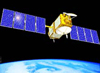 Time Transfer by Laser Link (T2L2) mission onboard the Jason-2 satellite is now completedRelease Date: 04/09/2018The Time Transfer by Laser Link (T2L2) mission onboard the Jason-2 satellite is now completed. The T2L2 space instrument, which has been in operation for nearly 10 years, will be turned off on April 09, 2018. Most of the initial objectives for the experiment have been successfully achieved. The Jason-2 satellite remains operational, as does laser ranging to the satellite.
 New NASA VLBI Civil Servant position open for applicationsRelease Date: 03/13/2018A new NASA VLBI Civil Servant position is now posted and open for applications. There are two postings, one senior and one mid-level, and applicants should decide which one best fits his/her experience level:
GS-14: http://www.usajobs.gov/GetJob/ViewDetails/493509700
GS-15: http://www.usajobs.gov/GetJob/ViewDetails/493510000
The postings currently close on Tuesday, March 27, 2018. Please note that the job is only open to U.S. citizens and U.S. nationals.
 The passing of Dr Yoshihide KozaiRelease Date: 02/15/2018Dr. Yoshihide Kozai passed away on 5 February 2018 at the age of 89. He was very well known in the field of orbit dynamics and also as a leading pioneer of satellite laser ranging since 1960s. He later served as the founding Director General of National Astronomical Observatory of Japan (NAOJ). He had a strong presence even after that - many of us remember his appearance and great speech in the 18th Int. Workshop on Laser Ranging in Fujiyoshida. He will be extremely missed.
![]() EOSDIS awarded the 2015 Pecora awardRelease Date: 02/14/2018EOSDIS was awarded the 2015 Pecora award. This prestigious award is given to groups that make outstanding contributions toward understanding the Earth by means of remote sensing. The citation highlights the EOSDIS accomplishments in providing an open archive system for a global user community. CDDIS is one of twelve DAACs supporting EOSDIS efforts through the Earth Science Data and Information System (ESDIS) project. Carey Noll, CDDIS Manager, accepted their award certificate from Andy Mitchell, ESDIS Project Manager, and Jeanne Behnke, Deputy Project Manager/Operations, at the 2018 DAAC Managers Meeting.
EOSDIS awarded the 2015 Pecora awardRelease Date: 02/14/2018EOSDIS was awarded the 2015 Pecora award. This prestigious award is given to groups that make outstanding contributions toward understanding the Earth by means of remote sensing. The citation highlights the EOSDIS accomplishments in providing an open archive system for a global user community. CDDIS is one of twelve DAACs supporting EOSDIS efforts through the Earth Science Data and Information System (ESDIS) project. Carey Noll, CDDIS Manager, accepted their award certificate from Andy Mitchell, ESDIS Project Manager, and Jeanne Behnke, Deputy Project Manager/Operations, at the 2018 DAAC Managers Meeting.
![]() LARGE campaign to begin February 15Release Date: 02/06/2018The first LARGE Campaign for 2018 will run from February 15 to May 15. Each GNSS constellation has identified 4 primary and 4 secondary satellites for tracking:
LARGE campaign to begin February 15Release Date: 02/06/2018The first LARGE Campaign for 2018 will run from February 15 to May 15. Each GNSS constellation has identified 4 primary and 4 secondary satellites for tracking:
System
GLONASS
Galileo
COMPASS
GLONASS
Galileo
COMPASS
Secondary
GLONASS -128, -132, -133, -135
Galileo-103, -203, -211, -213
Compass-I5, -IS2, -I6B, -MS2
GLONASS -128, -132, -133, -135
Galileo-103, -203, -211, -213
Compass-I5, -IS2, -I6B, -MS2
Please refer to the ILRS priority list on February 15 for the exact priorities. Also note that in April, the list of secondary satellites for Galileo will change as per request from the mission.
https://ilrs.cddis.eosdis.nasa.gov/missions/mission_operations/priorities/index.html
During the campaign, the ILRS will provide GLONASS, Galileo, and Compass predictions to the stations for ONLY THESE SELECTED SATELLITES in order to encourage stations to focus on only these targets.
Stations are requested to track the primary satellites over at least two, preferably three, widely spaced segments over the arc, with each segment containing at least two normal points. For the secondary satellites, stations are asked to track at least one segment with at least two normal points over the arc. If some of the primary satellites cannot be tracked due to daylight, weather conditions or other reasons, then we are asking the stations to put more emphasis on the secondary satellites.
First Circular for the 21st International Workshop on Laser Ranging ReleasedRelease Date: 02/02/2018The Space Environment Research Centre (SERC) and the International Laser Ranging Service (ILRS) are pleased to announce that the 21st International Workshop on Laser Ranging will be held in Canberra, Australia during the week of November 04-09, 2018 at the John Curtin School of Medical Research (Australian National University) and Mount Stromlo. The first circular has been released.
2017
 Holiday Greetings from the ILRS GB and CBRelease Date: 12/18/2017The Governing Board and the Central Bureau of the International Laser Ranging Service extend our sincere thanks to you for your participation in service activities during 2017!
Once again, another busy year comes to an end for the ILRS. We saw the launch of new several missions requiring laser ranging support, new products under development, stations undergoing development, upgrade and improvement, participation in a very successful 2017 ILRS Technical Workshop in Riga, and new challenges and opportunities opening up for our community through GGOS and other international activities. We thank you for your continued support of the ILRS and its mission.
We also send our best wishes to you and your families during this holiday season and for a healthy, successful, and Happy New Year. We look forward to continued cooperation and success in 2018!
Pippo Bianco, Mike Pearlman, and Carey Noll
![]() CDDIS Computer System Outage will affect ILRS websiteRelease Date: 11/15/2017CDDIS must undergo an unplanned outage on 16-Nov-2017 from 14:00-18:00 EST (19:00–22:00 UTC) to replace critical system hardware. Because the ILRS website is hosted on the CDDIS server, there may be extended interruptions in connectivity to the ILRS website during this period. We expect that the system outage will not require the full 4 hours but have allocated time to address any unforeseen issues.
CDDIS Computer System Outage will affect ILRS websiteRelease Date: 11/15/2017CDDIS must undergo an unplanned outage on 16-Nov-2017 from 14:00-18:00 EST (19:00–22:00 UTC) to replace critical system hardware. Because the ILRS website is hosted on the CDDIS server, there may be extended interruptions in connectivity to the ILRS website during this period. We expect that the system outage will not require the full 4 hours but have allocated time to address any unforeseen issues.
We apologize for any inconvenience these outages may cause the user community.
 GRACE mission ends science operationsRelease Date: 10/27/2017After more than 15 productive years in orbit, the U.S./German GRACE (Gravity Recovery and Climate Experiment) satellite mission has ended science operations. During their mission, the twin GRACE satellites have provided unprecedented insights into how our planet is changing by tracking the continuous movement of liquid water, ice and the solid Earth.
Read more...
![]() Interruptions in network connectivity to ILRS websiteRelease Date: 10/27/2017The CDDIS network will undergo maintenance on Tuesday, October 31, 2017 between 15:00 - 19:00 UTC. Because the ILRS website is hosted on the CDDIS server, there may be extended interruptions in connectivity to the ILRS website during this maintenance period but we expect only short 5-10 minute outages during the timeframe.
Interruptions in network connectivity to ILRS websiteRelease Date: 10/27/2017The CDDIS network will undergo maintenance on Tuesday, October 31, 2017 between 15:00 - 19:00 UTC. Because the ILRS website is hosted on the CDDIS server, there may be extended interruptions in connectivity to the ILRS website during this maintenance period but we expect only short 5-10 minute outages during the timeframe.
We apologize for any inconvenience these outages may cause the user community.
GRACE-B to be decommissionedRelease Date: 09/11/2017After over 15 years of successful operations, the GRACE-B satellite will be decommissioned due to battery and fuel problems. The community was pleased to contribute to this exciting mission and looks forward to future collaborations on future gravity missions such as the GRACE Follow-On (GRACE-FO) mission.
 The passing of Charles "Chuck" LundquistRelease Date: 08/24/2017The SLR community is sad to report that Charles (Chuck) Lundquist passed away on June 3, 2017. Chuck was at the Smithsonian Astrophysical Observatory in the 1960s and, as Associate Director for Science, helped guide the Satellite Tracking Program that was a forerunner of our current space geodesy program. He was a very strong advocate of both Satellite Laser Ranging and VLBI, and in general, greatly encouraged international programs. Some of you may recall meeting Chuck at the International Workshop on Laser Ranging in Annapolis a few years ago and hearing some of the fascinating stories about the early space program. More about Chuck’s career can be found in his published obituary.
![]() 2017 ILRS Technical Workshop: Second circularRelease Date: 07/21/2017The Institute of Astronomy at the University of Latvia and the International Laser Ranging Service (ILRS) will host the 2017 ILRS Technical Workshop on October 02 through 05, 2017 in Riga, Latvia. The second circular, containing important information about upcoming deadlines, is now available. The first circular for the workshop was issued in February 2017 and contains information about the workshop topics.
2017 ILRS Technical Workshop: Second circularRelease Date: 07/21/2017The Institute of Astronomy at the University of Latvia and the International Laser Ranging Service (ILRS) will host the 2017 ILRS Technical Workshop on October 02 through 05, 2017 in Riga, Latvia. The second circular, containing important information about upcoming deadlines, is now available. The first circular for the workshop was issued in February 2017 and contains information about the workshop topics.
Printed version of the Journal of Geodesy Special Issue on VLBI now availableRelease Date: 06/21/2017The printed version of the Journal of Geodesy Special Issue on VLBI: Journal of Geodesy, Volume 91, Issue 7, July 2017, is now available at https://link.springer.com/journal/190/91/7/page/1. This volume includes a Preface and 14 scientific articles devoted to various aspects of the VLBI theory, methodology and data analysis.
![]() ILRS approves new network application form and policyRelease Date: 06/14/2017The ILRS has approved a new policy and application form for new stations to join the ILRS network.
ILRS approves new network application form and policyRelease Date: 06/14/2017The ILRS has approved a new policy and application form for new stations to join the ILRS network.
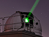 Innovation column in GPS World discusses importance of laser ranging to GNSS satellitesRelease Date: 05/25/2017In the May 2017 Innovation column of GPS World, author Urs Hugentobler discusses the importance of laser ranging to GNSS satellites for improvement in modeling the orbits of these satellites. Better GNSS satellite orbits result in better receiver position accuracies, which are required to improve monitoring of Earth processes.
 NRK TV (Norway) features the need for a precise Terrestrial Reference Frame, and discusses role of NASA and the Space Geodesy Program Release Date: 04/14/2017NRK TV in Norway has published a video feature (in Norwegian) discussing the importance,and challenges of global cooperation in making precise measurements to support the maintenance of an international terrestrial reference frame necessary for natural hazard and global change studies. The video also discusses the future plans for cooperation with NASA in the construction of the geodetic station in Ny Alesund. The video features interviews (in English) with SGP Manager Stephen Merkowitz (Code 61A @ NASA GSFC; time index 5:26, 8:45, 10:20) and colleagues Hayo Hase (AGGO, La Plata Argentina ; time index 11:14 20:07) Ludwig Combrinck (HartRAO, South Africa; time index 6:24, 17:24); Per Erik Opseth, Laila Lovhoiden, Gary Johnston (Geoscience Australia, time index 20:53, 23:05), and others, as well as a visit to NASA GSFC and GGAO.
Upcoming maintenance on CDDIS and ILRS email explodersRelease Date: 04/14/2017The NASA system used for CDDIS and ILRS email exploders will be undergoing maintenance from 13:00 - 17:00 UTC on April 23.
![]() ILRS 2017 Technical Workshop: First circularRelease Date: 03/29/2017The Institute of Astronomy at the University of Latvia and the International Laser Ranging Service (ILRS) will host the 2017 ILRS Technical Workshop on October 02 through 05, 2017 in Riga, Latvia. The program committee for the 2017 ILRS Technical Workshop, to be held in Riga Latvia, October 02-05, 2017, has issued the meeting’s first circular. The workshop will have four sessions held over four days.
ILRS 2017 Technical Workshop: First circularRelease Date: 03/29/2017The Institute of Astronomy at the University of Latvia and the International Laser Ranging Service (ILRS) will host the 2017 ILRS Technical Workshop on October 02 through 05, 2017 in Riga, Latvia. The program committee for the 2017 ILRS Technical Workshop, to be held in Riga Latvia, October 02-05, 2017, has issued the meeting’s first circular. The workshop will have four sessions held over four days.
The workshop sessions will be focused on:
 SpinSat re-enters Earth's atmosphereRelease Date: 03/22/2017NRL/Jake Griffiths has informed the ILRS that SpinSat re-entered late on March 11, 2017. The last track of the satellite was received that day at 22:39 UTC from a Space Surveillance Network station located in the UK. NRL has expressed its gratitude to the ILRS for supporting the mission.
![]() New ILRS AAC at IGIGRelease Date: 03/22/2017The ILRS is pleased to welcome the Wroclaw University of Enviromental and Life Sciences (WUELS), Institute of Geodesy and Geoinformatics (IGIG) as an ILRS Associate Analysis Center (AAC). Krzysztof Sosnica’s group at the Institute is generating scientific products based on the SLR observations to new GNSS systems on the operational basis. IGIG generates daily reports that include a comparison between IGS MGEX orbits of GLONASS, Galileo, BeiDou MEO, BeiDou IGSO and QZSS satellites and SLR observations collected by a global network of ILRS stations.
New ILRS AAC at IGIGRelease Date: 03/22/2017The ILRS is pleased to welcome the Wroclaw University of Enviromental and Life Sciences (WUELS), Institute of Geodesy and Geoinformatics (IGIG) as an ILRS Associate Analysis Center (AAC). Krzysztof Sosnica’s group at the Institute is generating scientific products based on the SLR observations to new GNSS systems on the operational basis. IGIG generates daily reports that include a comparison between IGS MGEX orbits of GLONASS, Galileo, BeiDou MEO, BeiDou IGSO and QZSS satellites and SLR observations collected by a global network of ILRS stations.
![]() ILRS survey of user tracking needsRelease Date: 03/21/2017Many stations in the ILRS network are nearly saturated in their tracking schedule. The ILRS is presently assessing its tracking needs to try to maximize its utility. We recently sent out an email to various ILRS users and groups to ask for user needs. If you want your needs to be considered, and did not receive an email invitation, please send an email to Erricos Pavlis
(epavlis @ umbc.edu). Once we compile the results, the ILRS plans to make revisions to its tracking list based on users needs. Therefore, user input is critical. The survey should not take you more than 5-10 minutes to complete, depending on your level of involvement with SLR data. Thank you for supporting the ILRS!
ILRS survey of user tracking needsRelease Date: 03/21/2017Many stations in the ILRS network are nearly saturated in their tracking schedule. The ILRS is presently assessing its tracking needs to try to maximize its utility. We recently sent out an email to various ILRS users and groups to ask for user needs. If you want your needs to be considered, and did not receive an email invitation, please send an email to Erricos Pavlis
(epavlis @ umbc.edu). Once we compile the results, the ILRS plans to make revisions to its tracking list based on users needs. Therefore, user input is critical. The survey should not take you more than 5-10 minutes to complete, depending on your level of involvement with SLR data. Thank you for supporting the ILRS!
 Russian satellite laser and radio ranging system has officially been inaugurated in South AfricaRelease Date: 03/07/2017A new SLR station has recently been installed at the Hartebeesthoek Radio Astronomy Observatory (HartRAO). The system was designed, produced and installed by JC <<RPC <<PSI>>. An opening ceremony, led by the Russian State Space Corporation (Roscosmos), was held on February 27, 2017 and attended by representatives from both Russia and South Africa; more information about the system and the dedication is available (in English) from the HartRAO website and the South African Department of Science and Technology.
 Designation "NORAD ID" changed to "Satellite Catalog Number"Release Date: 01/11/2017The ILRS, and other groups, have used the term "NORAD ID" for the sequential, 5-digit number assigned to satellite missions after launch. This designation was previously assigned and maintained by NORAD (North American Aerospace Defense Command). The assignment is now performed by The United States Space Command (USSPACECOM); therefore, the designation NORAD ID has been changed to the Satellite Catalog Number on the ILRS mission pages and lists.
2016
Holiday Greetings from the ILRSRelease Date: 12/31/2016The Governing Board and the Central Bureau of the International Laser Ranging Service would like to extend our sincere thanks to you and your colleagues for your participation in service activities during 2016.
The year 2016 has once again been a very busy year for the ILRS where we supported new missions and the generation of data and products for the international research community. We sponsored the very successful 20th International Workshop on Laser Ranging in Potsdam in October. The ILRS also participated in various international activities and GGOS. We thank you for your continued support of the ILRS and its mission.
We would like to send our warmest wishes for a wonderful holiday season to all of our ILRS colleagues, staff members, and their families. Best wishes for a healthy and Happy New Year.
We look forward to even more successes in 2017!
Pippo Bianco, Mike Pearlman, and Carey Noll
![]() CDDIS successfully moves all primary operations to an upgraded computer systemRelease Date: 12/01/2016The CDDIS successfully moved all primary operations to an upgraded computer system on December 01, 2016; in total, the CDDIS archive was inaccessible to the user community for approximately 30 hours during the transition. The new IT infrastructure provides a more robust, reliable, and expandable system with increased storage capacity to handle future growth. All suppliers of data, derived products, and ancillary files for the CDDIS archive were required to modify their software to use the HTTP protocol for file upload. In addition to new hardware, the CDDIS archive processing software was redesigned and improved to provide for more efficient operations and additional QC on incoming files.
CDDIS successfully moves all primary operations to an upgraded computer systemRelease Date: 12/01/2016The CDDIS successfully moved all primary operations to an upgraded computer system on December 01, 2016; in total, the CDDIS archive was inaccessible to the user community for approximately 30 hours during the transition. The new IT infrastructure provides a more robust, reliable, and expandable system with increased storage capacity to handle future growth. All suppliers of data, derived products, and ancillary files for the CDDIS archive were required to modify their software to use the HTTP protocol for file upload. In addition to new hardware, the CDDIS archive processing software was redesigned and improved to provide for more efficient operations and additional QC on incoming files.
![]() Update to ILRS Terms of ReferenceRelease Date: 11/17/2016The IAG has recently approved the update to the ILRS Terms of Reference.
Update to ILRS Terms of ReferenceRelease Date: 11/17/2016The IAG has recently approved the update to the ILRS Terms of Reference.
![]() CDDIS unavailable November 30-December 01 for transition to new systemsRelease Date: 11/17/2016On November 30, 2016 at 13:00 UTC, CDDIS will terminate all services (ftp, CDDIS/ILRS/SGP websites, data deliveries) as we transition to all new hardware and facilities. We are projecting about 24 hours to fully move to our new facilities and ensure all operations are back to normal. As such, all users need to plan on a 24+ hour disruption of service to the CDDIS archive with resumption of normal operations no earlier than December 01, 2016 at 17:00 UTC.
CDDIS unavailable November 30-December 01 for transition to new systemsRelease Date: 11/17/2016On November 30, 2016 at 13:00 UTC, CDDIS will terminate all services (ftp, CDDIS/ILRS/SGP websites, data deliveries) as we transition to all new hardware and facilities. We are projecting about 24 hours to fully move to our new facilities and ensure all operations are back to normal. As such, all users need to plan on a 24+ hour disruption of service to the CDDIS archive with resumption of normal operations no earlier than December 01, 2016 at 17:00 UTC.
In summary the following will take place:
While CDDIS is unavailable, users can access one of the other data centers supporting the services:
![]() Workshop website for the 20th International Workshop on Laser Ranging 2016 in PotsdamRelease Date: 11/09/2016A dedicated ILRS website for the 20th International Workshop on Laser Ranging 2016 in Potsdam is now available at http://cddis.gsfc.nasa.gov/lw20/ which also contains instructions for preparing contributions to the proceedings. Please follow the instructions and be aware of the deadline January 31, 2017.
Workshop website for the 20th International Workshop on Laser Ranging 2016 in PotsdamRelease Date: 11/09/2016A dedicated ILRS website for the 20th International Workshop on Laser Ranging 2016 in Potsdam is now available at http://cddis.gsfc.nasa.gov/lw20/ which also contains instructions for preparing contributions to the proceedings. Please follow the instructions and be aware of the deadline January 31, 2017.
Brief network outages at GSFC on September 03, 2016Release Date: 08/30/2016
Work will be performed on the NASA GSFC network infrastructure from 09:00 a.m. EDT (13:00 UTC) through 05:00 p.m. EDT (21:00 UTC) on Saturday, September 03, 2016. Users may experience short intermittent interruptions in connectivity to CDDIS web and ftp sites during that time period.
Should the CDDIS be unaccessible, users can access one of the other data centers supporting the services:
- ILRS:
http://ilrs.gsfc.nasa.gov/data_and_products/data_centers/index.html (check before December 19!)
- IVS: http://ivscc.gsfc.nasa.gov/about/org/components/dc-list.html
- IDS: http://ids-doris.org/data-products/info.html
 Ajisai celebrates 30 years in space Release Date: 08/13/2016JAXA launched the Ajisai spacecraft from the Tanegashima Space Center on August 13, 1986 at 05:45 JST. Ajisai is Japan’s first geometric satellite. Read more about the anniversary celebration.
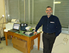 User Profile: Dr. Erricos C. Pavlis Release Date: 08/11/2016NASA Earthdata has published a user profile of Dr. Erricos Pavlis as part of their "Who uses NASA Earth science data?" series.
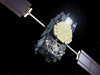 Galileo-205 and -206 are now in working orbits and will soon broadcast test navigation signals.Release Date: 08/17/2016Europe’s fifth and sixth Galileo satellites, which were salvaged from their faulty launch into working orbits, are set to begin broadcasting working navigation signals for test purposes. Read more
Paper regarding estimation of systematic errors in LAGEOS observations 1993–2014 publishedRelease Date: 07/25/2016A paper by Graham Appleby, José Rodríguez, and Zuheir Altamimi, titled, "Assessment of the accuracy of global geodetic satellite laser ranging observations and estimated impact on ITRF scale: estimation of systematic errors in LAGEOS observations 1993–2014," has been published in the August, 2016 issue of the Journal of Geodesy. doi:10.1007/s00190-016-0929-2.
![]() First Circular for the 20th International Workshop on Laser Ranging ReleasedRelease Date: 07/19/2016
GFZ Potsdam and the International Laser Ranging Service (ILRS) are pleased to announce that the 20th International Workshop on Laser Ranging will be held in Potsdam Germany during the week of October 09-14, 2016 at GFZ Potsdam, Telegrafenberg. The first circular has been released.
First Circular for the 20th International Workshop on Laser Ranging ReleasedRelease Date: 07/19/2016
GFZ Potsdam and the International Laser Ranging Service (ILRS) are pleased to announce that the 20th International Workshop on Laser Ranging will be held in Potsdam Germany during the week of October 09-14, 2016 at GFZ Potsdam, Telegrafenberg. The first circular has been released.
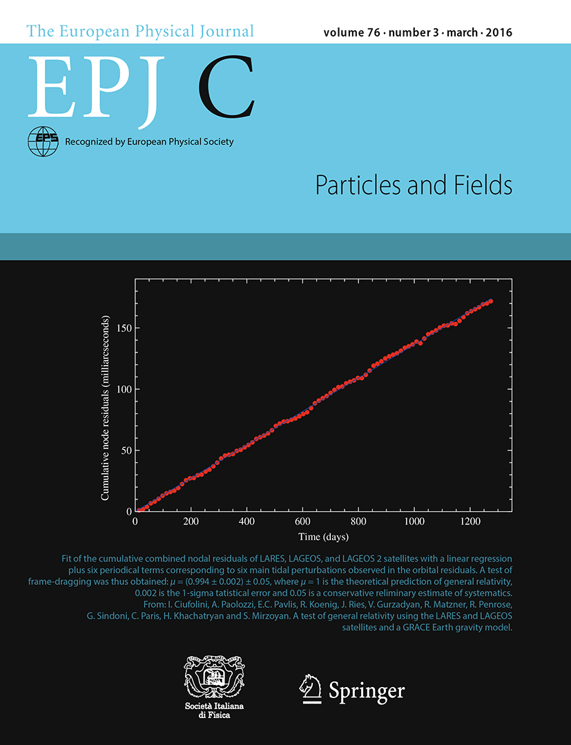 LARES + LAGEOS 1&2 Lense-Thirring results selected as EPJ-C coverRelease Date: 07/19/2016
The article, "A test of general relativity using the LARES and LAGEOS satellites and a GRACE Earth gravity model," (Ciufolini et. al.) has been published in the March 2016 issue of the European Physical Journal-C. Furthermore, a figure from this paper has been selected for the cover of that issue.
LARES + LAGEOS 1&2 Lense-Thirring results selected as EPJ-C coverRelease Date: 07/19/2016
The article, "A test of general relativity using the LARES and LAGEOS satellites and a GRACE Earth gravity model," (Ciufolini et. al.) has been published in the March 2016 issue of the European Physical Journal-C. Furthermore, a figure from this paper has been selected for the cover of that issue.
 The passing of Dr. Bob CoatesRelease Date: 07/12/2016
We are saddened to report the passing of Dr. Bob Coates, a long time colleague in the field of space geodesy. Bob was the Project Manager for NASA’s very successful Crustal Dynamics Project (CDP). Bob helped advance the SLR and VLBI technologies at NASA GSFC, incorporating them as the key measurement components of the CDP, which succeeded in describing the relative motions of the Earth’s plates with unprecedented accuracies. He will be remembered for his many contributions in both science and engineering, and for his guidance and encouragement to those who worked in the program.
The passing of Dr. Bob CoatesRelease Date: 07/12/2016
We are saddened to report the passing of Dr. Bob Coates, a long time colleague in the field of space geodesy. Bob was the Project Manager for NASA’s very successful Crustal Dynamics Project (CDP). Bob helped advance the SLR and VLBI technologies at NASA GSFC, incorporating them as the key measurement components of the CDP, which succeeded in describing the relative motions of the Earth’s plates with unprecedented accuracies. He will be remembered for his many contributions in both science and engineering, and for his guidance and encouragement to those who worked in the program.
 Positive leap second to be introducedRelease Date: 07/11/2016
A positive leap second will be introduced at the end of December 2016.
Positive leap second to be introducedRelease Date: 07/11/2016
A positive leap second will be introduced at the end of December 2016.
![]() NASA Space Geodesy Data for Precise Orbit Determination of Altimeter Satellites Webinar (NASA Earthdata webinar series)Release Date: 06/29/2016
Over the last 25 years, ocean radar altimeter satellites have revolutionized our understanding of the world’s oceans. Today six altimeter satellites from different national and international space agencies synoptically measure the ocean surface topography in order to determine how the ocean surface changes with time. The heart of the altimeter measurement is the precise determination of the orbit reference which is used as the basis from which the changes in the ocean surface are determined. We now routinely determine the orbits of the joint NASA/CNES/NOAA/EUMETSAT missions Jason-2 and Jason-3 with a radial RMS precision of 1 cm.
NASA Space Geodesy Data for Precise Orbit Determination of Altimeter Satellites Webinar (NASA Earthdata webinar series)Release Date: 06/29/2016
Over the last 25 years, ocean radar altimeter satellites have revolutionized our understanding of the world’s oceans. Today six altimeter satellites from different national and international space agencies synoptically measure the ocean surface topography in order to determine how the ocean surface changes with time. The heart of the altimeter measurement is the precise determination of the orbit reference which is used as the basis from which the changes in the ocean surface are determined. We now routinely determine the orbits of the joint NASA/CNES/NOAA/EUMETSAT missions Jason-2 and Jason-3 with a radial RMS precision of 1 cm.
This webinar describes how we can compute these orbits with such accuracy, and will further outline how these computations rely directly and indirectly on a suite of international Space Geodesy data as well as data from different NASA satellites.
![]() ILRS Networks and Engineering SC ForumRelease Date: 06/15/2016
The ILRS Networks and Engineering Standing Committee (NESC) has created an online forum to allow colleagues to discuss issues, develop ideas, pose questions, and ask for or provide advice. Although the forum was created within the NESC, membership is open to the ILRS community in general. The forum is accessible at: http://sgf.rgo.ac.uk/forumNESC/.
ILRS Networks and Engineering SC ForumRelease Date: 06/15/2016
The ILRS Networks and Engineering Standing Committee (NESC) has created an online forum to allow colleagues to discuss issues, develop ideas, pose questions, and ask for or provide advice. Although the forum was created within the NESC, membership is open to the ILRS community in general. The forum is accessible at: http://sgf.rgo.ac.uk/forumNESC/.
 Norway's contribution to the Global Geodetic Reference FrameRelease Date: 05/23/2016
From the Norwegian Mapping Authority: Norway's contribution to the Global Geodetic Reference Frame: The Geodetic Earth Observatory in Ny-Ålesund, Svalbard. The UN General Assembly has adopted its first resolution recognising the importance of geodesy. Norway co-chaired work on the first UN resolution. Its most important contribution is the Norwegian Mapping Authority's geodetic Earth observatory in Ny-Ålesund on Svalbard. This is the northernmost facility of its kind, and plays a key role in a global network for observation and research. Data acquired here are important for climate research and monitoring.
Norway's contribution to the Global Geodetic Reference FrameRelease Date: 05/23/2016
From the Norwegian Mapping Authority: Norway's contribution to the Global Geodetic Reference Frame: The Geodetic Earth Observatory in Ny-Ålesund, Svalbard. The UN General Assembly has adopted its first resolution recognising the importance of geodesy. Norway co-chaired work on the first UN resolution. Its most important contribution is the Norwegian Mapping Authority's geodetic Earth observatory in Ny-Ålesund on Svalbard. This is the northernmost facility of its kind, and plays a key role in a global network for observation and research. Data acquired here are important for climate research and monitoring.
 Now 40, NASA's LAGEOS Set the Bar for Studies of EarthRelease Date: 05/04/2016
On May 4, 1976, NASA launched a cannonball-shaped satellite that transformed studies of Earth’s shape, rotation and gravity field.
Now 40, NASA's LAGEOS Set the Bar for Studies of EarthRelease Date: 05/04/2016
On May 4, 1976, NASA launched a cannonball-shaped satellite that transformed studies of Earth’s shape, rotation and gravity field.
LAGEOS – short for Laser Geodynamic Satellite – was the first NASA orbiter dedicated to the precision measurement technique called laser ranging. With it, scientists have measured the movement of Earth’s tectonic plates, detected irregularities in the rotation of the planet, weighed it, and tracked small shifts in its center of mass.
Small deviations in the satellite’s orbit were used to develop early models of Earth’s gravitational field. Further perturbations in the orbit helped explain how sunlight heating small objects can affect their orbits, including near-Earth asteroids.
Read more...
 Data Chat: Carey Noll Release Date: 04/28/2016
NASA Earthdata has published an interview with CDDIS Manager Carey Noll as part of their "Data chat" series.
Data Chat: Carey Noll Release Date: 04/28/2016
NASA Earthdata has published an interview with CDDIS Manager Carey Noll as part of their "Data chat" series.
Read more...
The GREAT experimentRelease Date: 04/27/2016
The unplanned eccentric orbit of Galileo-201 and -202 provides a unique opportunity to study the behavior of on-board clocks and the gravitational redshift predicted by General Relativity. The Galileo-201 and -202 satellites, the first two Fully Operational Capability (FOC) satellites, were launched on August 22, 2014. Due to technical problems with the launch, these satellites remain in an elliptical orbit, which is not useful for the Galileo operations.
Colleagues with the Galileo mission have proposed a one-year, ESA funded experiment, GREAT (Galileo gravitational Redshift Experiment with eccentric sATellites) during which the SLR will provide periods of intensive tracking on Galileo-201. The GREAT experiment will begin May 1, 2016. The stations in the ILRS network are asked to support this experiment.
![]() The 20th International Workshop on Laser RangingRelease Date: 03/22/2016
The 20th International Workshop on Laser Ranging will be held at the Helmholtz Centre Potsdam/GFZ German Research Centre for Geosciences in Potsdam Germany on October 09-14, 2016.
The 20th International Workshop on Laser RangingRelease Date: 03/22/2016
The 20th International Workshop on Laser Ranging will be held at the Helmholtz Centre Potsdam/GFZ German Research Centre for Geosciences in Potsdam Germany on October 09-14, 2016.
 Happy Birthday Vladimir Vasiliev!Release Date: 03/21/2016
The ILRS sends warmest wishes to our colleague Prof. Vladimir Vasiliev who celebrated his 85th birthday on March 18, 2016. He continues to actively contribute to various space projects, including those of interest to the ILRS. Prof. Vasiliev is a Doctor of Technical Science and Chief Research Scientist at JC «RPC «PSI». He is also the author of 5 monographs and more than 250 scientific papers. Happy Birthday Vladimir!
Happy Birthday Vladimir Vasiliev!Release Date: 03/21/2016
The ILRS sends warmest wishes to our colleague Prof. Vladimir Vasiliev who celebrated his 85th birthday on March 18, 2016. He continues to actively contribute to various space projects, including those of interest to the ILRS. Prof. Vasiliev is a Doctor of Technical Science and Chief Research Scientist at JC «RPC «PSI». He is also the author of 5 monographs and more than 250 scientific papers. Happy Birthday Vladimir!
 NASA Station Leads Way for Improved Measurements of Earth Orientation, ShapeRelease Date: 03/10/2016
NASA has demonstrated the success of advanced technology for making precise measurements of Earth’s orientation and rotation – information that helps provide a foundation for navigation of all space missions and for geophysical studies of our planet.
NASA Station Leads Way for Improved Measurements of Earth Orientation, ShapeRelease Date: 03/10/2016
NASA has demonstrated the success of advanced technology for making precise measurements of Earth’s orientation and rotation – information that helps provide a foundation for navigation of all space missions and for geophysical studies of our planet.
The technology includes a new class of radio antenna and electronics that provide broadband capabilities for Very Long Baseline Interferometry, or VLBI. This technique is used to make precise measurements of Earth in space and time.
VLBI measurements have been conducted for decades using a worldwide network of stations that carry out coordinated observations of very distant astronomical objects called quasars. To meet the demand for more precise measurements, a new global network of stations, called the VLBI Global Observing System, or VGOS, is being rolled out to replace the legacy network.
Read more...
![]() New version of the ILRS Mission Support Request form released Release Date: 03/09/2016
Under the direction of the ILRS Missions Standing Committee (Toshi Otsubo and Scott Wetzel) and the ILRS Central Bureau, a new version of the ILRS Mission Support Request form has been formulated and posted on the ILRS website:
New version of the ILRS Mission Support Request form released Release Date: 03/09/2016
Under the direction of the ILRS Missions Standing Committee (Toshi Otsubo and Scott Wetzel) and the ILRS Central Bureau, a new version of the ILRS Mission Support Request form has been formulated and posted on the ILRS website:
http://ilrs.gsfc.nasa.gov/missions/mission_support/new_mission_support.html
This new form, available in Adobe PDF forms format, provides an improved method for obtaining the information required by the ILRS to support future missions. The form is easier to fill out and read; some additional questions have been added while obsolete, previously requested information has been removed. We encourage our mission colleagues to take a look at the new form and use it the next time support for a new mission is required!
Thanks to Toshi, Scott, the MSC, and the ILRS CB for their work on and reviews of the new MSR form.
 The passing of Carroll AlleyRelease Date: 03/02/2016
The ILRS is sad to report that Carroll Alley, Professor Emeritus of physics at the University of Maryland College Park passed away on February 24, 2016. Dr. Alley was the Principal Investigator for the Lunar Laser Ranging Retroreflector experiment placed on the Moon in 1969 by the crew of Apollo 11. More information can be found at:
http://www.legacy.com/obituaries/name/carroll-alley-obituary?pid=1000000177892088. Carroll was a person of great vision and strength to the scientific community.
The passing of Carroll AlleyRelease Date: 03/02/2016
The ILRS is sad to report that Carroll Alley, Professor Emeritus of physics at the University of Maryland College Park passed away on February 24, 2016. Dr. Alley was the Principal Investigator for the Lunar Laser Ranging Retroreflector experiment placed on the Moon in 1969 by the crew of Apollo 11. More information can be found at:
http://www.legacy.com/obituaries/name/carroll-alley-obituary?pid=1000000177892088. Carroll was a person of great vision and strength to the scientific community.
 NASA Contributes to Global Standard for Navigation, Studies of EarthRelease Date: 02/25/2016
The surface of Earth is constantly being reshaped by earthquakes, volcanic eruptions, landslides, floods, changes in sea levels and ice sheets, and other processes. Since some of these changes amount to only millimeters per year, scientists must make very precise measurements of the landscape and ocean in space and time in order to study their evolution and help mitigate their impacts.
NASA Contributes to Global Standard for Navigation, Studies of EarthRelease Date: 02/25/2016
The surface of Earth is constantly being reshaped by earthquakes, volcanic eruptions, landslides, floods, changes in sea levels and ice sheets, and other processes. Since some of these changes amount to only millimeters per year, scientists must make very precise measurements of the landscape and ocean in space and time in order to study their evolution and help mitigate their impacts.
![]() Working Groups now called "Standing Committees"Release Date: 02/24/2016
The IAG, which is the parent organization of the ILRS, has informed the ILRS that we can no longer use the term "Working Group" for our entities that have a lifetime longer than four years. Therefore, ILRS "Working Groups" (Analysis, Networks and Engineering, Data Formats and Procedures, Missions, and Transponders) will now be called "Standing Committees". Over time, high-level documentation and web material will be changed to reflect the new terminology, as must all new material being produced within the ILRS.
Working Groups now called "Standing Committees"Release Date: 02/24/2016
The IAG, which is the parent organization of the ILRS, has informed the ILRS that we can no longer use the term "Working Group" for our entities that have a lifetime longer than four years. Therefore, ILRS "Working Groups" (Analysis, Networks and Engineering, Data Formats and Procedures, Missions, and Transponders) will now be called "Standing Committees". Over time, high-level documentation and web material will be changed to reflect the new terminology, as must all new material being produced within the ILRS.
![]() Satellite Laser Ranging Research Geophysicist Position at NASA/GSFCRelease Date: 01/13/2016
The Sciences & Exploration Directorate, Solar System Exploration Division, Laser Remote Sensing Laboratory (Code 694) at NASA Goddard Space Flight Center is seeking a research scientist to provide expertise in space geodesy and Satellite Laser Ranging (SLR) system development and operations. As a Research Geophysicist, the successful candidate will be responsible for conducting, managing, planning, and directing the research and development of NASA’s next generation SLR stations. Conceives and conducts instrument and systems development to increase fundamental knowledge and understanding of space geodesy via SLR. Serve as a technical leader for the implementation of new NASA SLR stations as part of the NASA Space Geodesy Network (NSGN), and ensure the operational NSGN produces the data required by NASA missions and the scientific community. Identify problems and requirements for making geodetic SLR observations to best achieve an improved understanding of Earth dynamic processes, and initiating new experiments and programs to address these problems. Responsible for the development of new and novel applications of the SLR technique. Participate in the writing and publication of significant scientific and technological findings in appropriate journals and other media. Give presentations at scientific and technical meetings, both nationally and internationally. Responsible for defining, articulating, advancing, and publicizing NASA's role in the worldwide SLR community and participating in the direction of international organizations using SLR results and supporting SLR activities. This includes leading and supporting activities of the International Satellite Laser Ranging Service (ILRS). Work closely with NASA and NASA partner mission owners to develop SLR related requirements on the mission, associated retroreflectors, and the operational SLR network to meet the mission's science requirements. Applicants should have experience in instrument design, research and development of precision laser ranging and related optical measurement systems (such as SLR, LIDAR, and laser interferometers) and their application to space geodesy, geoscience, and/or Earth observations. Further information about NASA’s Space Geodesy Project can be found at: http://space-geodesy.nasa.gov.
Satellite Laser Ranging Research Geophysicist Position at NASA/GSFCRelease Date: 01/13/2016
The Sciences & Exploration Directorate, Solar System Exploration Division, Laser Remote Sensing Laboratory (Code 694) at NASA Goddard Space Flight Center is seeking a research scientist to provide expertise in space geodesy and Satellite Laser Ranging (SLR) system development and operations. As a Research Geophysicist, the successful candidate will be responsible for conducting, managing, planning, and directing the research and development of NASA’s next generation SLR stations. Conceives and conducts instrument and systems development to increase fundamental knowledge and understanding of space geodesy via SLR. Serve as a technical leader for the implementation of new NASA SLR stations as part of the NASA Space Geodesy Network (NSGN), and ensure the operational NSGN produces the data required by NASA missions and the scientific community. Identify problems and requirements for making geodetic SLR observations to best achieve an improved understanding of Earth dynamic processes, and initiating new experiments and programs to address these problems. Responsible for the development of new and novel applications of the SLR technique. Participate in the writing and publication of significant scientific and technological findings in appropriate journals and other media. Give presentations at scientific and technical meetings, both nationally and internationally. Responsible for defining, articulating, advancing, and publicizing NASA's role in the worldwide SLR community and participating in the direction of international organizations using SLR results and supporting SLR activities. This includes leading and supporting activities of the International Satellite Laser Ranging Service (ILRS). Work closely with NASA and NASA partner mission owners to develop SLR related requirements on the mission, associated retroreflectors, and the operational SLR network to meet the mission's science requirements. Applicants should have experience in instrument design, research and development of precision laser ranging and related optical measurement systems (such as SLR, LIDAR, and laser interferometers) and their application to space geodesy, geoscience, and/or Earth observations. Further information about NASA’s Space Geodesy Project can be found at: http://space-geodesy.nasa.gov.
U.S. citizenship is required. To view the full vacancy announcement, which contains further information including qualification requirements and application instructions, go to (http://www.usajobs.gov/GetJob/ViewDetails/426383000). Applications must be received by February 29, 2016 via the USAJobs website. For additional questions, please contact Dr. Stephen M. Merkowitz at stephen.m.merkowitz@nasa.gov.
NASA GSFC is an Equal Opportunity Employer.
![]() Changes in NORAD and COSPAR IDs for COMPASS satellitesRelease Date: 01/06/2016
The COSPAR and NORAD numbers in the CPF files for Compass-MS1 and Compass-MS2 were incorrect (they did not correspond to the TLE data); the numbers were switched by the prediction provider starting with CPF 5041 (dated January 05, 2016) and now correspond to the TLE data. The SIC numbers did NOT change. The ILRS website has been updated as well.
Changes in NORAD and COSPAR IDs for COMPASS satellitesRelease Date: 01/06/2016
The COSPAR and NORAD numbers in the CPF files for Compass-MS1 and Compass-MS2 were incorrect (they did not correspond to the TLE data); the numbers were switched by the prediction provider starting with CPF 5041 (dated January 05, 2016) and now correspond to the TLE data. The SIC numbers did NOT change. The ILRS website has been updated as well.
- Compass-MS1: NORAD ID=40749/COSPAR ID=1503702/SIC=2007
- Compass-MS2: NORAD ID=40748/COSPAR ID=1503701/SIC=2008
Data archived before the change will be replaced at the data centers shortly.
2015
Brief network outages at GSFC on December 19, 2015Release Date: 12/11/2015
Work will be performed on the NASA GSFC network infrastructure from 03:00 p.m. (20:00 UTC), Saturday, December 19, 2015 through 03:00 a.m. (08:00 UTC) on Sunday, December 20. Users can expect 10-15 minute interruptions during that time period.
Should the CDDIS be unaccessible, users can access one of the other data centers supporting the services:
- ILRS:
http://ilrs.gsfc.nasa.gov/data_and_products/data_centers/index.html (check before December 19!)
- IVS: http://ivscc.gsfc.nasa.gov/about/org/components/dc-list.html
- IDS: http://ids-doris.org/data-products/info.html
![]() New "Site Requirements for GGOS Core Sites" document releasedRelease Date: 12/02/2015
Version 2 of the document Site Requirements for GGOS Core Sites has been issued.
New "Site Requirements for GGOS Core Sites" document releasedRelease Date: 12/02/2015
Version 2 of the document Site Requirements for GGOS Core Sites has been issued.
![]() ILRS Resolutions from the 2015 Technical WorkshopRelease Date: 11/18/2015
The 2015 ILRS Technical Workshop was held in Matera Italy, October 24 through 30. The theme of the workshop was "Network Performance and Future Expectations for ILRS Support of GNSS (Global Navigation Satellite Systems), Time Transfer, and Space Debris Tracking." Representatives from various global GNSS, such as the U.S. GPS, Russia's GLONASS, Europe's Galileo, and China's Beidou, presented their requirements for and satisfaction with the ILRS network's laser ranging support of their systems. The ILRS will use this information to better set satellite tracking priorities and develop tracking strategies. Several presentations reviewed capabilities established at select ILRS stations for using laser ranging to track and model space debris, where testing capabilities ranging to decommissioned satellites with retroreflector arrays is underway. The last main session reviewed ways the ILRS can monitor data quality through characterizing biases (timing, range, etc.) in laser systems that have adverse effects on the data analysis products. The week included a tour of the nearby Matera Space Geodesy Center, which is home to an SLR system, VLBI antenna, GNSS receiver, and gravimeter; the station also provides downlink and data processing capabilities for Europe's Copernicus program. Several resolutions were put forward at the conclusion of a very successful week of presentations, discussion, and splinter meetings. A website with links to abstracts, presentations, posters, and papers will be available soon.
ILRS Resolutions from the 2015 Technical WorkshopRelease Date: 11/18/2015
The 2015 ILRS Technical Workshop was held in Matera Italy, October 24 through 30. The theme of the workshop was "Network Performance and Future Expectations for ILRS Support of GNSS (Global Navigation Satellite Systems), Time Transfer, and Space Debris Tracking." Representatives from various global GNSS, such as the U.S. GPS, Russia's GLONASS, Europe's Galileo, and China's Beidou, presented their requirements for and satisfaction with the ILRS network's laser ranging support of their systems. The ILRS will use this information to better set satellite tracking priorities and develop tracking strategies. Several presentations reviewed capabilities established at select ILRS stations for using laser ranging to track and model space debris, where testing capabilities ranging to decommissioned satellites with retroreflector arrays is underway. The last main session reviewed ways the ILRS can monitor data quality through characterizing biases (timing, range, etc.) in laser systems that have adverse effects on the data analysis products. The week included a tour of the nearby Matera Space Geodesy Center, which is home to an SLR system, VLBI antenna, GNSS receiver, and gravimeter; the station also provides downlink and data processing capabilities for Europe's Copernicus program. Several resolutions were put forward at the conclusion of a very successful week of presentations, discussion, and splinter meetings. A website with links to abstracts, presentations, posters, and papers will be available soon.
![]() 2015 ILRS Pass Performance Standard releasedRelease Date: 11/17/2015
At its meeting during the 2015 ILRS Technical Workshop in Matera Italy, the ILRS Governing Board agreed to modify the ILRS Pass Performance Standard, which reflects our evolving technologies, improved procedures, increased ranging experience, and increased number of targets and users.
2015 ILRS Pass Performance Standard releasedRelease Date: 11/17/2015
At its meeting during the 2015 ILRS Technical Workshop in Matera Italy, the ILRS Governing Board agreed to modify the ILRS Pass Performance Standard, which reflects our evolving technologies, improved procedures, increased ranging experience, and increased number of targets and users.
![]() 2015 Leap second report releasedRelease Date: 10/08/2015
A report from a survey of the ILRS stations' experiences during the 2015 leap second event has been published.
2015 Leap second report releasedRelease Date: 10/08/2015
A report from a survey of the ILRS stations' experiences during the 2015 leap second event has been published.
 Michael Pearlman awarded the 2014 Golden Medal of MeritRelease Date: 08/28/2015
In April 2015, Michael Pearlman, Director of the ILRS Central Bureau, was awarded the 2014 Golden Medal of Merit by the Scientific Board of the Institute of Applied Astronomy of the Russian Academy of Sciences in recognition of his achievements and contributions in laser ranging and international scientific programs. The citation for the award read: "For outstanding contribution to the development of space geodesy and for promoting the IAA RAS role in creation and enhancement of GGOS." Mike visited the Institute of Applied Astronomy in Saint Petersburg in April and accepted the award during a ceremony in conjunction with the 6th All-Russian Meeting "Fundamental and Applied Positioning, Navigation and Timing" (PNT-2015). Mike also participated in the conference and gave a talk titled, "The Global Geodetic Observing System (GGOS) and the Important Role played by the Institute of Applied Astronomy, ROSCOSMOS, and other Russian Participants."
Michael Pearlman awarded the 2014 Golden Medal of MeritRelease Date: 08/28/2015
In April 2015, Michael Pearlman, Director of the ILRS Central Bureau, was awarded the 2014 Golden Medal of Merit by the Scientific Board of the Institute of Applied Astronomy of the Russian Academy of Sciences in recognition of his achievements and contributions in laser ranging and international scientific programs. The citation for the award read: "For outstanding contribution to the development of space geodesy and for promoting the IAA RAS role in creation and enhancement of GGOS." Mike visited the Institute of Applied Astronomy in Saint Petersburg in April and accepted the award during a ceremony in conjunction with the 6th All-Russian Meeting "Fundamental and Applied Positioning, Navigation and Timing" (PNT-2015). Mike also participated in the conference and gave a talk titled, "The Global Geodetic Observing System (GGOS) and the Important Role played by the Institute of Applied Astronomy, ROSCOSMOS, and other Russian Participants."
 Third GNSS Tracking CampaignRelease Date: 08/05/2015
The third SLR GNSS Tracking Campaign will run from August 10 through October 16 (10 weeks). The focus will be on the following GNSS satellites:
Third GNSS Tracking CampaignRelease Date: 08/05/2015
The third SLR GNSS Tracking Campaign will run from August 10 through October 16 (10 weeks). The focus will be on the following GNSS satellites:
- GLONASS-123, -125, -128, -129, -133, and -134
- Compass-M3
- Galileo-101, -102, -103, and -104
The revised priority list reflecting these changes for the third campaign is now available on the ILRS website at: http://ilrs.gsfc.nasa.gov/missions/mission_operations/priorities/index.html. The results from this campaign will be a topic of discussion at the upcoming ILRS Technical Workshop to be held October 26 - 30 in Matera (http://geodaf.mt.asi.it/2015_ILRS_TW/index.html).
Results from Second GNSS Tracking CampaignRelease Date: 07/31/2015
The second GNSS Tracking Campaign was held November 28, 2014 through February 28, 2015.
Justine Woo from Excelis has compiled a broad range of information on the campaign. To keep the document at a manageable size, it focuses on the 14 most productive sites in this campaign: Yarragadee, Mt. Stromlo, Changchun, Altay, Komsomolsk, Shanghai, Graz, Herstmonceux, Matera, Monument Peak, Zelenchukskaya, GSFC, Arkhyz, and Wettzell. The report can be accessed on the activities link in the LARGE Study Group section of the ILRS website at: http://ilrs.gsfc.nasa.gov/docs/2015/GNSScampaign2_statisticreport_20150630.pdf.
Even though the results are for only 14 stations, they should be of interest to all of the sites. This document was created with the intent of assessing the success of the campaign and planning our path forward in addressing our user requirements. It is rather extensive, but take a look and see what some of the stations were able to do.
Mark Torrence has also provided
additional charts on the time distribution of data over the day (24 hours) for the same period. We selected the GLONASS satellites GLONASS-123, -125, -129, -130, -131, and -132 from the campaign as an example. Performance on Galileo and Compass-M was similar. This report is also available on the ILRS website at:
http://ilrs.gsfc.nasa.gov/docs/2015/GNSScampaign2_localtimereport_20150730.pdf.
Conclusions from the campaign:
- We need more sectors covered for the 6 higher priority GLONASS satellites and Galileo and M class Compass satellites. It is more important to get 2 and 3 sectors of data in the higher priority GLONASS satellites than to track the lower priority GLONASS satellites.
- We need more data in daylight, or at least around sunrise and sunset.
- Figures 1-3: Number of normal points, pass sectors, and passed by station for each of the constellations and how often they got 1, 2 and 3 sectors in a pass. This distribution is very important. We recognize that some stations have the advantage of good weather and several shifts of operation.
- Figures 4-7: Number of Sectors (Beginning, Middle, End of the pass) that data was taken for each station and on each constellation. Some stations were able to achieve 2 and 3 sector coverage during some passes.
- Figures 8-21: Mean and maximum number of normal points per satellites per pass. We can see that some stations have higher priorities for some satellites.
- Figures 22-35: Show pie charts showing the percentage of the passes tracked that included one, two, and three segments by constellation, and the distribution of the these segments with in the passes (B - beginning, M - middle, E - end). Again, some stations were able to track 2 and 3 segments in some passes. The charts also show that some stations are tracking with their own tracking preferences.
- Figures 36-63: Show a sample in time of the satellites tracked by each stations.
- Figures 64-67: Show tracking campaign - GNSS satellites vs non-campaign-GNSS satellites.
 First quantum data communication performed to an Earth-orbiting satellite (Lares)Release Date: 07/28/2015
For the first time, a quantum data communication was performed to an Earth-orbiting satellite (at 1,700 km). The experiment, published in the journal Physical Review Letters was a collaboration between the Center of Space Geodesy of the Italian Space Agency (ASI) and University of Padova.
First quantum data communication performed to an Earth-orbiting satellite (Lares)Release Date: 07/28/2015
For the first time, a quantum data communication was performed to an Earth-orbiting satellite (at 1,700 km). The experiment, published in the journal Physical Review Letters was a collaboration between the Center of Space Geodesy of the Italian Space Agency (ASI) and University of Padova.
Data were 'bundled' into light particles and sent from the ASI station in Matera up to the Lares satellite, launched by ASI in 2012, whose surface is covered with retroreflectors. Once caught by the light beam, the mirrors reflected the signal back to the Matera station. It "a decisive step" that approaches quantum communications, a mode that is impossible to intercept, since interception automatically destroy them.
Quantum communication of the letter "E" over a distance of 1,700 km was a first said ASI president, Roberto Battiston. Quantum communication over land has been attempted, but over distances ten times shorter.
Authors of the jPR Letters are Paolo Villoresi, University of Padova, and Giuseppe Bianco, of the Centre for Geodesy ASI Matera. The Matera station, noted Battiston, is one of the fundamental global benchmarks in the international space geodesy network that provides precise measurements of the position of the moon and satellites with pinpoint accuracy. Battiston said that this is a great achievement that puts Italy at the forefront in a sector with important science and industrial applications.
![]() CDDIS Earthdata webinarRelease Date: 07/22/2015
The CDDIS held an Earthdata webinar titled, "Distributing Real-Time GNSS Data and Derived Products at the CDDIS". This webinar provides an overview of the Global Navigation Satellite System (GNSS), the International GNSS Service (IGS), Real-time GNSS, the CDDIS real-time data caster and protocol, the registration process before accessing the real-time data, and several demonstrations on configuring and using the client software.
CDDIS Earthdata webinarRelease Date: 07/22/2015
The CDDIS held an Earthdata webinar titled, "Distributing Real-Time GNSS Data and Derived Products at the CDDIS". This webinar provides an overview of the Global Navigation Satellite System (GNSS), the International GNSS Service (IGS), Real-time GNSS, the CDDIS real-time data caster and protocol, the registration process before accessing the real-time data, and several demonstrations on configuring and using the client software.
 The passing of Suriya Kerimovna TatevianRelease Date: 07/20/2015
Author: INASAN Administration Staff
The passing of Suriya Kerimovna TatevianRelease Date: 07/20/2015
Author: INASAN Administration Staff
The Institute of Astronomy regrets to announce that Suriya Kerimovna Tatevian, Doctor of Technical Sciences and a leading researcher at the Institute of Astronomy of the Russian Academy of Sciences (RAS), died suddenly on July 16, 2015; she was 79 years old.
Suriya was known as an expert in the field of space geodesy and space geodynamics. In 1962, two years after the end of her studies at MIIGAiK, Suriya started working at the Astronomical Council of the USSR, which was later transformed into the Institute of Astronomy. She progressed from a research assistant to the head of the department. For more than half a century, Suriya devoted all her strength, talent and energy to the establishment and development of a new scientific direction in the field of space geodesy and geodynamics. Suriya made significant contributions to the organization of high-precision laser observations of satellites, as well as many international cooperative programs. Up until her passing, Suriya Tatevyan continued scientific and organizational activities with her continued passion and enthusiasm.
Employees of the Institute of Astronomy mourn the loss of their colleague and express their condolences to the families and friends of Suriya Kerimovna Tatevian.
![]() ILRS Technical Workshop (26-30 October 2015, Matera, Italy) Abstract SubmissionRelease Date: 07/20/2015
Author: Cinzia Luceri/Giuseppe Bianco
ILRS Technical Workshop (26-30 October 2015, Matera, Italy) Abstract SubmissionRelease Date: 07/20/2015
Author: Cinzia Luceri/Giuseppe Bianco
At the next ILRS Technical Workshop (26-30 October 2015, Matera, Italy) session chairs will designate key people to present position papers to introduce topics and set the scene for discussion. Abstracts for these position papers must be submitted through the abstract submission process. Other abstracts may be submitted for oral and poster presentations. Oral presentations must be relevant to a particular session and address some of the key questions identified in the session description. Oral presentations will go through an approval process by session chairs so they can plan an orderly program including sufficient time for discussion. Presentations should be short and informative. All presentations not accepted for oral talks may be given as posters. We view posters as a very important part of the meeting; they provide one-on-one opportunity for discussion on key features of the papers. Participants are welcome to submit abstracts for any or all sessions.
We need broad participation in the session discussions. In addition to the scheduled talks, participants are encouraged to bring one or two charts to stress or support particular points and issues in the discussion. Look carefully at the questions listed for each session. These charts will be uploaded before each session but do not require a submitted abstract. The Session Chairs will coordinate this activity. All charts will be included in the workshop proceedings.
The opportunity to submit abstracts is now open, deadline September 30th, 2015.
Please, use the conference website
http://geodaf.mt.asi.it/2015_ILRS_TW/itwl_abstract.htm
 NASA Explains Why June 30 Will Get Extra SecondRelease Date: 06/26/2015
The day will officially be a bit longer than usual on Tuesday, June 30, 2015, because an extra second, or "leap" second, will be added.
NASA Explains Why June 30 Will Get Extra SecondRelease Date: 06/26/2015
The day will officially be a bit longer than usual on Tuesday, June 30, 2015, because an extra second, or "leap" second, will be added.
"Earth's rotation is gradually slowing down a bit, so leap seconds are a way to account for that," said Daniel MacMillan of NASA’s Goddard Space Flight Center in Greenbelt, Maryland.
Strictly speaking, a day lasts 86,400 seconds. That is the case, according to the time standard that people use in their daily lives – Coordinated Universal Time, or UTC. UTC is "atomic time" – the duration of one second is based on extremely predictable electromagnetic transitions in atoms of cesium. These transitions are so reliable that the cesium clock is accurate to one second in 1,400,000 years.
However, the mean solar day – the average length of a day, based on how long it takes Earth to rotate – is about 86,400.002 seconds long. That's because Earth's rotation is gradually slowing down a bit, due to a kind of braking force caused by the gravitational tug of war between Earth, the moon and the sun. Scientists estimate that the mean solar day hasn't been 86,400 seconds long since the year 1820 or so.
This difference of 2 milliseconds, or two thousandths of a second – far less than the blink of an eye – hardly seems noticeable at first. But if this small discrepancy were repeated every day for an entire year, it would add up to almost a second. In reality, that's not quite what happens. Although Earth's rotation is slowing down on average, the length of each individual day varies in an unpredictable way.
Read more...
 The passing of Dr. Bob SchutzRelease Date: 06/11/2015We are sad to announce that our colleague and friend, Dr. Bob Schutz, University of Texas at Austin/Center for Space Research (CSR) passed away on June 7, 2015, surrounded by family.
Bob was a member of the faculty at the University of Texas since 1969. His research interests included space geodesy and its applications, space geodetic instrumentation, precise orbit determination, orbital mechanics, mission planning and computational techniques. He was the science team leader for NASA's Geoscience Laser Altimeter System (GLAS), an instrument used to measure topography, especially the changes in Antarctic and Greenland ice sheets, that operated on the Ice, Cloud, and land Elevation Satellite (ICESat) in Earth's orbit for seven years.
Bob was recently elected a member of the National Academy of Engineering (NAE), and he was a fellow of the American Institute of Aeronautics and Astronautics, the American Geophysical Union, and the American Astronautical Society. Most recently, he held the Joe J. King Chair in Engineering and the FSX Professorship in Space Applications and Exploration at the University of Texas at Austin. Bob was also a special friend of the IAG Services, participating in many activities over the years and giving advice both in the early days and through recent years. His IAG contributions including being a co-founder of the International Laser Ranging Service (ILRS), and being closely involved in the IGS (International GPS Service, now the International GNSS Service) since its inception in the early 1990s, serving most recently on the ILRS Governing Board.
Bob was a cherished colleague, a Ph.d advisor, mentor and a fine gentleman. His legacy will be appreciated for many years to come. We wish to pass on our condolences to Bob’s family, friends, and colleagues around the world. We will truly miss him.
![]() Leap second to be introduced into UTC on June 30, 2015Release Date: 06/04/2015UTC must be adjusted to maintain its correlation to mean solar time due to irregularities in the Earth's rotation. Therefore, a leap second will be introduced into UTC on June 30, 2015 at 23:59:59 UTC. More information about the leap second and preparing for it is available from the following websites:
Leap second to be introduced into UTC on June 30, 2015Release Date: 06/04/2015UTC must be adjusted to maintain its correlation to mean solar time due to irregularities in the Earth's rotation. Therefore, a leap second will be introduced into UTC on June 30, 2015 at 23:59:59 UTC. More information about the leap second and preparing for it is available from the following websites:
- U.S. Department of Homeland Security, Navigation Center: http://www.navcen.uscg.gov/pdf/cgsic/Leap_Second_Best_Practices_20150526_Intrl_Version.pdf
NASA network connectivity outageRelease Date: 04/22/2015
Starting this Sunday, April 26, there will be a scheduled outage for NASA network connectivity, from April 26 17:00 UTC through April 27 05:00 UTC. We have been told that the NASA network will be unavailable during the first four hours; intermittent outages of several minutes can be expected after that time until the end of the period specified above. During the outage, the ILRS, CDDIS, and Space Geodesy Project websites will not be accessible.
While the CDDIS is unavailable, users can access one of the other data centers supporting the services:
IGS: https://igs.org/data-access/#global-dcs
IGS RTS: http://igs.org/rts
ILRS: http://ilrs.gsfc.nasa.gov/data_and_products/data_centers/index.html (consult prior to outage)
IVS: http://ivscc.gsfc.nasa.gov/about/org/components/dc-list.html
IDS: http://ids-doris.org/data-products/info.html
We regret any problems this outage may cause the user community.
 2015 is the International Year of LightRelease Date: 04/10/2015
The International Year of Light, a UN initiative to raise public awareness of the importance of photonics on everyday life, was officially launched at a ceremony at UNESCO in Paris on January 19. Photonics is the science and technology of generating, controlling and detecting photons, or light particles. The Year is endorsed by the International Council for Science (ICSU) and the International Social Science Council (ISSC), as well as by a number of scientific unions.
2015 is the International Year of LightRelease Date: 04/10/2015
The International Year of Light, a UN initiative to raise public awareness of the importance of photonics on everyday life, was officially launched at a ceremony at UNESCO in Paris on January 19. Photonics is the science and technology of generating, controlling and detecting photons, or light particles. The Year is endorsed by the International Council for Science (ICSU) and the International Social Science Council (ISSC), as well as by a number of scientific unions.
2014
Holiday Greetings from the ILRSRelease Date: 12/18/2014Author: Carey Noll/ILRS CB
The Governing Board and the Central Bureau of the International
Laser Ranging Service would like to extend thanks to you for your
participation in service activities during 2014.
The ILRS has once again experienced a busy year, with the launch
of new missions requiring laser ranging support, new products under
development (not to mention all the effort involved in generating
the ILRS contribution to the next ITRF computation), stations
undergoing upgrade and improvement, sponsoring the very successful
19th International Workshop on Laser Ranging in Annapolis, and new
challenges and opportunities opening up for our community through
the various international activities and GGOS. We thank you for your
continued support of the ILRS and its mission.
We would like to send our warmest wishes for a wonderful holiday
season to all of our ILRS colleagues, staff members, and their
families. Best wishes for a healthy and happy New Year.
We look forward to even more successes in 2015!
Pippo Bianco, Mike Pearlman, and Carey Noll
Older News
SpinSat added to mission priorities listRelease Date: 12/12/2014SpinSat has been added to mission priorities list.
![]() Global report cards now generated monthlyRelease Date: 12/11/2014The quarterly global report cards are now generated monthly.
Global report cards now generated monthlyRelease Date: 12/11/2014The quarterly global report cards are now generated monthly.
![]() Earthdata Article Featuring CDDIS Data PublishedRelease Date: 12/04/2014Like many physicists today, Rafael Lang at Purdue University is on the hunt. As in a treasure hunt, the odds of finding the treasure may be slim, but the rewards are huge and the lure of the hunt irresistible. Lang said, "If we were to find something, it would be super, super exciting, another puzzle piece to open this new world."
Earthdata Article Featuring CDDIS Data PublishedRelease Date: 12/04/2014Like many physicists today, Rafael Lang at Purdue University is on the hunt. As in a treasure hunt, the odds of finding the treasure may be slim, but the rewards are huge and the lure of the hunt irresistible. Lang said, "If we were to find something, it would be super, super exciting, another puzzle piece to open this new world."
Read more...Galileo-201 satellite in stable Earth-pointing altitudeRelease Date: 12/02/2014ESA has informed the ILRS that the Galileo-201 satellite has undergone a series of maneuvers to place it into a stable Earth-pointing altitude and is now transmitting. The mission is now supplying predictions and the satellite has been added to the ILRS priority list. ![]() 19th International Laser Ranging Workshop at GSFC was a great successRelease Date: 11/18/2014The 19th International Laser Ranging Workshop was hosted by NASA GSFC from October 27-31, 2014 in Annapolis, Maryland. October 31 marks the 50th anniversary of the first successful Satellite Laser Ranging (SLR) measurement which occurred at the Goddard Geophysical and Astronomical Observatory (GGAO) in 1964. The theme for this workshop, "Celebrating 50 Years of SLR: Remembering the Past and Planning for the Future" allowed the community to look back on its many accomplishments and to present plans for future advances in SLR technology and science. Sponsors for the Workshop were NASA, the Smithsonian Astrophysical Observatory (SAO), and the International Laser Ranging Service (ILRS). The Workshop was organized by Carey Noll (NASA GSFC, CDDIS DAAC Manager), Jan McGarry (NASA GSFC), Mike Pearlman (SAO) and Stephen Merkowitz (NASA GSFC) and was attended by approximately 180 participants from 25 countries.
19th International Laser Ranging Workshop at GSFC was a great successRelease Date: 11/18/2014The 19th International Laser Ranging Workshop was hosted by NASA GSFC from October 27-31, 2014 in Annapolis, Maryland. October 31 marks the 50th anniversary of the first successful Satellite Laser Ranging (SLR) measurement which occurred at the Goddard Geophysical and Astronomical Observatory (GGAO) in 1964. The theme for this workshop, "Celebrating 50 Years of SLR: Remembering the Past and Planning for the Future" allowed the community to look back on its many accomplishments and to present plans for future advances in SLR technology and science. Sponsors for the Workshop were NASA, the Smithsonian Astrophysical Observatory (SAO), and the International Laser Ranging Service (ILRS). The Workshop was organized by Carey Noll (NASA GSFC, CDDIS DAAC Manager), Jan McGarry (NASA GSFC), Mike Pearlman (SAO) and Stephen Merkowitz (NASA GSFC) and was attended by approximately 180 participants from 25 countries.
On Monday, the history of SLR was given in a series of six invited talks by the pioneers in the field. The afternoon was devoted to invited science talks showing SLR's positive impact on various NASA and international missions.
In addition to the events in Annapolis, the participants were given a day-long tour of GSFC and GGAO, including tours of the Goddard Visitor's Center, Building 7 Integration and Testing facilities, Building 29 James Webb Space Telescope (JWST) integration and testing, and tours of the NASA next generation space geodesy systems at GGAO. A Goddard Joint Engineering and Scientific Colloquium on Wednesday featured a seminar by John Degnan, "A Celebration of Fifty Years of Satellite Laser Ranging." John's talk was introduced with a few words from GSFC Center Director, Chris Scolese.
A new format for a station operations session was introduced at this workshop where ILRS experts met in small groups of station engineers and operators to provide solutions to common station problems, information to maintain station stability, and guidelines for interacting with the analysts in determining station biases. These station clinics were well attended and received by workshop attendees.
A highlight of the Workshop was a speech and question and answer session at Thursday evening's banquet given by Dr. Piers Sellers, GSFC Deputy Director of the Sciences and Exploration Directorate and NASA astronaut.
There were 81 oral presentations and 70+ posters at the Workshop. The Goddard participants were authors or co-authors of over 30 of these, with many highlighting the new Space Geodesy Satellite Laser Ranging (SGSLR) Systems and the Next Generation Space Geodesy Network. SGSLR and the Space Geodesy Network will be built by Space Geodesy Project at Goddard for global deployment over the coming decade.
This workshop in Annapolis and GSFC proved to be a very successful gathering of international experts in the field of satellite laser ranging. The workshop website (http://cddis.gsfc.nasa.gov/lw19) will soon be updated with presentations, posters, summaries, and photos from the week. ![]() New Associate Analysis CenterRelease Date: 11/18/2014The Istituto Naz. di Fisica Nucleare - Laboratori Naz. di Frascati (Italy) has been approved as ILRS Associate Analysis Center (AAC)
New Associate Analysis CenterRelease Date: 11/18/2014The Istituto Naz. di Fisica Nucleare - Laboratori Naz. di Frascati (Italy) has been approved as ILRS Associate Analysis Center (AAC) IRNSS-1CRelease Date: 11/17/2014IRNSS-1C has been added to the missions priorities list.
![]() New Associate Analysis CentersRelease Date: 09/27/2014The Institute for Space Astrophysics and Planetology (IAPS)/National Institute for Astrophysics (INAF) and the Korea Astronomy and Space Science Institute (KASI) South Korea have been approved as ILRS Associate Analysis Centers (AACs)
New Associate Analysis CentersRelease Date: 09/27/2014The Institute for Space Astrophysics and Planetology (IAPS)/National Institute for Astrophysics (INAF) and the Korea Astronomy and Space Science Institute (KASI) South Korea have been approved as ILRS Associate Analysis Centers (AACs) Site Log Viewer availableRelease Date: 09/17/2014The Site Log Viewer is now available. Browse site log files for one site or across sites.
 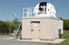 Celebrating 50 Years of Satellite Laser Ranging at NASA Goddard Space Flight CenterRelease Date: 08/28/2014In a field near Goddard 50 years ago this October, the first successful Satellite Laser Ranging (SLR) measurements were taken, ushering in a new era in the science of measuring the Earth.
 Read more
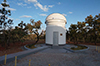 New ILRS tracking station at Brasilia, Brazil Release Date: 08/26/2014Data from new ILRS tracking station at Brasilia, Brazil (IERS DOMES Number: 48081S001; CDDIS SOD Number: 74072701), recently estabilished by the Russian space agency, has been validated by the ILRS Analysis Working Group.
![]() ITRF2013Release Date: 08/25/2014The ILRS Analysis Working Group (AWG) is finishing its contribution to the development of the next realization of the International Terrestrial Reference Frame (ITRF2013). Preliminary solution has been delivered to the IERS -- and final solution will be delivered by September.
ITRF2013Release Date: 08/25/2014The ILRS Analysis Working Group (AWG) is finishing its contribution to the development of the next realization of the International Terrestrial Reference Frame (ITRF2013). Preliminary solution has been delivered to the IERS -- and final solution will be delivered by September.
 DE430/DE431 ephemeridesRelease Date: 08/25/2014IE, the new planetary ephemeris solution, includes 45 years of data from Lunar Laser Ranging, including six years of data to the station at Apache Point. See attached paper.
ILRS supporting special IRNSS Tracking Campaign Release Date: 08/22/2014The ILRS is providing tracking support to the Indian Navigation Synchronous Satellites (IRNSS 1A and IRNSS 1B). Short duration campaigns are underway to seek near-simultaneous satellite laser ranging observations to help evaluate and calibrate the IRNSS orbits that are computed via other techniques. The ILRS stations that have participated in this campaign so far include: Changchun, Grasse, Graz, Herstmonceux, Matera, Yaragadee, Wettzell, and Zimmerwald.
The IRNSS satellites will provide navigation and positioning services to users in or near India, and ultimately will include a constellation of seven satellites.
![]() The third circular for the 19th International Workshop on Laser Ranging - Celebrating 50 years of SLR has been released.Release Date: 08/15/2014
The third circular for the 19th International Workshop on Laser Ranging - Celebrating 50 years of SLR has been released.Release Date: 08/15/2014![]() The second circular for the 19th International Workshop on Laser Ranging - Celebrating 50 years of SLR has been released.Release Date: 07/10/2014
The second circular for the 19th International Workshop on Laser Ranging - Celebrating 50 years of SLR has been released.Release Date: 07/10/2014![]() 19th International Workshop on Laser Ranging - Celebrating 50 years of SLR Release Date: 07/10/2014The National Aeronautics and Space Administration (NASA), along with the Smithsonian Astrophysical Observatory, and the International Laser Ranging Service (ILRS), are pleased to announce that the 19th International Workshop on Laser Ranging will be held in Annapolis Maryland during the week of October 27-31, 2014 at the Historic Inns of Annapolis.
19th International Workshop on Laser Ranging - Celebrating 50 years of SLR Release Date: 07/10/2014The National Aeronautics and Space Administration (NASA), along with the Smithsonian Astrophysical Observatory, and the International Laser Ranging Service (ILRS), are pleased to announce that the 19th International Workshop on Laser Ranging will be held in Annapolis Maryland during the week of October 27-31, 2014 at the Historic Inns of Annapolis.
October 31, 2014 will mark the 50th anniversary of the first successful SLR measurement, conducted at what is now the Goddard Geophysical and Astronomical Observatory (GGAO). The theme for this workshop, "Celebrating 50 Years of SLR: Remembering the Past and Planning for the Future" will allow us to look back on our many accomplishments and present plans for future advances in SLR technology and science.
Visit the workshop website for more information at:
http://ilrs.gsfc.nasa.gov/ilrw19/
![]() Proceedings from the 18th International Workshop on Laser RangingRelease Date: 03/25/2014
A website for the proceedings from the 18th International Workshop on Laser Ranging, held November 11-15, 2013 in Fujiyoshida Japan, has been created and is now available at http://cddis.gsfc.nasa.gov/lw18/.
Proceedings from the 18th International Workshop on Laser RangingRelease Date: 03/25/2014
A website for the proceedings from the 18th International Workshop on Laser Ranging, held November 11-15, 2013 in Fujiyoshida Japan, has been created and is now available at http://cddis.gsfc.nasa.gov/lw18/.
Because a hardcopy of the proceedings will not be published, all presentations, posters, and papers collected thus far have been made available through this website. Session summaries and ILRS splinter meeting notes are also linked on the website. The ILRS would like to acknowledge the significant, and thorough, efforts of the program committee in working with workshop participants to collect the documents that are now available through the website.
![]() New CDDIS website now availableRelease Date: 03/24/2014
The CDDIS staff is pleased to announce a new CDDIS website is now available. This redesign has allowed for a review of the organization of the site and its contents, ensuring information is current and useful. The new site also incorporates an improved navigation scheme. The website features access to applications enabling data discovery. One application, the SiteLogViewer, provides an enhanced display and comparison of the contents of ILRS and IDS site logs used by the services to document a site's system configuration; IGS and IVS site logs will be added to the utility in the near future.
New CDDIS website now availableRelease Date: 03/24/2014
The CDDIS staff is pleased to announce a new CDDIS website is now available. This redesign has allowed for a review of the organization of the site and its contents, ensuring information is current and useful. The new site also incorporates an improved navigation scheme. The website features access to applications enabling data discovery. One application, the SiteLogViewer, provides an enhanced display and comparison of the contents of ILRS and IDS site logs used by the services to document a site's system configuration; IGS and IVS site logs will be added to the utility in the near future.
Comments and suggestions are welcome and should be directed to the CDDIS support group through the "Contact Us" link. We would like to acknowledge the efforts of the website development team (Lori Tyahla, Nathan Pollack, and Carey Noll) for their contributions to the site content.
 Robert H. Goddard Award RecipientsRelease Date: 03/18/2014
Congratulations to the Space Geodesy Project Team for receiving the Robert H. Goddard Exceptional Achievement Group Award for Engineering. Additional congratulations goes to Jan McGarry, who received an individual Robert H. Goddard Award for Exceptional Engineering Achievement.
Network outage - Saturday, March 15, 2014 from 08:00 a.m. through 04:00 p.m. EDT (12:00-20:00 UTC)
Release Date: 03/07/2014
We have been notified that there will be a network outage (due to work on NASA's backbone equipment) on Saturday, March 15, 2014 from 08:00 a.m. through 04:00 p.m. EDT (12:00-20:00 UTC). Unfortunately, this activity will affect CDDIS operations. All connectivity to our servers will be off-line during that time. The outage will also affect access to the CDDIS, ILRS, LRO-LR, and Space Geodesy Project websites.
Robert H. Goddard Award RecipientsRelease Date: 03/18/2014
Congratulations to the Space Geodesy Project Team for receiving the Robert H. Goddard Exceptional Achievement Group Award for Engineering. Additional congratulations goes to Jan McGarry, who received an individual Robert H. Goddard Award for Exceptional Engineering Achievement.
Network outage - Saturday, March 15, 2014 from 08:00 a.m. through 04:00 p.m. EDT (12:00-20:00 UTC)
Release Date: 03/07/2014
We have been notified that there will be a network outage (due to work on NASA's backbone equipment) on Saturday, March 15, 2014 from 08:00 a.m. through 04:00 p.m. EDT (12:00-20:00 UTC). Unfortunately, this activity will affect CDDIS operations. All connectivity to our servers will be off-line during that time. The outage will also affect access to the CDDIS, ILRS, LRO-LR, and Space Geodesy Project websites.
While the CDDIS is unavailable, users can access one of the other data centers supporting the services:
We regret the inconvenience the outage will cause our user community.
![]() NASA Solar System Exploration Division Seminar Release Date: 01/29/2014
An SSED seminar will be held Monday, February 10 from 2 to 3 p.m. in Building 34, Room W150. The speaker, Dr. Zuheir Altamimi from IGN in France, will give a presentation entitled "The International Terrestrial Reference Frame: current status and future challenges."
NASA Solar System Exploration Division Seminar Release Date: 01/29/2014
An SSED seminar will be held Monday, February 10 from 2 to 3 p.m. in Building 34, Room W150. The speaker, Dr. Zuheir Altamimi from IGN in France, will give a presentation entitled "The International Terrestrial Reference Frame: current status and future challenges."
![]() 19th International Workshop on Laser Ranging AnnouncedRelease Date: 01/21/2014
We are pleased to announce that the 19th International Workshop on Laser Ranging will be hosted at NASA Goddard Space Flight Center, October 27-31 2014. Goddard has the unique opportunity to host this event at the birthplace of SLR: October 31, 2014 will mark the 50th anniversary of the first SLR measurement, conducted at what is now the Goddard Geophysical and Astronomical Observatory, GGAO. The theme for this workshop, "Celebrating 50 Years of SLR: Remembering the Past and Planning for the Future" will allow us to look back on our many accomplishments and present plans for future advances in the SLR technique. Furthermore, we solicit contributions from complementary space geodesy techniques and from activities that rely on the integration of SLR with other space geodesy techniques.
19th International Workshop on Laser Ranging AnnouncedRelease Date: 01/21/2014
We are pleased to announce that the 19th International Workshop on Laser Ranging will be hosted at NASA Goddard Space Flight Center, October 27-31 2014. Goddard has the unique opportunity to host this event at the birthplace of SLR: October 31, 2014 will mark the 50th anniversary of the first SLR measurement, conducted at what is now the Goddard Geophysical and Astronomical Observatory, GGAO. The theme for this workshop, "Celebrating 50 Years of SLR: Remembering the Past and Planning for the Future" will allow us to look back on our many accomplishments and present plans for future advances in the SLR technique. Furthermore, we solicit contributions from complementary space geodesy techniques and from activities that rely on the integration of SLR with other space geodesy techniques.
Please consider participation in this workshop and reserve the week to join us at NASA GSFC. More details will be provided shortly.
2013
NASA Earth and Space Science Fellowship (NESSF) Program
Release Date: 12/23/2013
NASA announces a call for graduate fellowship proposals to the NASA Earth and Space Science Fellowship (NESSF) program for the 2014-2015 academic year. This call for fellowship proposals solicits applications from accredited U.S. universities on behalf of individuals pursuing Master of Science (M.Sc.) or Doctoral (Ph.D.) degrees in Earth and space sciences, or related disciplines. The purpose of NESSF is to ensure continued training of a highly qualified workforce in disciplines needed to achieve NASA’s scientific goals. Awards resulting from the competitive selection will be made in the form of training grants to the respective universities.
The deadline for NEW applications is February 3, 2014, and the deadline for RENEWAL applications is March 17, 2014.
All proposals must be submitted in electronic format only through the NASA NSPIRES system. The advisor has an active role in the submission of the fellowship proposal. To use the NSPIRES system, the advisor, the student, and the university must all register. Extended instructions on how to submit an electronic proposal package are posted on the NESSF 14 solicitation index page listed above.
For further information contact Claire Macaulay, Program Administrator for NESSF Earth Science Research, Telephone: (202) 358-0151, E-mail: claire.i.macaulay@nasa.gov or Dolores Holland, Program Administrator for NESSF Heliophysics Research, Planetary Science Research, and Astrophysics Research, Telephone: (202) 358-0734, E-mail: hq-nessf-Space@nasa.gov.
Holiday Greetings from the ILRS Governing Board and Central Bureau
Release Date: 12/19/2013
Author: Carey Noll/ILRS CB
The Governing Board and the Central Bureau of the International
Laser Ranging Service would like to extend our sincere thanks to
you for your participation in service activities during 2013.
The ILRS has had another very busy year, with the launch of new
missions requiring laser ranging support, new products under
development, stations undergoing upgrade and improvement,
sponsoring the very successful 18th International Workshop on
Laser Ranging last month in Japan, and new challenges and
opportunities opening up for our community through GGOS and
other international activities. We thank you for your continued
support of the ILRS and its mission.
We would also like to send our best wishes for a wonderful
holiday season to all of our ILRS colleagues, staff members,
and their families. We wish you a healthy and happy New
Year.
We look forward to continued cooperation and success in 2014!
Pippo Bianco, Mike Pearlman, and Carey Noll
 Swarm launch Release Date: 11/22/2013
Swarm was launched today at 12:02 UTC from Plesetsk Russia.
Swarm launch Release Date: 11/22/2013
Swarm was launched today at 12:02 UTC from Plesetsk Russia.
Read more
![]() Dr. Giuseppe Bianco elected Chair of the ILRS Governing Board
Release Date: 11/15/2013
On Thursday, November 14, the newly elected ILRS Governing Board held its meeting during the 18th International Workshop on Laser Ranging in Fujiyoshida Japan. Dr. Giuseppe Bianco was elected to serve as the Chair of the ILRS Governing Board during the 2013-2015 term. Congratulations to Pippo!
Dr. Giuseppe Bianco elected Chair of the ILRS Governing Board
Release Date: 11/15/2013
On Thursday, November 14, the newly elected ILRS Governing Board held its meeting during the 18th International Workshop on Laser Ranging in Fujiyoshida Japan. Dr. Giuseppe Bianco was elected to serve as the Chair of the ILRS Governing Board during the 2013-2015 term. Congratulations to Pippo!
 Lunar Laser Ranging to Lunokhod reflectors
Release Date: 11/12/2013
A recent paper by V. Nasennik questions the degradation of performance of LLR returns from the Lunokhod reflectors. Tom Murphy/UCSD, using data from the APOLLO lunar laser ranging station, addresses Nasennik's results in his analysis.
Lunar Laser Ranging to Lunokhod reflectors
Release Date: 11/12/2013
A recent paper by V. Nasennik questions the degradation of performance of LLR returns from the Lunokhod reflectors. Tom Murphy/UCSD, using data from the APOLLO lunar laser ranging station, addresses Nasennik's results in his analysis.
![]() ILRS Governing Board Election Results
Release Date: 11/12/2013
The ILRS Central Bureau recently completed election of the ILRS Governing Board for the 2013-2015 term. The new board is:
ILRS Governing Board Election Results
Release Date: 11/12/2013
The ILRS Central Bureau recently completed election of the ILRS Governing Board for the 2013-2015 term. The new board is:
Ex-Officio Members:
Michael Pearlman (Director, Central Bureau)
Carey Noll (Secretary, Central Bureau)
Tonie Van Dam (President of IAG Commission 1)
Appointed Members:
Bob Schutz (IERS representative to ILRS)
Giuseppe Bianco (Eurolas Network Rep., Chair)
Georg Kirchner (Eurolas Network Rep.)
Wu Bin (WPLTN Network Rep.)
Toshi Otsubo (WPLTN Network Rep.)
David McCormick (NASA Network Rep.)
Jan McGarry (NASA Network Rep.)
Elected Members:
Vincenzia Luceri (Analysis Center Rep.)
Erricos Pavlis (Analysis Center Rep.)
Horst Mueller (Data Center Rep.)
Juergen Mueller (LLR Rep.)
Matt Wilkinson (At Large Rep.)
Ulrich Schreiber (At Large Rep.)
Giuseppe Bianco was elected as chair at the Board meeting on November 14, 2013.
 GOCE re-enters the Earth's atmosphere
Release Date: 11/11/2013
On November 11, 2013 ESA's GOCE satellite reentered Earth's atmosphere, disintegrating in the upper atmosphere. The satellite was launched in March 2009 to map variations in the Earth's gravity field. More information on the mission's end can be found on ESA's website: http://www.esa.int/Our_Activities/Observing_the_Earth/GOCE/GOCE_gives_in_to_gravity.
GOCE re-enters the Earth's atmosphere
Release Date: 11/11/2013
On November 11, 2013 ESA's GOCE satellite reentered Earth's atmosphere, disintegrating in the upper atmosphere. The satellite was launched in March 2009 to map variations in the Earth's gravity field. More information on the mission's end can be found on ESA's website: http://www.esa.int/Our_Activities/Observing_the_Earth/GOCE/GOCE_gives_in_to_gravity.
![]() Changes to System Configuration Documentation
Release Date: 10/28/2013
Over the last year, the ILRS CB has developed new procedures for tracking changes to the ILRS ranging stations. It has approved the use of the station change history log which replaces both the SCH and SCI files. Detailed documentation on the new procedures can be found on the ILRS web site at: http://ilrs.gsfc.nasa.gov/network/site_procedures/configuration_files.html
Changes to System Configuration Documentation
Release Date: 10/28/2013
Over the last year, the ILRS CB has developed new procedures for tracking changes to the ILRS ranging stations. It has approved the use of the station change history log which replaces both the SCH and SCI files. Detailed documentation on the new procedures can be found on the ILRS web site at: http://ilrs.gsfc.nasa.gov/network/site_procedures/configuration_files.html
 Release Date: 10/25/2013
The 2013 3rd quarter global report card has been published.
Release Date: 10/25/2013
The 2013 3rd quarter global report card has been published.
 NASA and US Air Force reach agreement
Release Date: 09/06/2013
An agreement was reached between NASA and the US Air Force concerning the hosting of NASA supplied laser retroreflector arrays onto future GPS satellites. This agreement gives NASA the formal approval to move forward with the GPS Laser Retroreflector Array (GPS-LRA) Project that will supply the retroreflectors for the GPS-III satellites starting with SV-9.
NASA and US Air Force reach agreement
Release Date: 09/06/2013
An agreement was reached between NASA and the US Air Force concerning the hosting of NASA supplied laser retroreflector arrays onto future GPS satellites. This agreement gives NASA the formal approval to move forward with the GPS Laser Retroreflector Array (GPS-LRA) Project that will supply the retroreflectors for the GPS-III satellites starting with SV-9.
Read more
 Release Date: 07/30/2013
The ILRS Central Bureau has developed an application for the enhanced display and comparison of the contents of the ILRS site logs. Users should select either to view a complete site log or view one section for multiple site logs. Comments should be directed to the ILRS web team (ilrs-web@lists.nasa.gov).
Release Date: 07/30/2013
The ILRS Central Bureau has developed an application for the enhanced display and comparison of the contents of the ILRS site logs. Users should select either to view a complete site log or view one section for multiple site logs. Comments should be directed to the ILRS web team (ilrs-web@lists.nasa.gov).
![]() The second announcement of the next International Workshop
on Laser Ranging has been issued.Release Date: 07/19/2013
Registration and abstract submission for the 18th International Workshop on Laser Ranging are now open. Participants are all requested to fill out these forms by 20 September. The overall schedule in the workshop week, including the opening lectures on Monday morning by Dr J J Degnan and Dr M Fujita, can be found on the workshop website.
The second announcement of the next International Workshop
on Laser Ranging has been issued.Release Date: 07/19/2013
Registration and abstract submission for the 18th International Workshop on Laser Ranging are now open. Participants are all requested to fill out these forms by 20 September. The overall schedule in the workshop week, including the opening lectures on Monday morning by Dr J J Degnan and Dr M Fujita, can be found on the workshop website.
Note that the number of hotel rooms, especially single rooms at the reduced price, are limited at the venue (Highland Resort Hotel). Early registration is strongly recommended. Participants who need a visa for the trip to Japan also have to complete the registration form as soon as possible, by clearly stating it in the "Special Request" textbox.
Authors are requested to complete the abstract submission form per presentation. Submitters must choose the preferred presentation style (oral or poster), and one of the following six themes closest to the presentation.
Science Products - Earth/Lunar/Planetary Science, Geodesy, Altimetry, IERS, Gravity, Refraction
SLR Technologies - kHz ranging, Two-color ranging, System Software Development, Timing Devices, Adaptive Optics, Detectors, Telescopes
Operation Aspects - New SLR Stations, Activities of SLR Stations, Calibration, Local Tie, Network, Automation, Operating Software, Safety
Space Mission - Satellite Projects, Reflector and Reflector Array, Satellite Orientation, Future Plans
Synergy - Time Transfer, Optical Communications, Space Debris, Multi-technique Combination and GGOS, Various Applications
Miscellaneous - New Challenges, Embryonic Research Topics, Education and Outreach
After gathering the submitted abstracts, the Program Committee intends to re-organize them into actual 10-15 sessions.
 Release Date: 07/19/2013
The 2013 2nd quarter global report card has been published.
Release Date: 07/19/2013
The 2013 2nd quarter global report card has been published.
 California's Chariot Fire affects Monument Peak operationsRelease Date: 07/15/2013
The Chariot Fire in southern California has required the shutdown of operations at NASA's MOBLAS-4 SLR station in Monument Peak. The crew safely evacuated on Monday July 8th and returned July 12th. The station has safely returned to operations. The fire reached within a mile of the station. (Photo courtesy of wildfiretoday.com)
California's Chariot Fire affects Monument Peak operationsRelease Date: 07/15/2013
The Chariot Fire in southern California has required the shutdown of operations at NASA's MOBLAS-4 SLR station in Monument Peak. The crew safely evacuated on Monday July 8th and returned July 12th. The station has safely returned to operations. The fire reached within a mile of the station. (Photo courtesy of wildfiretoday.com)
Read more
The first satellite, IRNSS-1A, of the Indian Regional Navigation Satellite System (IRNSS) successfully launchedRelease Date: 07/02/2013
The first satellite, IRNSS-1A, of the Indian Regional Navigation Satellite System (IRNSS) was successfully launched on July 1, 2013 at 18:13 UTC from the spaceport of Sriharikota. The IRNSS-1A satellite is the first of seven satellites that will make up the IRNSS.
Jason-1 mission endsRelease Date: 07/01/2013
On June 21, 2013 contact with the Jason-1 spacecraft was lost. Although the satellite appeared to still be flying in a normal nadir pointing attitude, no communication could be established with the spacecraft. The spacecraft engineers and control teams at CNES and JPL believe that a failure occurred in the telecommunications system of the spacecraft. Since the spacecraft was already operating on the second telecommunications channel after a previous anomaly, there is no remaining redundancy. All efforts to reboot and communicate with the spacecraft have been unsuccessful. Therefore, the mission was declared ended on July 1, 2013 after 11.5 years in operation.
 Presentations from the second IERS workshopRelease Date: 06/25/2013
Presentations from the second IERS workshop on local ties, tie vectors, co-location sites and their use in the combination of space geodetic solutions held on May 21 – 22 at University Paris-Diderot are now available at https://geo.science.hit-u.ac.jp/lw18/
Presentations from the second IERS workshopRelease Date: 06/25/2013
Presentations from the second IERS workshop on local ties, tie vectors, co-location sites and their use in the combination of space geodetic solutions held on May 21 – 22 at University Paris-Diderot are now available at https://geo.science.hit-u.ac.jp/lw18/
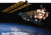 ILRS to track Envisat to help improve the quality of the orbitRelease Date: 05/30/2013
ESA has asked the ILRS to track Envisat to help improve the quality of the orbit and better predict the satellite trajectory and tumbling motion. Any SLR data acquired by the ILRS network will help improve the orbit.
ILRS to track Envisat to help improve the quality of the orbitRelease Date: 05/30/2013
ESA has asked the ILRS to track Envisat to help improve the quality of the orbit and better predict the satellite trajectory and tumbling motion. Any SLR data acquired by the ILRS network will help improve the orbit.
 Space Geodesy SLR Request for Information ReleasedRelease Date: 05/02/2013
The National Aeronautics and Space Administration (NASA) Space Geodesy Project (SGP) is soliciting information to improve its understanding of the interest, capabilities, and Rough Order of Magnitude (ROM) estimates for planning the construction, deployment, and operation of the next generation Space Geodesy (SG) Satellite Laser Ranging (SLR) Stations that will be part of a new NASA’s Space Geodetic Network (SGN). NASA is considering the construction of up to ten new SLR stations that will contribute to the larger Global Geodetic Observing System (GGOS).
Space Geodesy SLR Request for Information ReleasedRelease Date: 05/02/2013
The National Aeronautics and Space Administration (NASA) Space Geodesy Project (SGP) is soliciting information to improve its understanding of the interest, capabilities, and Rough Order of Magnitude (ROM) estimates for planning the construction, deployment, and operation of the next generation Space Geodesy (SG) Satellite Laser Ranging (SLR) Stations that will be part of a new NASA’s Space Geodetic Network (SGN). NASA is considering the construction of up to ten new SLR stations that will contribute to the larger Global Geodetic Observing System (GGOS).
Read more
![]() The first announcement of the next International Workshop
on Laser Ranging has been issued.Release Date: 04/23/2013
The 18th International Workshop on Laser Ranging is organized
so that worldwide scientists and engineers in this and related
fields can exchange their views, share opinions on the on-going
problems, and navigate the future.
The first announcement of the next International Workshop
on Laser Ranging has been issued.Release Date: 04/23/2013
The 18th International Workshop on Laser Ranging is organized
so that worldwide scientists and engineers in this and related
fields can exchange their views, share opinions on the on-going
problems, and navigate the future.
The theme of this year's workshop is "Pursuing Ultimate Accuracy & Creating New Synergies." In addition to the important topic of maximizing accuracy,
this workshop is intended to enhance the potential of laser
ranging with the inclusion of activities in relevant fields.
The workshop will take place November 11-15, 2013 at the Highland Resort Hotel, Fujiyoshida, Japan. More information is available on the workshop website: http://geo.science.hit-u.ac.jp/lw18/.
Please consider your participation and reserve the week now.
The procedures for the registration (including hotel booking) and
the abstract submission will be announced in July.
Please contact the local organizing committee (Z-LW18@jaxa.jp) for additional information.
 Release Date: 04/15/2013
The 2013 1st quarter report card has been published.
Release Date: 04/15/2013
The 2013 1st quarter report card has been published.
 BLITS satellite tracking endsRelease Date: 04/19/2013
BLITS mission contacts from the Scientific Research Institute for Precision Instrument Engineering in Moscow have asked the ILRS to end tracking on the satellite. They believe the satellite collided with a small, uncatalogued fragment of space debris. They are planning to report on the satellite and event at the 18th International Workshop on Laser Ranging in November 2013 in Japan. The mission scientists would like to thank the ILRS stations for their active support of BLITS laser ranging. (N. Parkhomenko/Scientific Research Institute for Precision Instrument Engineering)
BLITS satellite tracking endsRelease Date: 04/19/2013
BLITS mission contacts from the Scientific Research Institute for Precision Instrument Engineering in Moscow have asked the ILRS to end tracking on the satellite. They believe the satellite collided with a small, uncatalogued fragment of space debris. They are planning to report on the satellite and event at the 18th International Workshop on Laser Ranging in November 2013 in Japan. The mission scientists would like to thank the ILRS stations for their active support of BLITS laser ranging. (N. Parkhomenko/Scientific Research Institute for Precision Instrument Engineering)
 The Passing of Our Friend, Mark DavisRelease Date: 04/19/2013
It is with great sorrow that we inform the ILRS community about the passing of our colleague, Mark Davis, on April 13, 2013.
The Passing of Our Friend, Mark DavisRelease Date: 04/19/2013
It is with great sorrow that we inform the ILRS community about the passing of our colleague, Mark Davis, on April 13, 2013.
For the past 15 months, Mark fought valiantly against pancreatic cancer. Mark had 18 rounds of chemotherapy in total, surprising even his doctors, as he battled with this very aggressive form of cancer. Mark, true to his nature, remained positive and determined throughout his entire ordeal. He never lost his disarming smile, wit, and desire to help so many in the SLR community.
Mark’s accomplishments to the SLR community are too numerous to name, but he touched every aspect of the technique from the hardware and software of the ground stations, to the survey methods, to the retroreflectors, to the SLR data orbital analysis and beyond for both the NASA and NRL programs. He also lead and supported many other projects during his 21 years as part of our SLR family. He will be greatly missed by his friends and colleagues.
 in Calern, France") Grasse station tracks Lunokhod-1 retroreflector Release Date: 04/05/2013
On Tuesday night (2013.03.19T19:27), the LLR team of the MéO station (GRSM) in Calern, France, obtained a return signal from the Lunokhod-1 (Luna-17) reflector for the first time since the start of lunar laser ranging observations in the early 1980s. During three nights, before the reflector entered in the light, 214 echoes in 11 normal points were obtained. These results were obtained using the new instrumental configuration of the MéO station including a semiconductor mode locked Nd:YAG laser and a direct drive motorization. The relatively bad weather conditions didn't allow us to have a good determination of the efficiency of the Lunokhod-1 reflector, but the results seem in agreement with results presented by Tom Murphy in 2010. Using the MéO data, our colleagues from the Paris Observatory, modifying the rectangular coordinates of Lunokhod-1, aligned the MéO data with the APOLLO data, and along the way, reduced the dispersion of APOLLO data. Continuous ranging will be done on this reflector by the MéO station. The position on the Moon, the efficiency, and the accuracy should be taken into account to increase its priority into the ILRS Lunar Tracking Priorities table.
Grasse station tracks Lunokhod-1 retroreflector Release Date: 04/05/2013
On Tuesday night (2013.03.19T19:27), the LLR team of the MéO station (GRSM) in Calern, France, obtained a return signal from the Lunokhod-1 (Luna-17) reflector for the first time since the start of lunar laser ranging observations in the early 1980s. During three nights, before the reflector entered in the light, 214 echoes in 11 normal points were obtained. These results were obtained using the new instrumental configuration of the MéO station including a semiconductor mode locked Nd:YAG laser and a direct drive motorization. The relatively bad weather conditions didn't allow us to have a good determination of the efficiency of the Lunokhod-1 reflector, but the results seem in agreement with results presented by Tom Murphy in 2010. Using the MéO data, our colleagues from the Paris Observatory, modifying the rectangular coordinates of Lunokhod-1, aligned the MéO data with the APOLLO data, and along the way, reduced the dispersion of APOLLO data. Continuous ranging will be done on this reflector by the MéO station. The position on the Moon, the efficiency, and the accuracy should be taken into account to increase its priority into the ILRS Lunar Tracking Priorities table.
") The NSGF is now providing a daily satellite prediction comparison serviceRelease Date: 04/03/2013
The NERC Space Geodesy Facility (NSGF) is now providing a daily satellite prediction comparison service at http://sgf.rgo.ac.uk/qualityc/cpf_qc.html. The group has also updated the dynamic satellite priority service (http://sgf.rgo.ac.uk/operations/dynamicpriority.html).
The NSGF is now providing a daily satellite prediction comparison serviceRelease Date: 04/03/2013
The NERC Space Geodesy Facility (NSGF) is now providing a daily satellite prediction comparison service at http://sgf.rgo.ac.uk/qualityc/cpf_qc.html. The group has also updated the dynamic satellite priority service (http://sgf.rgo.ac.uk/operations/dynamicpriority.html).
 World Data System (WDS) Logo") The ILRS has been accepted as a network member of the International Council for Science (ICSU) World Data System (WDS). Release Date: 04/02/2013
The ILRS has recently been accepted as a network member of the International Council for Science (ICSU) World Data System (WDS). The WDS strives to enable open and long-term access to multidisciplinary scientific data, data services, products and information. The WDS works to ensure long-term stewardship of data and data services to a global scientific user community. The ILRS is a network member of the WDS, representing its two data centers and coordinating their activities within the WDS.
The ILRS has been accepted as a network member of the International Council for Science (ICSU) World Data System (WDS). Release Date: 04/02/2013
The ILRS has recently been accepted as a network member of the International Council for Science (ICSU) World Data System (WDS). The WDS strives to enable open and long-term access to multidisciplinary scientific data, data services, products and information. The WDS works to ensure long-term stewardship of data and data services to a global scientific user community. The ILRS is a network member of the WDS, representing its two data centers and coordinating their activities within the WDS.
 The ILRS Governing Board approves tracking of the STPSat-2 mission Release Date: 04/01/2013
The ILRS Governing Board has approved the tracking of the U.S. Air Force Research Laboratory (AFRL) STPSat-2 mission to study hollow retroreflector technology.
The ILRS Governing Board approves tracking of the STPSat-2 mission Release Date: 04/01/2013
The ILRS Governing Board has approved the tracking of the U.S. Air Force Research Laboratory (AFRL) STPSat-2 mission to study hollow retroreflector technology.
 ITRF2013 Call for Participation Release Date: 03/28/2013
Please be informed that the ITRF2013 Call for Participation is now released and could be retrieved at the ITRF web site, using the following link:
ITRF2013 Call for Participation Release Date: 03/28/2013
Please be informed that the ITRF2013 Call for Participation is now released and could be retrieved at the ITRF web site, using the following link:
http://itrf.ign.fr/ITRF_solutions/2013/CFP-ITRF2013-27-03-2013.pdf
In addition to the solicited global solutions from the four
space geodesy techniques (to be provided by the Technique
Services), we also solicit and encourage the owners of
co-location sites to consider conducting new local tie surveys
using the most up to date survey methods. Indeed, the local
ties available at the ITRS Center for a certain number of
co-location sites are now old by 10 to 20 years. In this
respect, we would greatly appreciate the contribution of the
national mapping and space agencies investing and operating
co-location sites, which constitute the main foundation of the
ITRF. More details regarding the local tie survey are available
in the ITRF2013 CfP.
 Satellite Laser Ranging (SLR) and Pi Release Date: 03/14/2013
Satellite Laser Ranging (SLR) and Pi? Check out this podcast to learn how SLR is using pi to determine the effective reflective surface area of retroreflectors!
Satellite Laser Ranging (SLR) and Pi Release Date: 03/14/2013
Satellite Laser Ranging (SLR) and Pi? Check out this podcast to learn how SLR is using pi to determine the effective reflective surface area of retroreflectors!
 MOBLAS-4 SLR station in Monument Peak, CA experiences a 4.7 magnitude earthquake Release Date: 03/12/2013
The MOBLAS-4 SLR station in Monument Peak, CA experienced a 4.7 magnitude earthquake during routine operations. The earthquake was 20 km ESE of Anza, CA and is summarized at the USGS Earthquake Hazards Program website. The event was felt at the site but no damage occurred to the SLR system.
The Russian BLITS nanosatellite has collided with a piece of space debris Release Date: 02/28/2013
On January 22, 2013, a collision happened between the BLITS passive laser nanosatellite and a space debris fragment. As a result, an abrupt change occurred of the BLITS orbit parameters (a decrease of the orbiting period). Besides this, as can be seen from the Altay SLR station photometrical observation results, the BLITS spin period has changed from 5.6 sec before collision to 2.1 sec after collision.
MOBLAS-4 SLR station in Monument Peak, CA experiences a 4.7 magnitude earthquake Release Date: 03/12/2013
The MOBLAS-4 SLR station in Monument Peak, CA experienced a 4.7 magnitude earthquake during routine operations. The earthquake was 20 km ESE of Anza, CA and is summarized at the USGS Earthquake Hazards Program website. The event was felt at the site but no damage occurred to the SLR system.
The Russian BLITS nanosatellite has collided with a piece of space debris Release Date: 02/28/2013
On January 22, 2013, a collision happened between the BLITS passive laser nanosatellite and a space debris fragment. As a result, an abrupt change occurred of the BLITS orbit parameters (a decrease of the orbiting period). Besides this, as can be seen from the Altay SLR station photometrical observation results, the BLITS spin period has changed from 5.6 sec before collision to 2.1 sec after collision.
Currently, additional observations are made to determine the reasonability of continuing the BLITS observation campaign.
 SARAL satellite successfully launched Release Date: 02/26/2013
The SARAL satellite was successfully launched from the Satish Dhawan Spaceport in India on February 25, 2013 at 12:31 UTC. SARAL (Satellite with ARgos and ALtika) is a cooperative mission between CNES and the Indian Space Research Organization (ISRO). The mission is complemenatary to Jason-2 and will provide observations of ice, rain, coastal zones, and wave heights. SLR will play an important role by providing strong tracking information to complement DORIS and by providing a unique and unambiguous verification of the absolute radial orbit accuracy.
SARAL satellite successfully launched Release Date: 02/26/2013
The SARAL satellite was successfully launched from the Satish Dhawan Spaceport in India on February 25, 2013 at 12:31 UTC. SARAL (Satellite with ARgos and ALtika) is a cooperative mission between CNES and the Indian Space Research Organization (ISRO). The mission is complemenatary to Jason-2 and will provide observations of ice, rain, coastal zones, and wave heights. SLR will play an important role by providing strong tracking information to complement DORIS and by providing a unique and unambiguous verification of the absolute radial orbit accuracy.
 International Laser Ranging Service 2009-2010 Report Available Online
Release Date: 01/31/2013
The ILRS is very pleased to announce that the International Laser Ranging Service 2009-2010 Report is in final preparations for printing. Hardcopies will be shipped to all ILRS associates and correspondents in the coming weeks. In the meantime, the document is available online at:
International Laser Ranging Service 2009-2010 Report Available Online
Release Date: 01/31/2013
The ILRS is very pleased to announce that the International Laser Ranging Service 2009-2010 Report is in final preparations for printing. Hardcopies will be shipped to all ILRS associates and correspondents in the coming weeks. In the meantime, the document is available online at:
http://ilrs.gsfc.nasa.gov/about/reports/annualrpts/ilrsreport_2009.html
 NASA Beams Mona Lisa to Lunar Reconnaissance Orbiter at the Moon
Release Date: 01/28/2013
Laser communication and ranging experiments were successfully conducted from the satellite laser ranging (SLR) station at NASA Goddard Space Flight Center (GSFC) to the Lunar Reconnaissance Orbiter (LRO) in lunar orbit. The experiments used 4096-ary pulse position modulation (PPM) for the laser pulses during one-way LRO Laser Ranging (LR) operations. Reed-Solomon forward error correction codes were used to correct the PPM symbol errors due to atmosphere turbulence and pointing jitter. The signal fading was measured and the results were compared to the model.
NASA Beams Mona Lisa to Lunar Reconnaissance Orbiter at the Moon
Release Date: 01/28/2013
Laser communication and ranging experiments were successfully conducted from the satellite laser ranging (SLR) station at NASA Goddard Space Flight Center (GSFC) to the Lunar Reconnaissance Orbiter (LRO) in lunar orbit. The experiments used 4096-ary pulse position modulation (PPM) for the laser pulses during one-way LRO Laser Ranging (LR) operations. Reed-Solomon forward error correction codes were used to correct the PPM symbol errors due to atmosphere turbulence and pointing jitter. The signal fading was measured and the results were compared to the model.
Optics Express
 SWARM Launch Delayed
Release Date: 01/25/2013
SpaceNews reports that "the launch of the three European Space Agency (ESA) Swarm satellites designed to study the Earth's magnetic field has been delayed again, to mid-year at the earliest, due to an inquiry into the Jan. 15 malfunction of the Breeze-KM upper stage of the Rockot vehicle, the rocket's commercial service provider said Jan. 24."
SWARM Launch Delayed
Release Date: 01/25/2013
SpaceNews reports that "the launch of the three European Space Agency (ESA) Swarm satellites designed to study the Earth's magnetic field has been delayed again, to mid-year at the earliest, due to an inquiry into the Jan. 15 malfunction of the Breeze-KM upper stage of the Rockot vehicle, the rocket's commercial service provider said Jan. 24."
 2012 Leap Second Survey Results
Release Date: 01/24/2013
As many of you are aware, the ILRS handling of the leap second on June 30/July 1, 2012 could have been smoother. The ILRS CB has been learning the magnitude of the problems and working on solutions. The result is the 2012 Leap Second Survey Results document, which outlines specific steps to make the next leap second transition smoother. Most of these involve proper implementation of the CPF leap second flag by predictions providers and stations.
2012 Leap Second Survey Results
Release Date: 01/24/2013
As many of you are aware, the ILRS handling of the leap second on June 30/July 1, 2012 could have been smoother. The ILRS CB has been learning the magnitude of the problems and working on solutions. The result is the 2012 Leap Second Survey Results document, which outlines specific steps to make the next leap second transition smoother. Most of these involve proper implementation of the CPF leap second flag by predictions providers and stations.
We look forward of the participation of the ILRS stations, prediction providers, and analysts to make the next leap second insertion
problem-free!
 Release Date: 01/04/2013
The 2012 4th quarter report card has been published.
Release Date: 01/04/2013
The 2012 4th quarter report card has been published.
2012
 Release Date: 11/20/2012
The ILRS held an International Technical Laser Workshop 2012 (ITLW-12) on "Satellite, Lunar and Planetary Laser Ranging: characterizing the space segment" at the Frascati National Laboratories of the INFN-LNF, Frascati (Rome), Italy on November 5-9, 2012, in conjunction with a one-day Workshop on "ASI-INFN ETRUSCO-2 Project of Technological Development and Test of SLR Payloads for GNSS Satellites". The meeting focused on the laser ranging space segment including retroreflector arrays for Earth orbiting satellites and the moon, with special attention to the expanding role of ranging to GNSS and geosynchronous satellites. Topics also included receivers in space for time transfer experiments (T2L2), one-way ranging to lunar orbiters (LRO) and interplanetary spacecraft (MLA, MOLA), and data relay systems.
Release Date: 11/15/2012
On November 15, 2012, Galileo-103 and Galilieo-104 were added to the ILRS priority list.
Release Date: 11/20/2012
The ILRS held an International Technical Laser Workshop 2012 (ITLW-12) on "Satellite, Lunar and Planetary Laser Ranging: characterizing the space segment" at the Frascati National Laboratories of the INFN-LNF, Frascati (Rome), Italy on November 5-9, 2012, in conjunction with a one-day Workshop on "ASI-INFN ETRUSCO-2 Project of Technological Development and Test of SLR Payloads for GNSS Satellites". The meeting focused on the laser ranging space segment including retroreflector arrays for Earth orbiting satellites and the moon, with special attention to the expanding role of ranging to GNSS and geosynchronous satellites. Topics also included receivers in space for time transfer experiments (T2L2), one-way ranging to lunar orbiters (LRO) and interplanetary spacecraft (MLA, MOLA), and data relay systems.
Release Date: 11/15/2012
On November 15, 2012, Galileo-103 and Galilieo-104 were added to the ILRS priority list.
 Release Date: 10/23/2012
The 2012 3rd quarter report card has been published.
Release Date: 10/23/2012
The 2012 3rd quarter report card has been published.
 Release Date: 10/23/2012
On October 23, 2012 GLONASS-129 replaced GLONASS-127 in the ILRS priority list.
Galileo IOV launched
Release Date: 10/12/2012
The Soyuz ST-B launcher carrying the next two Galileo In-Orbit Validation satellites took off as scheduled on 18:15:00 GMT (20:15:00 CEST). Deployment of its twin satellites into orbit is scheduled for three hours 44 minutes after take-off. Read more.
Release Date: 10/23/2012
On October 23, 2012 GLONASS-129 replaced GLONASS-127 in the ILRS priority list.
Galileo IOV launched
Release Date: 10/12/2012
The Soyuz ST-B launcher carrying the next two Galileo In-Orbit Validation satellites took off as scheduled on 18:15:00 GMT (20:15:00 CEST). Deployment of its twin satellites into orbit is scheduled for three hours 44 minutes after take-off. Read more.
![]() New ILRS web site released
Release Date: 10/09/2012
The ILRS Central Bureau is pleased to announce the implementation of a new design for the ILRS website, http://ilrs.gsfc.nasa.gov. The redesign process has allowed for a review of the organization of the site and its contents, ensuring information is current and useful. Comments and suggestions are welcome and should be directed to the ILRS web team at ilrs-web@lists.nasa.gov. We would like to acknowledge the efforts of the website development team (Lisa Lee, Mark Torrence, Lori Tyahla, and Carey Noll) as well as members of the Central Bureau and the ILRS community for their contributions to the site content.
Release Date: 09/24/2012
On September 24, 2012 GLONASS-127 replaced GLONASS-115 in the ILRS priority list.
New ILRS web site released
Release Date: 10/09/2012
The ILRS Central Bureau is pleased to announce the implementation of a new design for the ILRS website, http://ilrs.gsfc.nasa.gov. The redesign process has allowed for a review of the organization of the site and its contents, ensuring information is current and useful. Comments and suggestions are welcome and should be directed to the ILRS web team at ilrs-web@lists.nasa.gov. We would like to acknowledge the efforts of the website development team (Lisa Lee, Mark Torrence, Lori Tyahla, and Carey Noll) as well as members of the Central Bureau and the ILRS community for their contributions to the site content.
Release Date: 09/24/2012
On September 24, 2012 GLONASS-127 replaced GLONASS-115 in the ILRS priority list.
 Release Date: 09/11/2012
The second circular for the next ILRS Technical Workshop "Satellite, Lunar and Planetary Laser Ranging: Characterizing the Space Segment" has been issued. The workshop will be held November 05-09, 2012 at the Frascati National Laboratories of the INFN-LNF in Frascati Italy in conjunction with a one-day Workshop on "ASI-INFN ETRUSCO-2 Project of Technological Development on SLR Payloads for GNSS". This is the first time we have dedicated a full workshop to the space segment and new concepts, new designs, and new laboratory testing capabilities give us exciting opportunities to address our evolving requirements.
Release Date: 09/11/2012
The second circular for the next ILRS Technical Workshop "Satellite, Lunar and Planetary Laser Ranging: Characterizing the Space Segment" has been issued. The workshop will be held November 05-09, 2012 at the Frascati National Laboratories of the INFN-LNF in Frascati Italy in conjunction with a one-day Workshop on "ASI-INFN ETRUSCO-2 Project of Technological Development on SLR Payloads for GNSS". This is the first time we have dedicated a full workshop to the space segment and new concepts, new designs, and new laboratory testing capabilities give us exciting opportunities to address our evolving requirements.
 Release Date: 09/05/2012
The initial tracking campaign for ZY-3 ended on September 05, 2012. The mission will inform the ILRS of the next tracking campaign request.
Release Date: 09/05/2012
The initial tracking campaign for ZY-3 ended on September 05, 2012. The mission will inform the ILRS of the next tracking campaign request.
 Release Date: 08/06/2012
On August 4, 2012, our colleague Steve Klosko passed away surrounded by family and loved ones. We will greatly miss his immense contributions to the field of satellite laser ranging, space geodesy, and other scientific research areas.
Release Date: 08/06/2012
On August 4, 2012, our colleague Steve Klosko passed away surrounded by family and loved ones. We will greatly miss his immense contributions to the field of satellite laser ranging, space geodesy, and other scientific research areas.
 Release Date: 07/15/2012
The 2012 2nd quarter report card has been published.
Release Date: 07/15/2012
The 2012 2nd quarter report card has been published.
 Release Date: 07/05/2012
Three additional COMPASS satellites (COMPASS-M3, COMPASS-I3, and COMPASS-G1) have been approved for ILRS tracking.
ILRS Technical Workshop
Release Date: 06/12/2012
The first announcement for the next ILRS Technical Workshop "Satellite, Lunar and Planetary Laser Ranging: Characterizing the Space Segment" has been issued. The workshop will be held November 05-09, 2012 at the Frascati National Laboratories of the INFN-LNF in Frascati Italy in conjunction with a one-day Workshop on "ASI-INFN ETRUSCO-2 Project of Technological Development on SLR Payloads for GNSS". This is the first time we have dedicated a full workshop to the space segment and new concepts, new designs, and new laboratory testing capabilities give us exciting opportunities to address our evolving requirements.
Release Date: 07/05/2012
Three additional COMPASS satellites (COMPASS-M3, COMPASS-I3, and COMPASS-G1) have been approved for ILRS tracking.
ILRS Technical Workshop
Release Date: 06/12/2012
The first announcement for the next ILRS Technical Workshop "Satellite, Lunar and Planetary Laser Ranging: Characterizing the Space Segment" has been issued. The workshop will be held November 05-09, 2012 at the Frascati National Laboratories of the INFN-LNF in Frascati Italy in conjunction with a one-day Workshop on "ASI-INFN ETRUSCO-2 Project of Technological Development on SLR Payloads for GNSS". This is the first time we have dedicated a full workshop to the space segment and new concepts, new designs, and new laboratory testing capabilities give us exciting opportunities to address our evolving requirements.
 WPLTN-2012 Technical Workshop
Release Date: 05/03/2012
The first announcement for WPLTN-2012 Technical Workshop "One-way and two-way SLR for GNSS co-located with RF techniques", St. Petersburg Russia, September 24-28, 2012 has been released.
WPLTN-2012 Technical Workshop
Release Date: 05/03/2012
The first announcement for WPLTN-2012 Technical Workshop "One-way and two-way SLR for GNSS co-located with RF techniques", St. Petersburg Russia, September 24-28, 2012 has been released.
 ILRS Support of GNSS
Release Date: 04/24/2012
The ILRS tracking network is becoming increasingly involved in making laser range measurements to satellites of the emerging Global Navigation Satellite Systems. The very recent agreement of the Governing Board to support three new satellites of the Chinese COMPASS navigation system, a developing constellation that includes satellites in traditional 20,000 km orbits as well as in geosynchronous orbits, brings to 15 the numbers tracked. Of those 15 vehicles, six are from the Russian GLONASS system, which is now fully-populated and operational, and four are from the new EU Galileo system. In recent years, new ILRS recommendations on minimum standards for the design of retro-reflectors have led to range observations to the existing COMPASS-M1, newer GLONASS satellites and the recent two Galileo vehicles being carried out routinely by day and by night.
Laser ranging to the GNSS satellites will link those satellite orbits to the geocentric reference frame that is determined from laser tracking of the dedicated geodetic satellites, and thus enable the GNSS constellations to distribute a very precise reference frame to users worldwide. Laser range observations also provide an important independent check on equivalent ranges determined from analyses of the navigational signals, and thus act as a measure of orbital quality and potential systematic effects. An ILRS technical workshop to discuss these issues is being planned for late 2012 in Frascati, Italy.
Release Date: 03/13/2012
On March 13, 2012 GLONASS-130 replaced GLONASS-125 in the ILRS priority list.
LARES Launched!
Release Date: 02/13/2012
The LARES satellite was launched on February 13, 2012 aboard the maiden flight of ESA's new Vega launch vehicle. SLR tracking of the LARES satellite will achieve important measurements in gravitational physics, General Relativity, space geodesy and geodynamics, in particular, together with the LAGEOS-1 and LAGEOS-2 satellites and with the GRACE models, it will provide a very accurate determination of the Earth gravitomagnetic field and of the Lense-Thirring effect. More...
ILRS Support of GNSS
Release Date: 04/24/2012
The ILRS tracking network is becoming increasingly involved in making laser range measurements to satellites of the emerging Global Navigation Satellite Systems. The very recent agreement of the Governing Board to support three new satellites of the Chinese COMPASS navigation system, a developing constellation that includes satellites in traditional 20,000 km orbits as well as in geosynchronous orbits, brings to 15 the numbers tracked. Of those 15 vehicles, six are from the Russian GLONASS system, which is now fully-populated and operational, and four are from the new EU Galileo system. In recent years, new ILRS recommendations on minimum standards for the design of retro-reflectors have led to range observations to the existing COMPASS-M1, newer GLONASS satellites and the recent two Galileo vehicles being carried out routinely by day and by night.
Laser ranging to the GNSS satellites will link those satellite orbits to the geocentric reference frame that is determined from laser tracking of the dedicated geodetic satellites, and thus enable the GNSS constellations to distribute a very precise reference frame to users worldwide. Laser range observations also provide an important independent check on equivalent ranges determined from analyses of the navigational signals, and thus act as a measure of orbital quality and potential systematic effects. An ILRS technical workshop to discuss these issues is being planned for late 2012 in Frascati, Italy.
Release Date: 03/13/2012
On March 13, 2012 GLONASS-130 replaced GLONASS-125 in the ILRS priority list.
LARES Launched!
Release Date: 02/13/2012
The LARES satellite was launched on February 13, 2012 aboard the maiden flight of ESA's new Vega launch vehicle. SLR tracking of the LARES satellite will achieve important measurements in gravitational physics, General Relativity, space geodesy and geodynamics, in particular, together with the LAGEOS-1 and LAGEOS-2 satellites and with the GRACE models, it will provide a very accurate determination of the Earth gravitomagnetic field and of the Lense-Thirring effect. More...
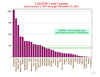 Release Date: 01/09/2012
The 4th quarter report card has been published.
Release Date: 01/09/2012
The 4th quarter report card has been published.
2011
 First Direct Measurement of the Earth's Rotation
Release Date: 12/22/2011
The Technische Universitaet Muenchen (TUM) reports on the first ever direct measurement of the Earth's rotation using the world's most stable ring laser. Our colleague Ulli Schreiber describes the experiment in this TUM press release. More...
First Direct Measurement of the Earth's Rotation
Release Date: 12/22/2011
The Technische Universitaet Muenchen (TUM) reports on the first ever direct measurement of the Earth's rotation using the world's most stable ring laser. Our colleague Ulli Schreiber describes the experiment in this TUM press release. More...
Galileo First Ranges
Release Date: 12/15/2011
First ranges to Galileo have been achieved by the ILRS and reported by ESA. More...
 Proceedings from the 17th International Laser Ranging Workshop
Release Date: 12/07/2011
The Bundesamt fuer Kartographie und Geodaesie/BKG (Geodetic Observatory Wettzell and TIGO), the Research Group Satellite Geodesy of the Technische Universitaet Muenchen and the International Laser Ranging Service (ILRS) sponsored the 17th International Workshop on Laser Ranging in Bad Kötzting, Germany during the week of May 16-20, 2011. A website with links to all presentations and available papers is now available. More...
Proceedings from the 17th International Laser Ranging Workshop
Release Date: 12/07/2011
The Bundesamt fuer Kartographie und Geodaesie/BKG (Geodetic Observatory Wettzell and TIGO), the Research Group Satellite Geodesy of the Technische Universitaet Muenchen and the International Laser Ranging Service (ILRS) sponsored the 17th International Workshop on Laser Ranging in Bad Kötzting, Germany during the week of May 16-20, 2011. A website with links to all presentations and available papers is now available. More...
 RadioAstron launch and first ranges
Release Date: 11/15/2011
RadioAstron was launched on July 18, 2011; first ranges were obtained by Grasse on November 15, 2011. More...
LARES has been approved for ILRS tracking.
RadioAstron launch and first ranges
Release Date: 11/15/2011
RadioAstron was launched on July 18, 2011; first ranges were obtained by Grasse on November 15, 2011. More...
LARES has been approved for ILRS tracking.
2010
2009
Data & Products Past News
